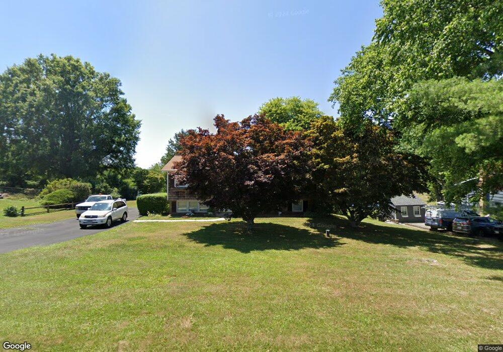
1806 High Point Rd Forest Hill, MD 21050
Estimated Value: $449,562 - $508,000
--
Bed
3
Baths
1,181
Sq Ft
$408/Sq Ft
Est. Value
About This Home
This home is located at 1806 High Point Rd, Forest Hill, MD 21050 and is currently estimated at $482,391, approximately $408 per square foot. 1806 High Point Rd is a home located in Harford County with nearby schools including Forest Lakes Elementary School, Fallston Middle School, and Fallston High School.
Ownership History
Date
Name
Owned For
Owner Type
Purchase Details
Closed on
Jun 29, 1999
Sold by
Wiseman Paul Melvin
Bought by
Miller Regina Susan
Current Estimated Value
Purchase Details
Closed on
Sep 10, 1996
Sold by
Winkler Mark T
Bought by
Wiseman Paul Melvin
Purchase Details
Closed on
Apr 13, 1988
Sold by
Brady Robert J
Bought by
Winkler Mark T
Home Financials for this Owner
Home Financials are based on the most recent Mortgage that was taken out on this home.
Original Mortgage
$80,000
Interest Rate
10.19%
Create a Home Valuation Report for This Property
The Home Valuation Report is an in-depth analysis detailing your home's value as well as a comparison with similar homes in the area
Home Values in the Area
Average Home Value in this Area
Purchase History
| Date | Buyer | Sale Price | Title Company |
|---|---|---|---|
| Miller Regina Susan | $159,900 | -- | |
| Wiseman Paul Melvin | $151,000 | -- | |
| Winkler Mark T | $118,500 | -- |
Source: Public Records
Mortgage History
| Date | Status | Borrower | Loan Amount |
|---|---|---|---|
| Previous Owner | Winkler Mark T | $80,000 | |
| Closed | Wiseman Paul Melvin | -- |
Source: Public Records
Tax History Compared to Growth
Tax History
| Year | Tax Paid | Tax Assessment Tax Assessment Total Assessment is a certain percentage of the fair market value that is determined by local assessors to be the total taxable value of land and additions on the property. | Land | Improvement |
|---|---|---|---|---|
| 2025 | $1,812 | $288,667 | $0 | $0 |
| 2024 | $1,752 | $276,100 | $116,000 | $160,100 |
| 2023 | $2,958 | $271,367 | $0 | $0 |
| 2022 | $2,966 | $266,633 | $0 | $0 |
| 2021 | $1,499 | $261,900 | $116,000 | $145,900 |
| 2020 | $1,499 | $259,867 | $0 | $0 |
| 2019 | $3,035 | $257,833 | $0 | $0 |
| 2018 | $2,985 | $255,800 | $131,000 | $124,800 |
| 2017 | $2,972 | $255,800 | $0 | $0 |
| 2016 | -- | $253,400 | $0 | $0 |
| 2015 | $2,986 | $252,200 | $0 | $0 |
| 2014 | $2,986 | $252,200 | $0 | $0 |
Source: Public Records
Map
Nearby Homes
- 1701 Ingleside Rd
- 1738 Shanwick Rd
- 1775 Pleasantville Rd
- 1702 Lasalle Rd
- 1932 Pleasantville Rd
- 600 Rock Spring Church Rd
- 2011 Fallsgrove Way
- 1605 Kiersten Ct
- 2033 Packard Dr
- 2401 Scotlon Ct
- 308 Rock Spring Church Rd
- 1705 Moonriver Ct
- 916 Delray Dr
- 2286 Phillips Mill Rd
- Lot 5 Arden Dr
- 1991 Gulfstream Ct
- 2204 Arden Dr
- 2208 Arden Dr
- 2326 Willow Vale Dr
- 1345 Cooptown Rd
- 1804 High Point Rd
- 1808 High Point Rd
- 1802 High Point Rd
- 1700 Boggs Rd
- 1800 High Point Rd
- 1812 High Point Rd
- 1709 Cannongate Rd
- 1702 Boggs Rd
- 1618 Boggs Rd
- 1810 High Point Rd
- 1814 High Point Rd
- 1711 Cannongate Rd
- 1701 Boggs Rd
- 1713 Cannongate Rd
- 1704 Boggs Rd
- 1616 Boggs Rd
- 1703 Boggs Rd
- 1816 High Point Rd
- 1619 Boggs Rd
- 1706 Boggs Rd