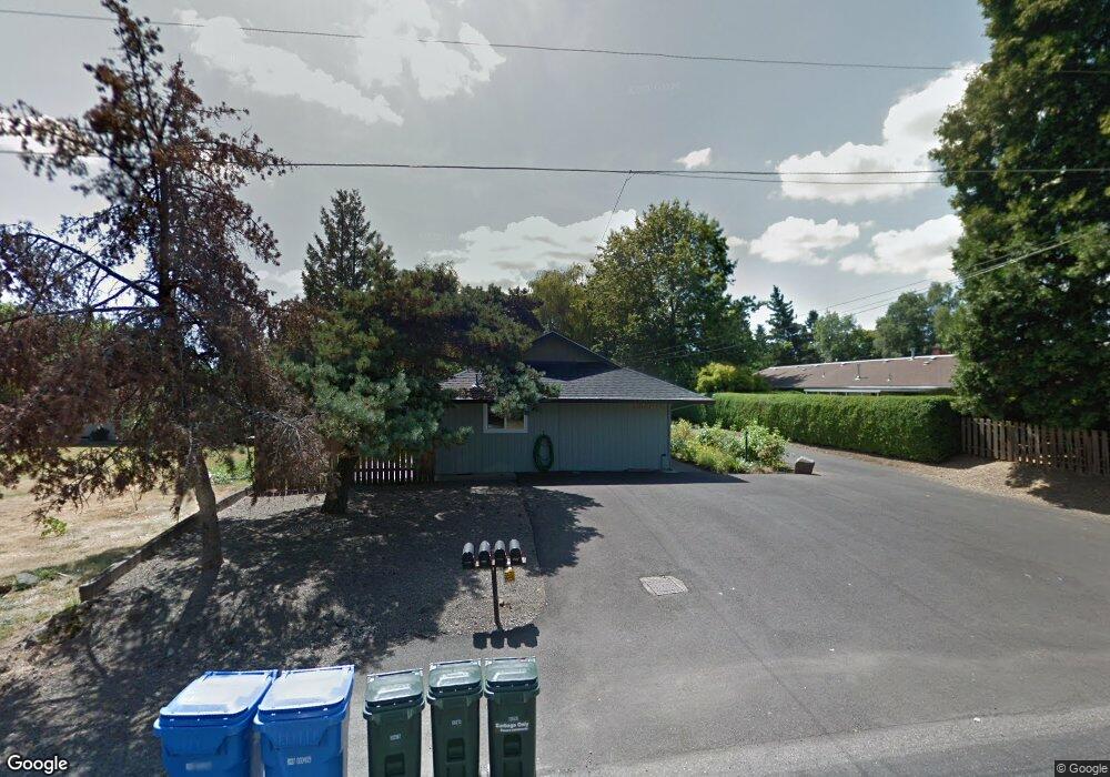
1806 SE Torbank Rd Portland, OR 97222
Estimated Value: $455,580 - $571,000
4
Beds
2
Baths
1,716
Sq Ft
$292/Sq Ft
Est. Value
About This Home
This home is located at 1806 SE Torbank Rd, Portland, OR 97222 and is currently estimated at $500,895, approximately $291 per square foot. 1806 SE Torbank Rd is a home with nearby schools including Oak Grove Elementary School, Alder Creek Middle School, and Rex Putnam High School.
Ownership History
Date
Name
Owned For
Owner Type
Purchase Details
Closed on
Jun 7, 2006
Sold by
Taylor Dennis Stanley and Taylor June Elaine
Bought by
Porter Frank D
Current Estimated Value
Home Financials for this Owner
Home Financials are based on the most recent Mortgage that was taken out on this home.
Original Mortgage
$119,300
Outstanding Balance
$72,854
Interest Rate
7.37%
Mortgage Type
Commercial
Estimated Equity
$428,041
Purchase Details
Closed on
Aug 4, 1995
Sold by
Moore Paul
Bought by
Taylor Dennis Stanley and Taylor June Elaine
Home Financials for this Owner
Home Financials are based on the most recent Mortgage that was taken out on this home.
Original Mortgage
$78,700
Interest Rate
7.63%
Create a Home Valuation Report for This Property
The Home Valuation Report is an in-depth analysis detailing your home's value as well as a comparison with similar homes in the area
Home Values in the Area
Average Home Value in this Area
Purchase History
| Date | Buyer | Sale Price | Title Company |
|---|---|---|---|
| Porter Frank D | $182,500 | Chicago Title Insurance Co | |
| Taylor Dennis Stanley | $105,000 | Fidelity National Title Co |
Source: Public Records
Mortgage History
| Date | Status | Borrower | Loan Amount |
|---|---|---|---|
| Open | Porter Frank D | $119,300 | |
| Previous Owner | Taylor Dennis Stanley | $78,700 | |
| Closed | Taylor Dennis Stanley | $15,700 |
Source: Public Records
Tax History Compared to Growth
Tax History
| Year | Tax Paid | Tax Assessment Tax Assessment Total Assessment is a certain percentage of the fair market value that is determined by local assessors to be the total taxable value of land and additions on the property. | Land | Improvement |
|---|---|---|---|---|
| 2025 | -- | $248,234 | -- | -- |
| 2024 | -- | $238,584 | -- | -- |
| 2023 | $0 | $240,833 | $0 | $0 |
| 2022 | $0 | $240,300 | $0 | $0 |
| 2021 | $0 | $232,435 | $0 | $0 |
| 2020 | $0 | $219,304 | $0 | $0 |
| 2019 | $0 | $208,666 | $0 | $0 |
| 2018 | $0 | $194,395 | $0 | $0 |
| 2017 | $0 | $103,553 | $0 | $0 |
| 2016 | -- | $100,537 | $0 | $0 |
| 2015 | -- | $97,609 | $0 | $0 |
| 2014 | -- | $94,766 | $0 | $0 |
Source: Public Records
Map
Nearby Homes
- 14007 SE Cedar Ave
- 13770 SE Linden Ln
- 14222 SE Laurie Ave
- 0 SE Cedar Ave
- 14368 SE Lee Ave
- 985 SE Rim Rock Ln
- 12735 SE 26th Ave
- 12556 SE 23rd Ave
- 12495 SE 23rd Ave
- 12437 SE 24th Ave
- 13740 Fielding Rd
- 14411 SE Wagner Ln
- 12850 Fielding Rd
- 251 Stampher Rd
- 12425 SE 27th Ave
- 13060 SW Elk Rock Rd
- 49 Briarwood Rd
- 12225 SE 19th Ave
- 0 SE Sparrow St
- 12815 SE 31st Ave
- 1810 SE Torbank Rd
- 1812 SE Torbank Rd
- 1818 SE Torbank Rd
- 1815 SE Torbank Rd
- 13614 SE River Rd
- 13512 SE River Rd
- 1802 SE Torbank Rd
- 1819 SE Torbank Rd
- 1935 SE Torbank Rd
- 13700 SE River Rd
- 13421 SE Wabash Ave
- 13500 SE River Rd
- 13419 SE Wabash Ave
- 13750 SE River Rd
- 13410 SE River Rd
- 13417 SE Wabash Ave
- 13409 SE Wabash Ave
- 13386 SE River Rd
- 1830 SE Rafaela Ln
- 13386 SE River Rd (Priv Rd)
