Estimated Value: $305,000 - $466,000
4
Beds
2
Baths
2,260
Sq Ft
$165/Sq Ft
Est. Value
About This Home
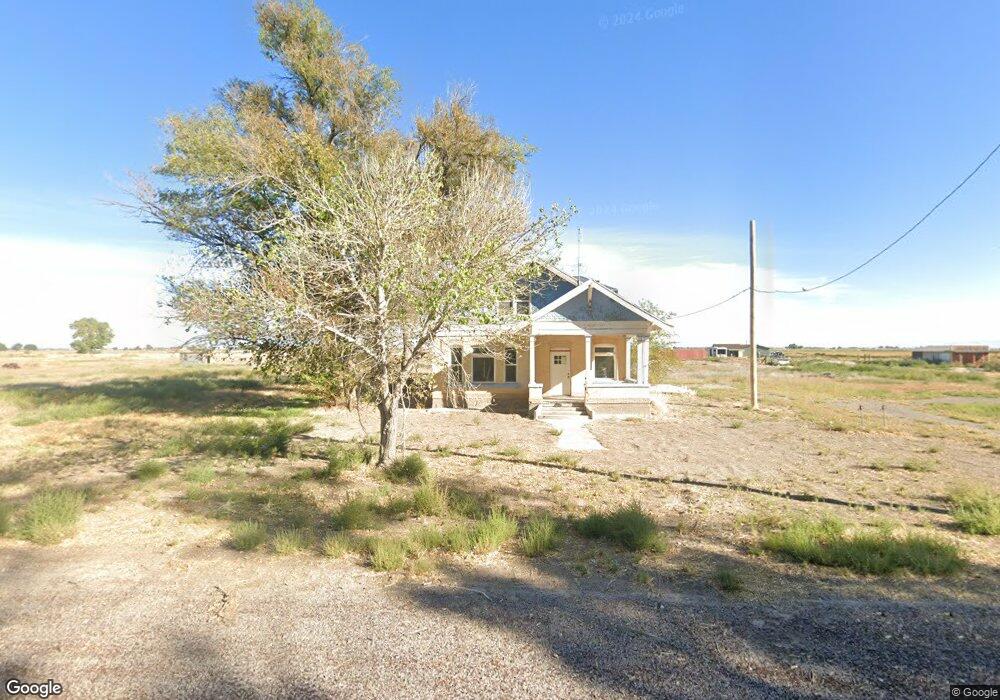
This home is located at 1806 W 4500 S, Delta, UT 84624 and is currently estimated at $371,861, approximately $164 per square foot. 1806 W 4500 S is a home located in Millard County.
Ownership History
Date
Name
Owned For
Owner Type
Purchase Details
Closed on
Aug 31, 2018
Sold by
Skeem Jerry Leslie and Skeem Leandra M
Bought by
Spencer Joseph B and Spencer Janel D
Current Estimated Value
Home Financials for this Owner
Home Financials are based on the most recent Mortgage that was taken out on this home.
Original Mortgage
$70,000
Outstanding Balance
$60,800
Interest Rate
4.6%
Mortgage Type
Seller Take Back
Estimated Equity
$311,061
Purchase Details
Closed on
Oct 12, 2016
Sold by
Skeem Jerry Leslia
Bought by
Skeem Jerry Leslie and Skeem Leandra M
Purchase Details
Closed on
Jun 17, 2015
Sold by
Jp Morgan Chase Bank
Bought by
Hud
Create a Home Valuation Report for This Property
The Home Valuation Report is an in-depth analysis detailing your home's value as well as a comparison with similar homes in the area
Home Values in the Area
Average Home Value in this Area
Purchase History
| Date | Buyer | Sale Price | Title Company |
|---|---|---|---|
| Spencer Joseph B | -- | First American Title | |
| Skeem Jerry Leslie | -- | First American Title | |
| Skeem Jerry Leslie | -- | First American Title | |
| Hud | -- | -- |
Source: Public Records
Mortgage History
| Date | Status | Borrower | Loan Amount |
|---|---|---|---|
| Open | Spencer Joseph B | $70,000 |
Source: Public Records
Tax History Compared to Growth
Tax History
| Year | Tax Paid | Tax Assessment Tax Assessment Total Assessment is a certain percentage of the fair market value that is determined by local assessors to be the total taxable value of land and additions on the property. | Land | Improvement |
|---|---|---|---|---|
| 2025 | $1,926 | $237,189 | $31,880 | $205,309 |
| 2024 | $1,926 | $134,198 | $14,972 | $119,226 |
| 2023 | $2,183 | $134,198 | $14,972 | $119,226 |
| 2022 | $1,002 | $88,691 | $13,100 | $75,591 |
| 2021 | $696 | $59,375 | $13,100 | $46,275 |
| 2020 | $594 | $51,084 | $13,100 | $37,984 |
| 2019 | $575 | $49,891 | $13,100 | $36,791 |
| 2018 | $531 | $47,273 | $13,100 | $34,173 |
| 2017 | $518 | $43,973 | $9,800 | $34,173 |
| 2016 | $495 | $43,973 | $9,800 | $34,173 |
| 2015 | $494 | $43,973 | $9,800 | $34,173 |
| 2014 | -- | $43,973 | $9,800 | $34,173 |
| 2013 | -- | $43,532 | $9,800 | $33,732 |
Source: Public Records
Map
Nearby Homes
- 470 S 2750 W Unit 6
- 460 S 2750 W Unit 7
- 490 S 2750 W Unit 5
- 465 S 2750 W Unit 4
- 6500 S 3000 West Rd
- 6177 S 3000 Rd W
- 0 Tbd 3000 Rd S Unit LotWP001
- 17000 W 2500 Rd S
- 16700 W 2500 South Rd
- 16800 W 2500 South Rd
- 3885 W 4500 S
- 3770 S 4000 Rd W
- 3480 S 4000 W
- 8000 S Highway 257
- 6500 W 2000 S
- 168 N 100 Rd W
- 289 W Center St S
- 294 S 300 W
- 242 S 400 W
- 328 S Center St
- 1740 W 4500 S
- 1755 W 4500 S
- 1925 W 4500 S
- 1955 W 4500 S
- 1985 W 4500 S
- 1900 W 4500 S
- 2224 W 4500 S
- 2355 W 4500 S
- 4125 S 2500 St W
- 5095 S 1750 W
- 775 W 4500 Rd S Unit LotWP001
- 6020 W 4500 Rd S
- 825 W 4500 Rd S Unit 2
- 3935 Oasis Rd
- 4410 S 2500 W
- 2600 S West St
- 1063 W 4500 S
- 2535 W 4250 S
- 4065 S 2500 W
- 3995 S 2500 W