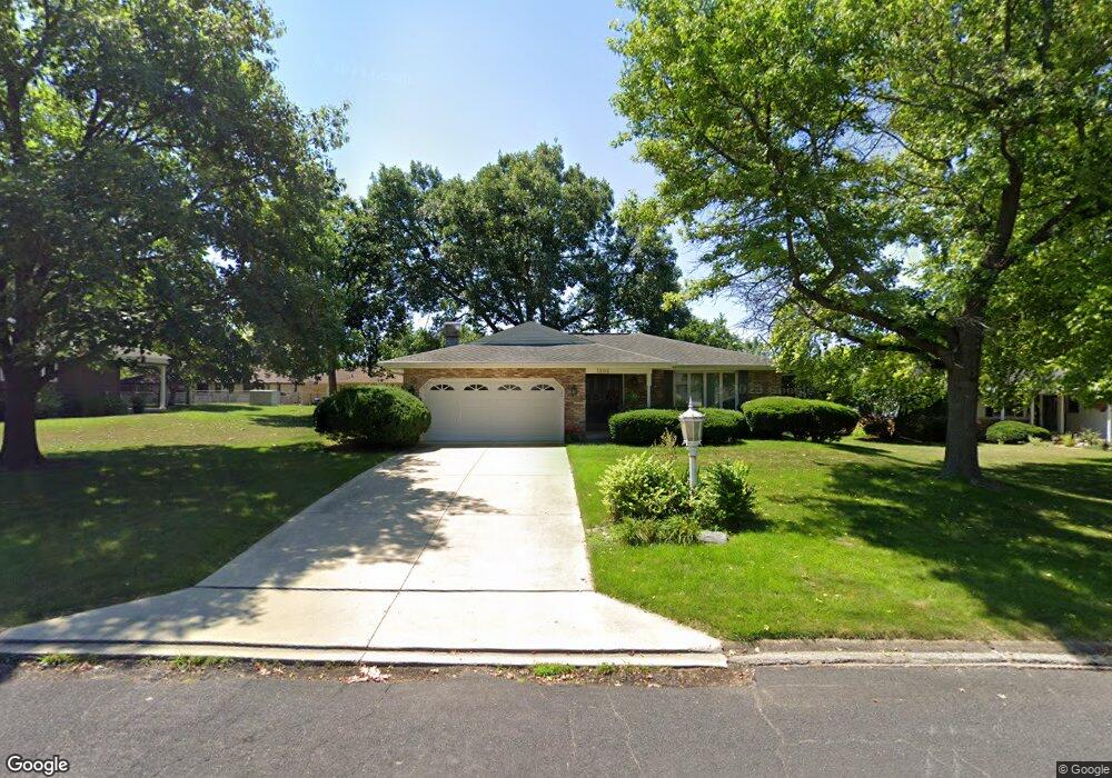
1806 W Bel Aire Ave Peoria, IL 61614
North Peoria NeighborhoodEstimated Value: $160,483 - $186,000
3
Beds
2
Baths
1,620
Sq Ft
$107/Sq Ft
Est. Value
About This Home
This home is located at 1806 W Bel Aire Ave, Peoria, IL 61614 and is currently estimated at $173,828, approximately $107 per square foot. 1806 W Bel Aire Ave is a home located in Peoria County with nearby schools including Dr. C. T. Vivian Primary School, Rolling Acres Middle School, and Richwoods High School.
Ownership History
Date
Name
Owned For
Owner Type
Purchase Details
Closed on
Feb 20, 2025
Sold by
Mary Lou Boettger Living Trust and Brewer William
Bought by
Meis Sharon K
Current Estimated Value
Home Financials for this Owner
Home Financials are based on the most recent Mortgage that was taken out on this home.
Original Mortgage
$133,000
Outstanding Balance
$132,213
Interest Rate
6.93%
Mortgage Type
New Conventional
Estimated Equity
$41,615
Create a Home Valuation Report for This Property
The Home Valuation Report is an in-depth analysis detailing your home's value as well as a comparison with similar homes in the area
Home Values in the Area
Average Home Value in this Area
Purchase History
| Date | Buyer | Sale Price | Title Company |
|---|---|---|---|
| Meis Sharon K | $170,000 | None Listed On Document |
Source: Public Records
Mortgage History
| Date | Status | Borrower | Loan Amount |
|---|---|---|---|
| Open | Meis Sharon K | $133,000 |
Source: Public Records
Tax History Compared to Growth
Tax History
| Year | Tax Paid | Tax Assessment Tax Assessment Total Assessment is a certain percentage of the fair market value that is determined by local assessors to be the total taxable value of land and additions on the property. | Land | Improvement |
|---|---|---|---|---|
| 2024 | $4,081 | $56,120 | $8,140 | $47,980 |
| 2023 | $3,810 | $51,490 | $7,470 | $44,020 |
| 2022 | $3,428 | $46,540 | $7,180 | $39,360 |
| 2021 | $3,314 | $44,330 | $6,840 | $37,490 |
| 2020 | $3,296 | $43,890 | $6,770 | $37,120 |
| 2019 | $3,366 | $44,790 | $6,910 | $37,880 |
| 2018 | $3,350 | $45,400 | $6,980 | $38,420 |
| 2017 | $3,361 | $45,860 | $7,050 | $38,810 |
| 2016 | $3,246 | $45,860 | $7,050 | $38,810 |
| 2015 | $3,214 | $44,960 | $6,910 | $38,050 |
| 2014 | $3,226 | $45,910 | $6,560 | $39,350 |
| 2013 | -- | $46,470 | $6,640 | $39,830 |
Source: Public Records
Map
Nearby Homes
- 4808 N Glen Ct
- 1412 W Glen Ave
- 4212 N Keenland Ave
- 5003 N Mansfield Dr
- 1910 W Sunnyview Dr
- 1413 W Aire Ave
- 5108 N Woodview Ave
- 5213 N Merrimac Ave
- 4023 N University St
- 5317 N Woodview Ave
- 1914 W White Oak Dr
- 3720 N Saint Michael Ave
- 2627 Eugenie Ave
- 1123 W Purtscher Dr
- 937 W Kenwick Ln
- 930 W Willow Ln
- 2505 W Camille St
- 2724 W Scenic Dr
- 5506 N Longwood Dr
- 5302 N Arrow Dr
- 1812 W Bel Aire Ave
- 1726 W Bel Aire Ave
- 1809 W Christine Ave
- 1803 W Christine Ave
- 1813 W Christine Ave
- 1816 W Bel Aire Ave
- 1727 W Christine Ave
- 1807 W Bel Aire Ave
- 1819 W Christine Ave
- 1803 W Bel Aire Ave
- 1813 W Bel Aire Ave
- 1822 W Bel Aire Ave
- 1722 W Bel Aire Ave
- 1727 W Bel Aire Ave
- 1817 W Bel Aire Ave
- 1823 W Christine Ave
- 1723 W Christine Ave
- 1723 W Bel Aire Ave
- 1810 W Christine Ave
- 1804 W Christine Ave