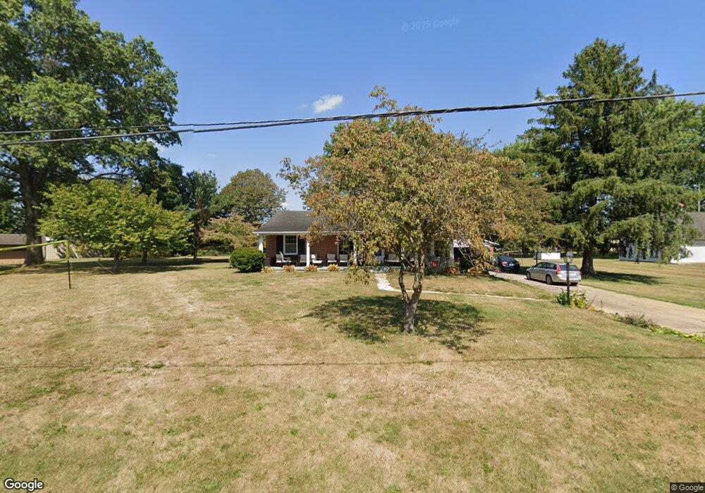
1806 W Maple St Baltimore, OH 43105
Estimated Value: $269,000 - $311,000
2
Beds
2
Baths
1,255
Sq Ft
$226/Sq Ft
Est. Value
About This Home
This home is located at 1806 W Maple St, Baltimore, OH 43105 and is currently estimated at $283,355, approximately $225 per square foot. 1806 W Maple St is a home located in Fairfield County with nearby schools including Liberty Union Elementary School, Liberty Union Middle School, and Liberty Union High School.
Ownership History
Date
Name
Owned For
Owner Type
Purchase Details
Closed on
Oct 6, 2014
Sold by
Harman Steven R
Bought by
Fackler Holly Harman and Fackler Van Dine
Current Estimated Value
Home Financials for this Owner
Home Financials are based on the most recent Mortgage that was taken out on this home.
Original Mortgage
$63,000
Outstanding Balance
$20,298
Interest Rate
3.26%
Mortgage Type
New Conventional
Estimated Equity
$263,057
Purchase Details
Closed on
Aug 5, 2013
Sold by
French Joyce Ann
Bought by
Harman Steven R
Purchase Details
Closed on
Sep 22, 1992
Sold by
French Ray Emerson
Bought by
French Ray Emerson
Create a Home Valuation Report for This Property
The Home Valuation Report is an in-depth analysis detailing your home's value as well as a comparison with similar homes in the area
Home Values in the Area
Average Home Value in this Area
Purchase History
| Date | Buyer | Sale Price | Title Company |
|---|---|---|---|
| Fackler Holly Harman | $112,000 | Valmer Land Title Agency Box | |
| Harman Steven R | $112,000 | Valmer Land Title Agency Box | |
| French Ray Emerson | -- | -- |
Source: Public Records
Mortgage History
| Date | Status | Borrower | Loan Amount |
|---|---|---|---|
| Open | Fackler Holly Harman | $63,000 |
Source: Public Records
Tax History Compared to Growth
Tax History
| Year | Tax Paid | Tax Assessment Tax Assessment Total Assessment is a certain percentage of the fair market value that is determined by local assessors to be the total taxable value of land and additions on the property. | Land | Improvement |
|---|---|---|---|---|
| 2024 | $5,012 | $66,770 | $17,570 | $49,200 |
| 2023 | $2,561 | $66,770 | $17,570 | $49,200 |
| 2022 | $2,540 | $66,770 | $17,570 | $49,200 |
| 2021 | $2,487 | $59,260 | $17,570 | $41,690 |
| 2020 | $2,544 | $59,260 | $17,570 | $41,690 |
| 2019 | $2,586 | $59,260 | $17,570 | $41,690 |
| 2018 | $2,486 | $47,380 | $17,570 | $29,810 |
| 2017 | $2,499 | $52,250 | $17,570 | $34,680 |
| 2016 | $2,463 | $52,250 | $17,570 | $34,680 |
| 2015 | $2,284 | $50,730 | $17,570 | $33,160 |
| 2014 | $2,253 | $50,730 | $17,570 | $33,160 |
| 2013 | $2,253 | $50,730 | $17,570 | $33,160 |
Source: Public Records
Map
Nearby Homes
- 0 S Company St Unit Lot 2 225029545
- 0 S Company St Unit Lot 1 225029543
- 111 N High St
- 118 N Oak St
- 601 S Main St
- 306 N Park Dr
- 101 Circle Dr
- 220 N Wagner Ave
- 602 E Cliff St
- 224 Baltimore Somerset Rd NE
- 9730 Lancaster-Kirkersville Rd NW
- 5 Baltimore Somerset Rd NW
- 4077 Basil Western Rd NW
- 9550 Heimberger Rd NW
- 1811 Pleasantville Rd NW
- 570 Baltimore Somerset Rd NE Unit Lot 1
- 0 Pleasantville Rd NW Unit Lot 7
- 11135 Basil Rd NW
- 0 Lancaster-Newark Rd NE Unit Lot A
- 0 Lancaster-Newark Rd NE
- 1810 W Maple St
- 1805 W Maple St
- 1775 W Maple St
- 1801 W Market St
- 219 Westwood Ave
- 1809 W Market St
- 1805 W Market St
- 1811 W Market St
- 212 Westwood Ave
- 1799 W Market St
- 1795 W Market St
- 205 Westwood Ave
- 208 Westwood Ave
- 1791 W Market St
- 0 W Market St
- 1785 W Market St
- 1800 W Market St
- 1804 W Market St
- 204 Westwood Ave
- 1820 W Market St