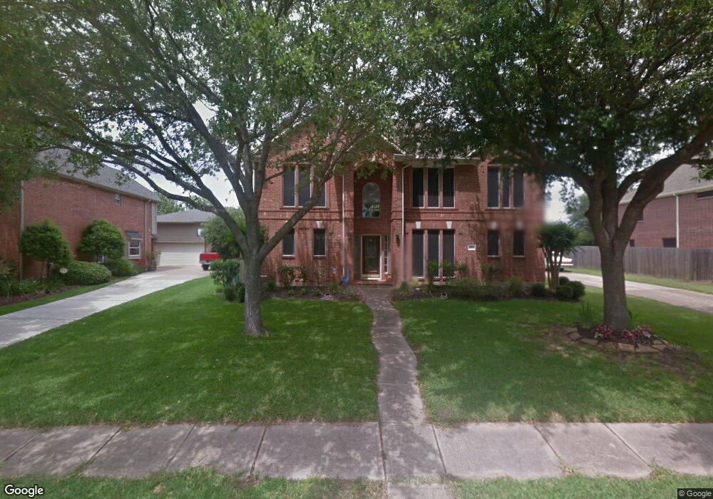
1807 Brookside Dr Friendswood, TX 77546
Estimated Value: $500,000 - $544,000
4
Beds
4
Baths
3,003
Sq Ft
$172/Sq Ft
Est. Value
About This Home
This home is located at 1807 Brookside Dr, Friendswood, TX 77546 and is currently estimated at $515,516, approximately $171 per square foot. 1807 Brookside Dr is a home located in Galveston County with nearby schools including C.W. Cline Elementary School, Windsong Elementary School, and Friendswood Junior High School.
Ownership History
Date
Name
Owned For
Owner Type
Purchase Details
Closed on
May 26, 2004
Sold by
Johnson Harrel W
Bought by
Chapman Rich
Current Estimated Value
Home Financials for this Owner
Home Financials are based on the most recent Mortgage that was taken out on this home.
Original Mortgage
$205,600
Outstanding Balance
$100,303
Interest Rate
5.97%
Mortgage Type
Purchase Money Mortgage
Estimated Equity
$415,213
Purchase Details
Closed on
Oct 24, 2003
Sold by
Monk Constance B
Bought by
Johnson Harrel W
Home Financials for this Owner
Home Financials are based on the most recent Mortgage that was taken out on this home.
Original Mortgage
$204,000
Interest Rate
5.97%
Mortgage Type
Purchase Money Mortgage
Purchase Details
Closed on
Aug 7, 2001
Sold by
Wade Richard A and Wade Donna L
Bought by
Secrest Betty G and Johnson Harrel W
Home Financials for this Owner
Home Financials are based on the most recent Mortgage that was taken out on this home.
Original Mortgage
$204,000
Interest Rate
7.14%
Mortgage Type
Purchase Money Mortgage
Create a Home Valuation Report for This Property
The Home Valuation Report is an in-depth analysis detailing your home's value as well as a comparison with similar homes in the area
Home Values in the Area
Average Home Value in this Area
Purchase History
| Date | Buyer | Sale Price | Title Company |
|---|---|---|---|
| Chapman Rich | -- | Chicago Title Insurance Comp | |
| Johnson Harrel W | -- | Chicago Title Insurance Comp | |
| Secrest Betty G | -- | Alamo Title Company |
Source: Public Records
Mortgage History
| Date | Status | Borrower | Loan Amount |
|---|---|---|---|
| Open | Chapman Rich | $205,600 | |
| Previous Owner | Johnson Harrel W | $204,000 | |
| Previous Owner | Secrest Betty G | $204,000 |
Source: Public Records
Tax History Compared to Growth
Tax History
| Year | Tax Paid | Tax Assessment Tax Assessment Total Assessment is a certain percentage of the fair market value that is determined by local assessors to be the total taxable value of land and additions on the property. | Land | Improvement |
|---|---|---|---|---|
| 2025 | $7,295 | $458,250 | $46,160 | $412,090 |
| 2024 | $7,295 | $458,250 | $46,160 | $412,090 |
| 2023 | $7,295 | $443,502 | $0 | $0 |
| 2022 | $8,880 | $403,184 | $0 | $0 |
| 2021 | $8,561 | $394,350 | $46,160 | $348,190 |
| 2020 | $8,028 | $333,210 | $46,160 | $287,050 |
| 2019 | $8,301 | $326,890 | $46,160 | $280,730 |
| 2018 | $8,419 | $329,610 | $46,160 | $283,450 |
| 2017 | $8,560 | $329,610 | $46,160 | $283,450 |
| 2016 | $7,813 | $318,370 | $46,160 | $272,210 |
| 2015 | $2,485 | $318,370 | $46,160 | $272,210 |
| 2014 | $2,339 | $248,630 | $46,160 | $202,470 |
Source: Public Records
Map
Nearby Homes
- 1802 Creekside Dr
- 1010 High Ridge Dr
- 506 Lakeside Ln
- 1906 Blue Quail Dr
- 505 Hunters Ln
- 705 High Ridge Dr
- 1531 Briar Bend Dr
- 1608 Keystone Dr
- 1509 Windsor Dr
- 1217 Red Wing Dr
- 1606 Falcon Ridge Blvd
- 1305 Edgewater Dr
- 2304 Old Rd
- 110 Century Dr
- 1783 Lake Crest Ln
- 1668 Turner Ct
- 204 Oak Dr
- 1811 Hunt Dr
- 2202 Calm Pond Ct
- 1402 Osborne Dr
- 1805 Brookside Dr
- 1809 Brookside Dr
- 1808 Stonecreek Cir
- 1810 Stonecreek Cir
- 1806 Stonecreek Cir
- 1803 Brookside Dr
- 1811 Brookside Dr
- 1806 Brookside Dr
- 1810 Brookside Dr
- 1812 Stonecreek Cir
- 1804 Stonecreek Cir
- 1804 Brookside Dr
- 1812 Brookside Dr
- 1801 Brookside Dr
- 1802 Stonecreek Cir
- 1807 Stonecreek Cir
- 1802 Brookside Dr
- 1807 Creekside Dr
- 1809 Stonecreek Cir
- 1805 Creekside Dr