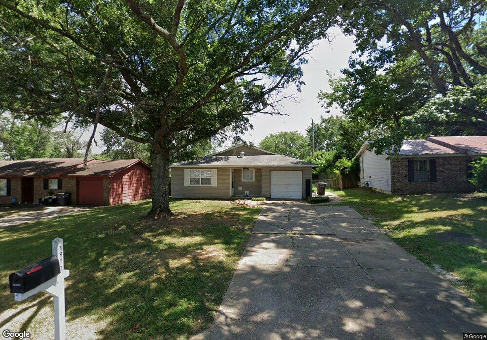
1807 Corbin St Jacksonville, AR 72076
Estimated Value: $92,000 - $128,000
Studio
3
Baths
1,168
Sq Ft
$94/Sq Ft
Est. Value
About This Home
This home is located at 1807 Corbin St, Jacksonville, AR 72076 and is currently estimated at $109,775, approximately $93 per square foot. 1807 Corbin St is a home located in Pulaski County with nearby schools including Murrell Taylor Elementary School, Jacksonville Middle School, and Jacksonville High School.
Ownership History
Date
Name
Owned For
Owner Type
Purchase Details
Closed on
May 23, 2006
Sold by
Simen Leon
Bought by
Ford Reginald and Ford Nicole J
Current Estimated Value
Home Financials for this Owner
Home Financials are based on the most recent Mortgage that was taken out on this home.
Original Mortgage
$74,000
Outstanding Balance
$43,102
Interest Rate
6.5%
Mortgage Type
Fannie Mae Freddie Mac
Estimated Equity
$66,673
Purchase Details
Closed on
Apr 10, 2003
Sold by
Mcclain James J and Mcclain Theresa A
Bought by
Simen Leon
Create a Home Valuation Report for This Property
The Home Valuation Report is an in-depth analysis detailing your home's value as well as a comparison with similar homes in the area
Home Values in the Area
Average Home Value in this Area
Purchase History
| Date | Buyer | Sale Price | Title Company |
|---|---|---|---|
| Ford Reginald | $74,000 | United Abstract & Title Co | |
| Simen Leon | $21,000 | United Abstract & Title Co |
Source: Public Records
Mortgage History
| Date | Status | Borrower | Loan Amount |
|---|---|---|---|
| Open | Ford Reginald | $74,000 |
Source: Public Records
Tax History
| Year | Tax Paid | Tax Assessment Tax Assessment Total Assessment is a certain percentage of the fair market value that is determined by local assessors to be the total taxable value of land and additions on the property. | Land | Improvement |
|---|---|---|---|---|
| 2025 | $1,016 | $16,899 | $1,200 | $15,699 |
| 2024 | $763 | $16,899 | $1,200 | $15,699 |
| 2023 | $763 | $16,899 | $1,200 | $15,699 |
| 2022 | $798 | $16,899 | $1,200 | $15,699 |
| 2021 | $726 | $11,820 | $1,600 | $10,220 |
| 2020 | $726 | $11,820 | $1,600 | $10,220 |
| 2019 | $726 | $11,820 | $1,600 | $10,220 |
| 2018 | $726 | $11,820 | $1,600 | $10,220 |
| 2017 | $726 | $11,820 | $1,600 | $10,220 |
| 2016 | $659 | $12,250 | $2,400 | $9,850 |
| 2015 | $659 | $12,250 | $2,400 | $9,850 |
| 2014 | $659 | $12,250 | $2,400 | $9,850 |
Source: Public Records
Map
Nearby Homes
- 813 Lehman Dr
- TRACT 1- 2003 Old Military Rd
- TRACT 3- 2003 Old Military Rd
- TRACT 2- 2003 Old Military Rd
- 702 Charlotte Cir Unit 704 Charlotte Cir
- 2003 Old Military Rd
- 617 Lehman Dr
- 2209 Old Military Rd
- 524 Southeastern Ave
- 1401 Tamara Park
- 1302 King St
- 802 Towering Oaks Dr
- 1305 Ray Rd
- 0 S J P Wright Loop Rd
- 626 Paul Place
- 404 S J P Wright Loop Rd
- 32 Ross Cir
- 28 Ross Cir
- 830 Military Rd
- 1000 Liberty Dr
- 1809 Corbin St
- 1805 Corbin St
- 104 Lonsdale Cir
- 1803 Corbin St
- 102 Lonsdale Cir
- 1811 Corbin St
- 106 Lonsdale Cir
- 1121 Ruth Ann Dr
- 1123 Ruth Ann Dr
- 108 Lonsdale Cir
- 1124 Lehman Dr
- 100 Lonsdale Cir
- 1801 Corbin St
- 1117 Ruth Ann Dr Unit AND
- 1120 Ruth Ann Dr
- 110 Lonsdale Cir
- 1119 Ruth Ann Dr
- 11161118 Ruth Ann Dr
- 1120 Lehman Dr
- 1118 Ruth Ann Dr
Your Personal Tour Guide
Ask me questions while you tour the home.