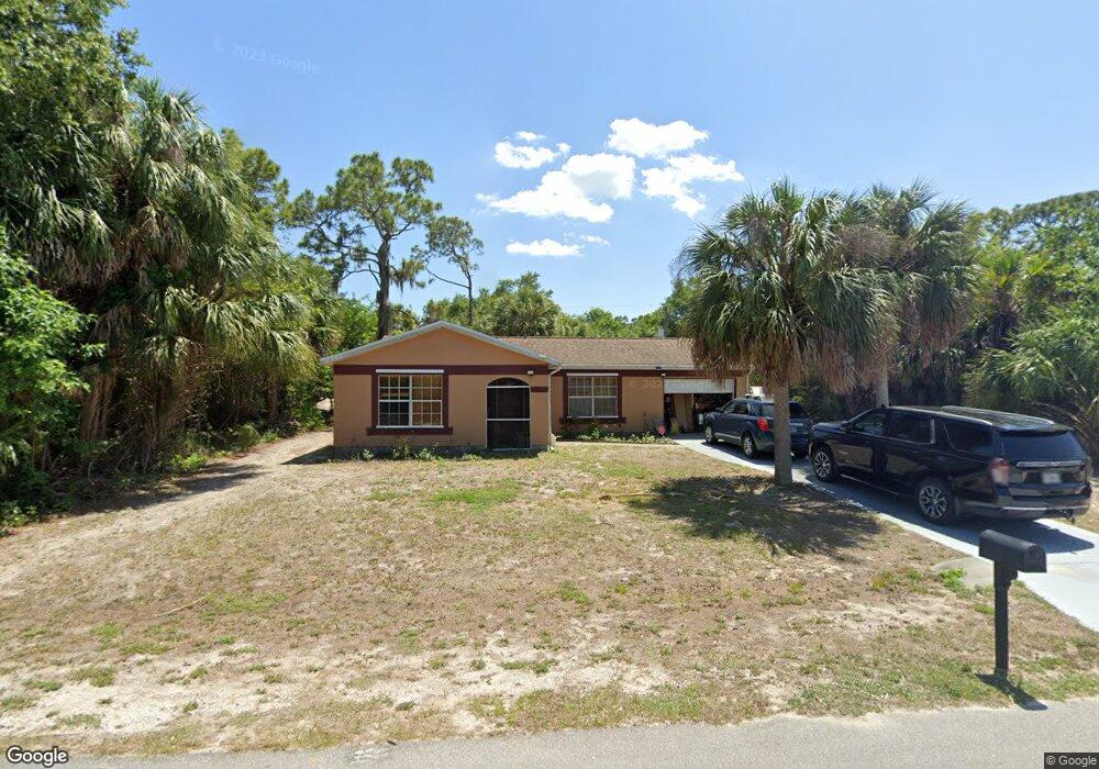
18079 Rickardway Ave Port Charlotte, FL 33948
Estimated Value: $197,104 - $339,000
3
Beds
2
Baths
998
Sq Ft
$240/Sq Ft
Est. Value
About This Home
This home is located at 18079 Rickardway Ave, Port Charlotte, FL 33948 and is currently estimated at $239,276, approximately $239 per square foot. 18079 Rickardway Ave is a home located in Charlotte County with nearby schools including Liberty Elementary School, Murdock Middle School, and Port Charlotte High School.
Ownership History
Date
Name
Owned For
Owner Type
Purchase Details
Closed on
Nov 19, 2019
Sold by
Collin Norman L and Collin Sheila F
Bought by
Cogdill Cletus V and Ruivivar Ruth Ann
Current Estimated Value
Purchase Details
Closed on
May 26, 1998
Sold by
Oakley Ernest V and Oakley Marie L
Bought by
Smith Brian and Smith Jennifer
Home Financials for this Owner
Home Financials are based on the most recent Mortgage that was taken out on this home.
Original Mortgage
$46,703
Interest Rate
7.11%
Mortgage Type
FHA
Create a Home Valuation Report for This Property
The Home Valuation Report is an in-depth analysis detailing your home's value as well as a comparison with similar homes in the area
Home Values in the Area
Average Home Value in this Area
Purchase History
| Date | Buyer | Sale Price | Title Company |
|---|---|---|---|
| Cogdill Cletus V | $275,000 | Stewart Title Company | |
| Smith Brian | $46,500 | -- |
Source: Public Records
Mortgage History
| Date | Status | Borrower | Loan Amount |
|---|---|---|---|
| Previous Owner | Smith Brian | $46,703 |
Source: Public Records
Tax History Compared to Growth
Tax History
| Year | Tax Paid | Tax Assessment Tax Assessment Total Assessment is a certain percentage of the fair market value that is determined by local assessors to be the total taxable value of land and additions on the property. | Land | Improvement |
|---|---|---|---|---|
| 2023 | $1,078 | $47,370 | $0 | $0 |
| 2022 | $1,017 | $45,990 | $0 | $0 |
| 2021 | $1,005 | $45,067 | $0 | $0 |
| 2020 | $965 | $44,445 | $0 | $0 |
| 2019 | $890 | $43,446 | $0 | $0 |
| 2018 | $812 | $42,636 | $0 | $0 |
| 2017 | $796 | $41,759 | $0 | $0 |
| 2016 | $781 | $40,900 | $0 | $0 |
| 2015 | $757 | $40,616 | $0 | $0 |
| 2014 | $726 | $39,942 | $0 | $0 |
Source: Public Records
Map
Nearby Homes
- 18080 Windswept Ave
- 18071 Windswept Ave
- 2151 Corfell St
- 18183 Windingvail Ave
- 18088 Windingvail Ave
- 2145 Winningway St
- 18161 Windswept Ave
- 2212 Bendway Dr
- 2055 Bendway Dr
- 2063 Bendway Dr
- 2120 Bendway Dr
- 2082 Winningway St
- 18057 Garvin Ave
- 2113 Barksdale St
- 2127 Collingswood Blvd
- 2272 Auburn Blvd
- 2256 Auburn Blvd
- 2047 Bendway Dr
- 2039 Bendway Dr
- 2113 Wonderwin St
- 18095 Rickardway Ave
- 18063 Rickardway Ave
- 18064 Windswept Ave
- 18103 Rickardway Ave
- 18055 Rickardway Ave
- 18104 Windswept Ave
- 2160 Corfell St
- 18079 Windswept Ave
- 18111 Rickard Way Ave
- 18111 Rickardway Ave
- 18087 Windswept Ave
- 18103 Windswept Ave
- 2143 Corfell St
- 2159 Corfell St
- 18096 Windingvail Ave
- 18056 Windingvail Ave Corfell St
- 18064 Windingvail Ave
- 18104 Windingvail Ave
- 2177 Lanternlight St
- 18071 Windswept Ave Unit 16