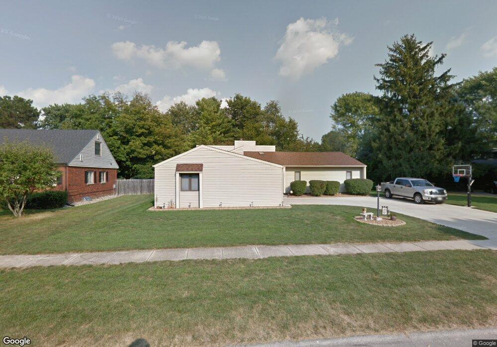
1808 Bridgestone Dr Champaign, IL 61822
Estimated Value: $281,478 - $354,000
--
Bed
--
Bath
--
Sq Ft
0.36
Acres
About This Home
This home is located at 1808 Bridgestone Dr, Champaign, IL 61822 and is currently estimated at $323,620. 1808 Bridgestone Dr is a home located in Champaign County with nearby schools including Centennial High School, Countryside School, and Swann Special Care Center-Elem/Secondary School.
Ownership History
Date
Name
Owned For
Owner Type
Purchase Details
Closed on
Nov 18, 2009
Sold by
Strode Lynette M
Bought by
Strode Steven M and Strode Lynette M
Current Estimated Value
Home Financials for this Owner
Home Financials are based on the most recent Mortgage that was taken out on this home.
Original Mortgage
$76,500
Interest Rate
4.44%
Mortgage Type
New Conventional
Purchase Details
Closed on
Nov 4, 2009
Sold by
Jacobs Gregory J and Jacobs Erin M
Bought by
Strode Lynette M
Home Financials for this Owner
Home Financials are based on the most recent Mortgage that was taken out on this home.
Original Mortgage
$76,500
Interest Rate
4.44%
Mortgage Type
New Conventional
Purchase Details
Closed on
Sep 21, 2009
Sold by
Loftus Thomas E
Bought by
Strode Lynette M and Jacobs Gregory J
Home Financials for this Owner
Home Financials are based on the most recent Mortgage that was taken out on this home.
Original Mortgage
$76,500
Interest Rate
4.44%
Mortgage Type
New Conventional
Create a Home Valuation Report for This Property
The Home Valuation Report is an in-depth analysis detailing your home's value as well as a comparison with similar homes in the area
Home Values in the Area
Average Home Value in this Area
Purchase History
| Date | Buyer | Sale Price | Title Company |
|---|---|---|---|
| Strode Steven M | -- | None Available | |
| Strode Lynette M | $76,500 | None Available | |
| Strode Lynette M | -- | None Available |
Source: Public Records
Mortgage History
| Date | Status | Borrower | Loan Amount |
|---|---|---|---|
| Closed | Strode Lynette M | $76,500 |
Source: Public Records
Tax History Compared to Growth
Tax History
| Year | Tax Paid | Tax Assessment Tax Assessment Total Assessment is a certain percentage of the fair market value that is determined by local assessors to be the total taxable value of land and additions on the property. | Land | Improvement |
|---|---|---|---|---|
| 2024 | $4,863 | $78,070 | $30,890 | $47,180 |
| 2023 | $4,863 | $72,080 | $28,520 | $43,560 |
| 2022 | $4,628 | $67,230 | $26,600 | $40,630 |
| 2021 | $4,415 | $66,040 | $26,130 | $39,910 |
| 2020 | $4,375 | $65,380 | $25,870 | $39,510 |
| 2019 | $4,231 | $64,290 | $25,440 | $38,850 |
| 2018 | $4,119 | $62,420 | $25,440 | $36,980 |
| 2017 | $3,978 | $60,370 | $25,440 | $34,930 |
| 2016 | $3,454 | $58,720 | $25,440 | $33,280 |
| 2015 | $3,271 | $58,720 | $25,440 | $33,280 |
| 2014 | $3,249 | $54,540 | $25,440 | $29,100 |
| 2013 | $3,194 | $54,540 | $25,440 | $29,100 |
Source: Public Records
Map
Nearby Homes
- 1818 Tahoe Ct
- 3510 S Duncan Rd
- 1309 Maplepark Dr
- 2605 Trafalgar Square
- 1806 Bentbrook Dr
- 2612 W Kirby Ave
- 2808 Carrelton Dr
- 4002 Lakepoint Rd
- 4005 Pinecrest Dr
- 2205 Edgewater Place
- 1402 Scottsdale Dr
- 2006 S Staley Rd
- 1012 Waters Edge Rd
- 7 Briar Hill Cir Unit G
- 3311 Brentwood Dr
- 1407 Kenwood Rd
- 1601 Carolyn Dr
- 901 Dogwood Dr
- 2424 Prairie Ridge Place
- 3907 Aberdeen Dr
- 1806 Bridgestone Dr
- 1821 Maynard Dr
- 1817 Maynard Dr
- 1813 Maynard Dr
- 1807 Bridgestone Dr
- 1809 Maynard Dr
- 1809 Bridgestone Dr
- 1804 Bridgestone Dr
- 1805 Bridgestone Dr
- 1811 Bridgestone Dr
- 1829 Maynard Dr
- 1805 Maynard Dr
- 1826 Maynard Dr
- 1803 Bridgestone Dr
- 1810 Coventry Dr
- 1802 Bridgestone Dr
- 1830 Maynard Dr
- 1812 Coventry Dr
- 1808 Coventry Dr
- 3307 Roxford Dr