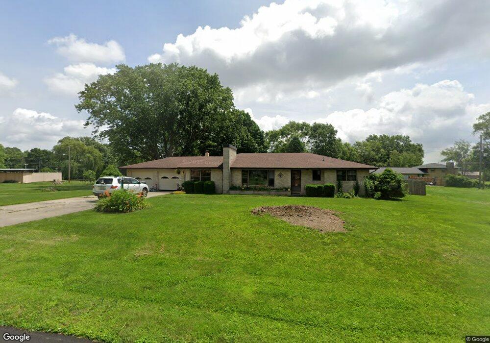
1808 Bruce Ln Anderson, IN 46012
Estimated Value: $228,000 - $258,000
3
Beds
2
Baths
1,861
Sq Ft
$129/Sq Ft
Est. Value
About This Home
This home is located at 1808 Bruce Ln, Anderson, IN 46012 and is currently estimated at $239,322, approximately $128 per square foot. 1808 Bruce Ln is a home located in Madison County with nearby schools including Eastside Elementary School, Highland Middle School, and Anderson High School.
Ownership History
Date
Name
Owned For
Owner Type
Purchase Details
Closed on
Dec 31, 2019
Sold by
Manship David K and Manship Brydgette
Bought by
Singleton Chelsea and Sipes Karen
Current Estimated Value
Purchase Details
Closed on
Apr 30, 2010
Sold by
Manship Sandra K and Hiatt Kenneth E
Bought by
Manship David R and Manship Brydgette
Home Financials for this Owner
Home Financials are based on the most recent Mortgage that was taken out on this home.
Original Mortgage
$88,522
Interest Rate
5.37%
Mortgage Type
FHA
Create a Home Valuation Report for This Property
The Home Valuation Report is an in-depth analysis detailing your home's value as well as a comparison with similar homes in the area
Home Values in the Area
Average Home Value in this Area
Purchase History
| Date | Buyer | Sale Price | Title Company |
|---|---|---|---|
| Singleton Chelsea | -- | None Available | |
| Manship David R | -- | -- |
Source: Public Records
Mortgage History
| Date | Status | Borrower | Loan Amount |
|---|---|---|---|
| Previous Owner | Manship David R | $88,522 |
Source: Public Records
Tax History
| Year | Tax Paid | Tax Assessment Tax Assessment Total Assessment is a certain percentage of the fair market value that is determined by local assessors to be the total taxable value of land and additions on the property. | Land | Improvement |
|---|---|---|---|---|
| 2025 | $1,643 | $164,500 | $21,800 | $142,700 |
| 2024 | $1,643 | $150,100 | $21,800 | $128,300 |
| 2023 | $1,508 | $137,600 | $20,600 | $117,000 |
| 2022 | $1,568 | $141,500 | $19,800 | $121,700 |
| 2021 | $1,440 | $129,800 | $19,600 | $110,200 |
| 2020 | $1,355 | $123,300 | $18,700 | $104,600 |
| 2019 | $1,411 | $128,000 | $18,700 | $109,300 |
| 2018 | $1,315 | $116,700 | $17,800 | $98,900 |
| 2017 | $1,015 | $101,100 | $15,300 | $85,800 |
| 2016 | $1,015 | $101,100 | $15,300 | $85,800 |
| 2014 | $1,022 | $101,400 | $15,300 | $86,100 |
| 2013 | $1,022 | $101,400 | $15,300 | $86,100 |
Source: Public Records
Map
Nearby Homes
- 2226 Lake Dr
- 2316 Lake Dr
- 2409 Melody Ln
- 2605 Catalina Dr
- 2334 Impala Dr
- 1035 N Scatterfield Rd
- 1004 Shepherd Rd
- 926 E Post Rd
- 2013 Alexandria Pike
- 239 N Coventry Dr
- 1925 Lindberg Rd
- 1719 Lindberg Rd
- 127 Nursery Rd
- 2724 Heritage Pkwy
- 1918 Summer Place
- 1100 Alexandria Pike
- 0 Ranike Dr
- 724 Iroquois Dr
- 724 Iroquois St
- 701 Westgate Dr
Your Personal Tour Guide
Ask me questions while you tour the home.