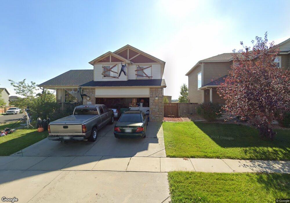
1808 Buckskin Ave Brighton, CO 80603
Estimated Value: $475,882 - $507,000
4
Beds
3
Baths
2,576
Sq Ft
$191/Sq Ft
Est. Value
About This Home
This home is located at 1808 Buckskin Ave, Brighton, CO 80603 and is currently estimated at $491,471, approximately $190 per square foot. 1808 Buckskin Ave is a home located in Weld County with nearby schools including Weld Central Senior High School, Bromley East Charter School, and Foundations Academy.
Ownership History
Date
Name
Owned For
Owner Type
Purchase Details
Closed on
Dec 27, 2024
Sold by
Wright Robert M and Wright Debbie S
Bought by
Stevenson Joshua P and Stevenson Brenda L
Current Estimated Value
Purchase Details
Closed on
Jun 15, 2011
Sold by
Stevenson Joshua P
Bought by
Stevenson Joshua P and Wright Robert M
Purchase Details
Closed on
May 11, 2011
Sold by
Fannie Mae
Bought by
Stevenson Joshua P
Purchase Details
Closed on
Oct 4, 2010
Sold by
Avalon Manuel and Avalon Adelaida L
Bought by
Federal National Mortgage Association
Purchase Details
Closed on
Dec 15, 2006
Sold by
J & J Construction Northern Colorado Llc
Bought by
Avalos Manuel and Avalos Adelaida L
Home Financials for this Owner
Home Financials are based on the most recent Mortgage that was taken out on this home.
Original Mortgage
$191,500
Interest Rate
6.31%
Mortgage Type
Unknown
Create a Home Valuation Report for This Property
The Home Valuation Report is an in-depth analysis detailing your home's value as well as a comparison with similar homes in the area
Home Values in the Area
Average Home Value in this Area
Purchase History
| Date | Buyer | Sale Price | Title Company |
|---|---|---|---|
| Stevenson Joshua P | -- | None Listed On Document | |
| Stevenson Joshua P | -- | None Available | |
| Stevenson Joshua P | $160,000 | None Available | |
| Federal National Mortgage Association | $222,489 | None Available | |
| Avalos Manuel | $216,500 | Ltg |
Source: Public Records
Mortgage History
| Date | Status | Borrower | Loan Amount |
|---|---|---|---|
| Previous Owner | Avalos Manuel | $191,500 |
Source: Public Records
Tax History Compared to Growth
Tax History
| Year | Tax Paid | Tax Assessment Tax Assessment Total Assessment is a certain percentage of the fair market value that is determined by local assessors to be the total taxable value of land and additions on the property. | Land | Improvement |
|---|---|---|---|---|
| 2025 | $4,367 | $28,780 | $7,810 | $20,970 |
| 2024 | $4,367 | $28,780 | $7,810 | $20,970 |
| 2023 | $4,251 | $33,970 | $8,120 | $25,850 |
| 2022 | $3,269 | $24,460 | $4,520 | $19,940 |
| 2021 | $3,429 | $25,170 | $4,650 | $20,520 |
| 2020 | $3,033 | $23,000 | $3,220 | $19,780 |
| 2019 | $3,173 | $23,000 | $3,220 | $19,780 |
| 2018 | $2,884 | $20,080 | $3,240 | $16,840 |
| 2017 | $2,916 | $20,080 | $3,240 | $16,840 |
| 2016 | $2,345 | $17,620 | $2,550 | $15,070 |
| 2015 | $2,259 | $17,620 | $2,550 | $15,070 |
| 2014 | $1,711 | $12,920 | $2,790 | $10,130 |
Source: Public Records
Map
Nearby Homes
- 252 Firestone Cir
- 1688 Aquamarine Dr
- 246 Iron St
- 269 Jewel St
- 277 Jewel St
- 894 Willow Oak St
- ELDER II Plan at Silver Peaks
- BRIDGEPORT Plan at Silver Peaks
- Hennessy Plan at Silver Peaks
- HENLEY Plan at Silver Peaks
- Chatham Plan at Silver Peaks
- LARK Plan at Silver Peaks
- BELLAMY Plan at Silver Peaks
- Edmon Plan at Silver Peaks
- Adair Plan at Silver Peaks
- 766 Gamble Oak St
- 412 Iron St
- 607 Azalea St
- 802 Gamble Oak St
- 637 Gamble Oak St
- 1816 Buckskin Ave
- 174 Gem Way
- 166 Gem Way
- 189 Firestone Cir
- 1807 Buckskin Ave
- 213 Firestone Cir
- 1793 Buckskin Ave
- 183 Firestone Cir
- 1776 Buckskin Ave
- 1791 Aquamarine Dr
- 1783 Aquamarine Dr
- 1779 Buckskin Ave
- 190 Firestone Cir
- 1775 Aquamarine Dr
- 1768 Buckskin Ave
- 177 Firestone Cir
- 205 Hermosa St
- 219 Firestone Cir
- 1767 Aquamarine Dr
- 213 Hermosa St