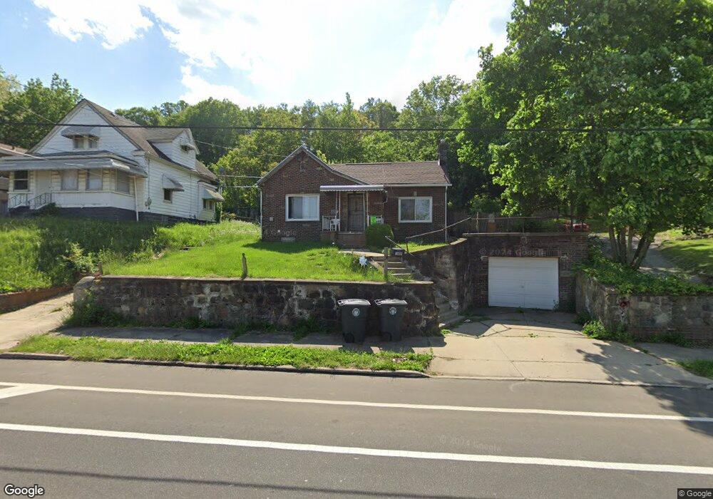
1808 Manchester Rd Akron, OH 44314
Kenmore NeighborhoodEstimated Value: $55,000 - $128,073
3
Beds
1
Bath
1,171
Sq Ft
$76/Sq Ft
Est. Value
About This Home
This home is located at 1808 Manchester Rd, Akron, OH 44314 and is currently estimated at $88,518, approximately $75 per square foot. 1808 Manchester Rd is a home located in Summit County with nearby schools including Pfeiffer Elementary School, Kenmore Garfield Community Learning Center, and St. Bernard-St. Mary Elementary School.
Ownership History
Date
Name
Owned For
Owner Type
Purchase Details
Closed on
Nov 3, 2025
Sold by
Wilmoth Cecil L
Bought by
S Flip Llc
Current Estimated Value
Home Financials for this Owner
Home Financials are based on the most recent Mortgage that was taken out on this home.
Original Mortgage
$90,000
Outstanding Balance
$60,630
Interest Rate
6.34%
Mortgage Type
Construction
Estimated Equity
$27,888
Purchase Details
Closed on
Nov 15, 2022
Sold by
County Treasurer
Bought by
Adair Asset Management Llc
Purchase Details
Closed on
Jun 30, 2016
Sold by
Brunson Mary V
Bought by
Wilmoth Cecil L
Purchase Details
Closed on
May 29, 2004
Sold by
Hagenbush James E and Hagenbush Kim
Bought by
Brunson Mary
Purchase Details
Closed on
Nov 20, 1995
Sold by
Est Henry J Horvath
Bought by
Hagenbush James E
Home Financials for this Owner
Home Financials are based on the most recent Mortgage that was taken out on this home.
Original Mortgage
$49,470
Interest Rate
7.65%
Mortgage Type
VA
Create a Home Valuation Report for This Property
The Home Valuation Report is an in-depth analysis detailing your home's value as well as a comparison with similar homes in the area
Home Values in the Area
Average Home Value in this Area
Purchase History
| Date | Buyer | Sale Price | Title Company |
|---|---|---|---|
| S Flip Llc | $55,000 | None Listed On Document | |
| Adair Asset Management Llc | -- | -- | |
| Wilmoth Cecil L | $14,500 | First American Title Ins Co | |
| Brunson Mary | $45,000 | Akron Title | |
| Hagenbush James E | $48,500 | -- |
Source: Public Records
Mortgage History
| Date | Status | Borrower | Loan Amount |
|---|---|---|---|
| Open | S Flip Llc | $90,000 | |
| Previous Owner | Hagenbush James E | $49,470 |
Source: Public Records
Tax History
| Year | Tax Paid | Tax Assessment Tax Assessment Total Assessment is a certain percentage of the fair market value that is determined by local assessors to be the total taxable value of land and additions on the property. | Land | Improvement |
|---|---|---|---|---|
| 2025 | $4,265 | $36,607 | $7,413 | $29,194 |
| 2024 | $2,158 | $36,607 | $7,413 | $29,194 |
| 2023 | $4,265 | $36,607 | $7,413 | $29,194 |
| 2022 | $1,703 | $21,966 | $4,361 | $17,605 |
| 2021 | $1,704 | $21,966 | $4,361 | $17,605 |
| 2020 | $1,782 | $21,970 | $4,360 | $17,610 |
| 2019 | $1,701 | $18,840 | $5,990 | $12,850 |
| 2018 | $1,682 | $18,840 | $5,990 | $12,850 |
| 2017 | $1,605 | $18,840 | $5,990 | $12,850 |
| 2016 | $1,656 | $18,840 | $5,990 | $12,850 |
| 2015 | $1,605 | $18,840 | $5,990 | $12,850 |
| 2014 | $1,593 | $18,840 | $5,990 | $12,850 |
| 2013 | $1,624 | $19,690 | $5,990 | $13,700 |
Source: Public Records
Map
Nearby Homes
- 1887 Ritzman Ct
- 603 Indian Trail
- 1909 2nd St SW
- 2125 7th St SW
- 780 Silvercrest Ave
- 1865 9th St SW
- 764 Harrison Ave
- 2125 10th St SW
- 0 Lakeside Dr Unit 5194584
- 2079 12th St SW
- 1575 Overlook Dr
- 2104 11th St SW
- 779 & 781 Jason Ave
- 333 Lloyd St
- 1556 Overlook Dr
- 2100 12th St SW
- 788 Saxon Ave
- 2171 12th St SW
- 2271 5th St SW
- 1797 13th St SW Unit 1799
- 1814 Manchester Rd
- 1820 Manchester Rd
- 567 Harvey Ave
- 1786 Manchester Rd
- 1809 Manchester Rd
- 1813 Manchester Rd
- 1795 Manchester Rd
- 1805 Manchester Rd
- 575 Harvey Ave
- 1791 Manchester Rd
- 1791 Manchester Rd Unit 1793
- 1784 Manchester Rd
- 566 Harvey Ave
- 1780 Manchester Rd
- 523 Harvey Ave
- 1778 Manchester Rd Unit 1780
- 521 Rothrock Ave
- 572 Harvey Ave
- 1791 Leighton Ave
- 1777 Manchester Rd
Your Personal Tour Guide
Ask me questions while you tour the home.