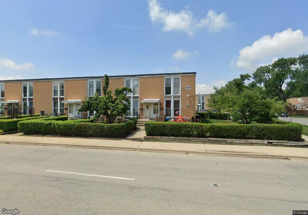
1808 Mannheim Rd Des Plaines, IL 60018
Estimated Value: $258,297 - $329,000
3
Beds
2
Baths
1,152
Sq Ft
$245/Sq Ft
Est. Value
About This Home
This home is located at 1808 Mannheim Rd, Des Plaines, IL 60018 and is currently estimated at $282,574, approximately $245 per square foot. 1808 Mannheim Rd is a home located in Cook County with nearby schools including Plainfield Elementary School, Algonquin Middle School, and Maine West High School.
Ownership History
Date
Name
Owned For
Owner Type
Purchase Details
Closed on
Mar 9, 1995
Sold by
Morales Cornelio C and Morales Isabel
Bought by
Martinez Fausto and Martinez Reyna
Current Estimated Value
Home Financials for this Owner
Home Financials are based on the most recent Mortgage that was taken out on this home.
Original Mortgage
$75,000
Interest Rate
9%
Create a Home Valuation Report for This Property
The Home Valuation Report is an in-depth analysis detailing your home's value as well as a comparison with similar homes in the area
Home Values in the Area
Average Home Value in this Area
Purchase History
| Date | Buyer | Sale Price | Title Company |
|---|---|---|---|
| Martinez Fausto | $90,000 | -- |
Source: Public Records
Mortgage History
| Date | Status | Borrower | Loan Amount |
|---|---|---|---|
| Closed | Martinez Fausto | $75,000 |
Source: Public Records
Tax History
| Year | Tax Paid | Tax Assessment Tax Assessment Total Assessment is a certain percentage of the fair market value that is determined by local assessors to be the total taxable value of land and additions on the property. | Land | Improvement |
|---|---|---|---|---|
| 2025 | $5,009 | $18,000 | $2,632 | $15,368 |
| 2024 | $5,009 | $19,000 | $3,000 | $16,000 |
| 2023 | $4,009 | $19,000 | $3,000 | $16,000 |
| 2022 | $4,009 | $19,000 | $3,000 | $16,000 |
| 2021 | $2,662 | $11,989 | $1,118 | $10,871 |
| 2020 | $2,685 | $11,989 | $1,118 | $10,871 |
| 2019 | $2,702 | $13,471 | $1,118 | $12,353 |
| 2018 | $3,591 | $15,442 | $987 | $14,455 |
| 2017 | $3,545 | $15,442 | $987 | $14,455 |
| 2016 | $3,597 | $15,442 | $987 | $14,455 |
| 2015 | $3,168 | $13,104 | $855 | $12,249 |
| 2014 | $3,118 | $13,104 | $855 | $12,249 |
| 2013 | $3,023 | $13,104 | $855 | $12,249 |
Source: Public Records
Map
Nearby Homes
- 1445 Everett Ave
- 1696 S Elm St
- 1689 S Elm St
- 1645 Illinois St
- 1370 Fargo Ave Unit E
- 1721 Prospect Ave
- 2220 S Chestnut St
- 1080 Bogart St
- 1754 E Lincoln Ave
- 815 E Oakton St Unit 311
- 1700 E Forest Ave
- 1640 S River Rd
- 1394 Carol Ln
- 1629 E Touhy Ave
- 1641 E Touhy Ave
- 635 Birchwood Ave
- 664 E Oakton St
- 614 Birchwood Ave
- 1990 Berry Ln
- 2323 Douglas Ave
- 1816 Mannheim Rd
- 1804 Mannheim Rd
- 1820 Mannheim Rd
- 1822 Mannheim Rd
- 1824 Mannheim Rd
- 1824 Mannheim Rd Unit 1824
- 1828 Mannheim Rd
- 1829 Pine Ct
- 1832 Mannheim Rd
- 1813 Pine St
- 1809 Pine St
- 1805 Pine St
- 1833 Pine Ct
- 1817 Pine St
- 1821 Pine St
- 1836 Mannheim Rd
- 1825 Pine St
- 1837 Pine Ct
- 1840 Mannheim Rd
- 1829 Pine St
Your Personal Tour Guide
Ask me questions while you tour the home.