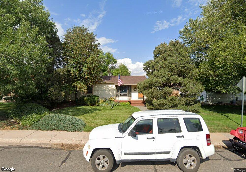
1808 Newton Dr Cheyenne, WY 82001
Estimated Value: $335,000 - $361,000
--
Bed
--
Bath
1,332
Sq Ft
$261/Sq Ft
Est. Value
About This Home
This home is located at 1808 Newton Dr, Cheyenne, WY 82001 and is currently estimated at $347,848, approximately $261 per square foot. 1808 Newton Dr is a home located in Laramie County with nearby schools including Henderson Elementary School, Carey Junior High School, and East High School.
Ownership History
Date
Name
Owned For
Owner Type
Purchase Details
Closed on
Sep 13, 2022
Sold by
Kowrach-Bentley Mariska M
Bought by
Kowrach Family Trust
Current Estimated Value
Purchase Details
Closed on
Jul 14, 2022
Sold by
Michael Brooks
Bought by
Results Real Estate Llc
Purchase Details
Closed on
Mar 25, 2022
Sold by
Raymond R Kowrach Revocable Trust
Bought by
Kowrach-Bentley Mariska M and Kowrach Patrick M
Create a Home Valuation Report for This Property
The Home Valuation Report is an in-depth analysis detailing your home's value as well as a comparison with similar homes in the area
Home Values in the Area
Average Home Value in this Area
Purchase History
| Date | Buyer | Sale Price | Title Company |
|---|---|---|---|
| Kowrach Family Trust | -- | -- | |
| Results Real Estate Llc | -- | First American Title | |
| Kowrach-Bentley Mariska M | -- | None Listed On Document |
Source: Public Records
Tax History Compared to Growth
Tax History
| Year | Tax Paid | Tax Assessment Tax Assessment Total Assessment is a certain percentage of the fair market value that is determined by local assessors to be the total taxable value of land and additions on the property. | Land | Improvement |
|---|---|---|---|---|
| 2025 | $2,177 | $24,187 | $3,124 | $21,063 |
| 2024 | $2,177 | $30,793 | $4,166 | $26,627 |
| 2023 | $2,207 | $31,218 | $4,166 | $27,052 |
| 2022 | $1,894 | $26,236 | $4,166 | $22,070 |
| 2021 | $1,577 | $24,799 | $4,166 | $20,633 |
| 2020 | $1,581 | $21,911 | $4,166 | $17,745 |
| 2019 | $1,502 | $20,803 | $4,166 | $16,637 |
| 2018 | $1,334 | $18,648 | $3,844 | $14,804 |
| 2017 | $1,287 | $17,828 | $3,844 | $13,984 |
| 2016 | $1,202 | $16,655 | $3,653 | $13,002 |
| 2015 | $1,119 | $15,488 | $3,653 | $11,835 |
| 2014 | $1,218 | $16,762 | $3,653 | $13,109 |
Source: Public Records
Map
Nearby Homes
- 1813 Andover Dr
- 1813 Newton Dr
- 1801 Milton Dr
- 3700 Essex Rd
- 1718 Newton Dr
- 1958 Newton Dr
- 3529 Concord Rd
- 1702 Newton Dr
- 1751 E Pershing Blvd
- 3444 Dover Rd
- 1731 E Pershing Blvd
- 3561 Boston Rd
- 1808 E 21st St
- 3628 Amherst Rd
- 1610 E 20th St
- 1408 E 22nd St
- TBD Charles St
- TBD E Lincolnway
- Lot 1 E Phipps Ave
- Tract 1 E Pershing Blvd
- 1802 Newton Dr
- 1812 Newton Dr
- 1820 Newton Dr
- 1809 Andover Dr
- 1801 Andover Dr
- 1824 Newton Dr
- 1794 Newton Dr
- 1819 Andover Dr
- 1801 Newton Dr
- 3612 Durham Rd
- 1828 Newton Dr
- 1825 Andover Dr
- 1821 Newton Dr
- 1795 Newton Dr
- 1789 Andover Dr
- 1825 Newton Dr
- 1831 Andover Dr
- 1834 Newton Dr
- 1782 Newton Dr
- 1789 Newton Dr