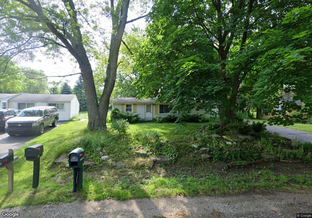
1808 Payson Rd Walled Lake, MI 48390
Estimated Value: $204,000 - $246,000
3
Beds
1
Bath
1,234
Sq Ft
$182/Sq Ft
Est. Value
About This Home
This home is located at 1808 Payson Rd, Walled Lake, MI 48390 and is currently estimated at $224,498, approximately $181 per square foot. 1808 Payson Rd is a home located in Oakland County with nearby schools including Mary Helen Guest Elementary School, James R Geisler Middle School, and Walled Lake Central High School.
Ownership History
Date
Name
Owned For
Owner Type
Purchase Details
Closed on
Jan 25, 2014
Sold by
Kirby Kenneth and Kirby Linda S
Bought by
Fink Matthew J and Fink Linda D
Current Estimated Value
Purchase Details
Closed on
Jan 23, 2014
Sold by
Kirby Michael J and Kirby Joanne M
Bought by
Fink Matthew J and Fink Linda D
Purchase Details
Closed on
Jan 22, 2014
Sold by
Fink Kathleen
Bought by
Fink Matthew J and Fink Linda D
Purchase Details
Closed on
Jan 3, 2014
Sold by
Kirby Michael and Estate Of Edward B Kirby
Bought by
Kirby Michael J and Fink Kathleen
Create a Home Valuation Report for This Property
The Home Valuation Report is an in-depth analysis detailing your home's value as well as a comparison with similar homes in the area
Home Values in the Area
Average Home Value in this Area
Purchase History
| Date | Buyer | Sale Price | Title Company |
|---|---|---|---|
| Fink Matthew J | -- | None Available | |
| Fink Matthew J | -- | None Available | |
| Fink Matthew J | -- | None Available | |
| Fink Matthew J | -- | None Available | |
| Fink Matthew J | -- | None Available | |
| Kirby Michael J | -- | None Available |
Source: Public Records
Tax History Compared to Growth
Tax History
| Year | Tax Paid | Tax Assessment Tax Assessment Total Assessment is a certain percentage of the fair market value that is determined by local assessors to be the total taxable value of land and additions on the property. | Land | Improvement |
|---|---|---|---|---|
| 2024 | $2,365 | $91,160 | $0 | $0 |
| 2023 | $1,972 | $84,890 | $0 | $0 |
| 2022 | $1,964 | $77,260 | $0 | $0 |
| 2021 | $1,990 | $73,910 | $0 | $0 |
| 2020 | $1,902 | $68,960 | $0 | $0 |
| 2019 | $1,960 | $62,960 | $0 | $0 |
| 2018 | $2,790 | $56,960 | $0 | $0 |
| 2017 | $3,193 | $55,810 | $0 | $0 |
| 2016 | $3,238 | $52,580 | $0 | $0 |
| 2015 | -- | $42,720 | $0 | $0 |
| 2014 | -- | $32,320 | $0 | $0 |
| 2011 | -- | $37,880 | $0 | $0 |
Source: Public Records
Map
Nearby Homes
- 1904 Meadow Ridge Dr
- 2138 Metzner Rd
- 3101 Cameron Cir
- 568 Woodhaven Dr Unit 89
- 462 Woodhaven Dr Unit 137
- 1128 Annjo St
- 29204 April Ct Unit 236
- 8204 Alexa Dr Unit 88
- 17102 Caitlin Cir Unit 147
- 30204 Chantel Dr Unit 228
- 18203 Adri Cir Unit 122
- 34202 Emma Cir
- 651 Woodhaven Dr
- 1439 Shankin Dr
- 2144 Park Place Dr
- 1700 Big Trail Rd
- 1895 Big Trail Rd
- 1533 Covington Crossing Unit 16
- 2450 S Commerce Rd
- 1747 Shankin Dr
- 1816 Payson Rd
- 1804 Payson Rd
- 1789 Weir Rd
- 1830 Payson Rd
- 1811 Payson Rd
- 1431 Appleford St
- 1835 Weir Rd
- 1799 Payson Rd
- 1825 Payson Rd
- 1785 Payson Rd
- 1439 Appleford St
- 1423 Appleford St
- 1842 Payson Rd
- 1919 Weir Rd
- 1961 Weir Rd
- 1839 Payson Rd
- 1451 Appleford St
- 1877 Weir Rd
- 1771 Payson Rd
- 1411 Appleford St