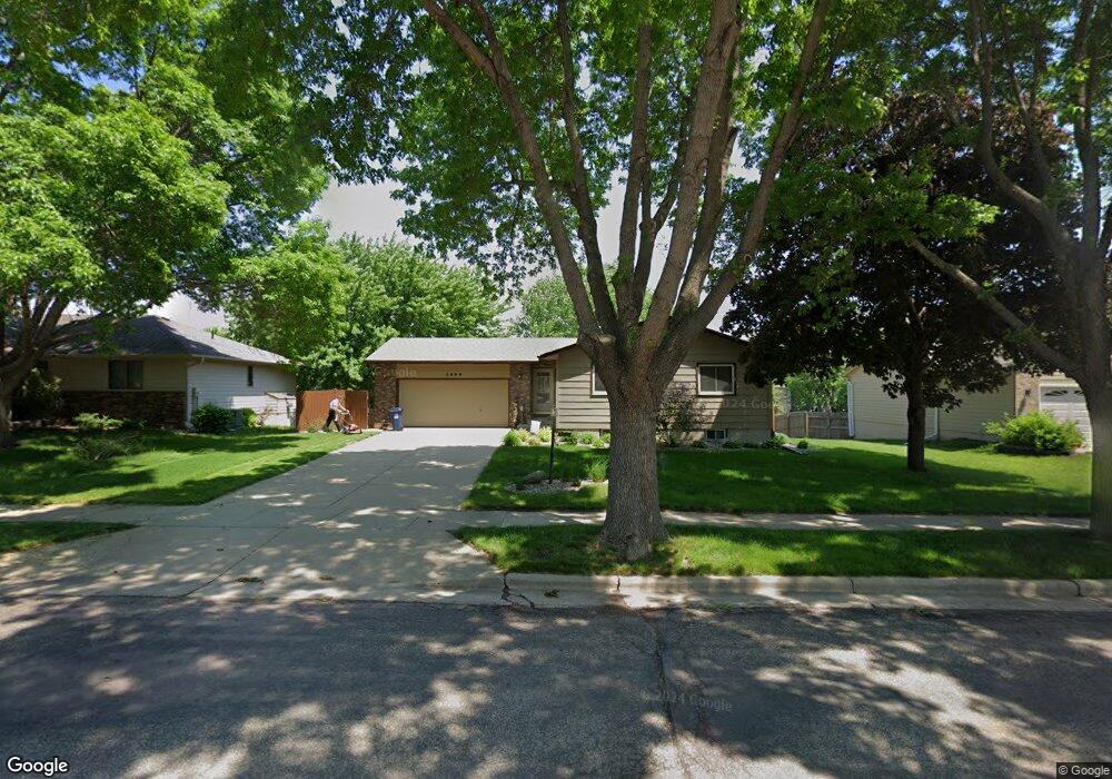
1808 S Devon Dr Sioux Falls, SD 57106
Kingswood NeighborhoodEstimated Value: $313,643 - $350,000
3
Beds
2
Baths
1,976
Sq Ft
$168/Sq Ft
Est. Value
About This Home
This home is located at 1808 S Devon Dr, Sioux Falls, SD 57106 and is currently estimated at $331,661, approximately $167 per square foot. 1808 S Devon Dr is a home located in Minnehaha County with nearby schools including Oscar Howe Elementary School, Memorial Middle School, and Roosevelt High School.
Ownership History
Date
Name
Owned For
Owner Type
Purchase Details
Closed on
Sep 6, 2024
Sold by
Solid Rock Properties Holdings Inc
Bought by
Kirk Ashley M
Current Estimated Value
Home Financials for this Owner
Home Financials are based on the most recent Mortgage that was taken out on this home.
Original Mortgage
$95,000
Outstanding Balance
$93,561
Interest Rate
6.47%
Estimated Equity
$238,100
Create a Home Valuation Report for This Property
The Home Valuation Report is an in-depth analysis detailing your home's value as well as a comparison with similar homes in the area
Home Values in the Area
Average Home Value in this Area
Purchase History
| Date | Buyer | Sale Price | Title Company |
|---|---|---|---|
| Kirk Ashley M | $345,000 | -- | |
| Kirk Ashley M | $345,000 | -- |
Source: Public Records
Mortgage History
| Date | Status | Borrower | Loan Amount |
|---|---|---|---|
| Open | Kirk Ashley M | $95,000 | |
| Closed | Kirk Ashley M | $95,000 |
Source: Public Records
Tax History
| Year | Tax Paid | Tax Assessment Tax Assessment Total Assessment is a certain percentage of the fair market value that is determined by local assessors to be the total taxable value of land and additions on the property. | Land | Improvement |
|---|---|---|---|---|
| 2024 | $2,850 | $206,500 | $26,600 | $179,900 |
| 2023 | $2,952 | $206,500 | $26,600 | $179,900 |
| 2022 | $2,654 | $174,400 | $26,600 | $147,800 |
| 2021 | $2,523 | $159,300 | $0 | $0 |
| 2020 | $2,523 | $159,200 | $0 | $0 |
| 2019 | $2,450 | $151,732 | $0 | $0 |
| 2018 | $2,226 | $147,542 | $0 | $0 |
| 2017 | $2,121 | $138,149 | $27,056 | $111,093 |
| 2016 | $2,121 | $131,498 | $25,365 | $106,133 |
| 2015 | $2,090 | $124,555 | $25,365 | $99,190 |
| 2014 | $2,051 | $123,563 | $25,365 | $98,198 |
Source: Public Records
Map
Nearby Homes
- 5913 W 27th St
- 2305 S Royal Ct
- 5417 W Oak St
- 2401 S Beech Ave
- 5808 W 32nd St
- 1605 S Silver Creek Cir
- 2408 S Valley View Rd
- 1000 S Bridgeport Place
- 6201 W 32nd St
- 5615 W Dardanella Rd
- 5909 W Chadwick Place
- 5704 W Walden Dr
- 6520 W Westminster Dr
- 1402 S Ebenezer Ave
- 6418 W Hillary Dr
- 5501 W Clay St
- 2209 S Dover Dr
- 2309 S Dover Dr
- 4501 W Graceland Place
- 1412 S Deerberry Trail
- 1804 S Devon Dr
- 1900 S Devon Dr
- 1800 S Devon Dr
- 1904 S Devon Dr
- 5700 W Parliament Dr
- 1809 S Cambridge Ave
- 1813 S Cambridge Ave
- 5701 W Parliament Dr
- 1817 S Cambridge Ave
- 5701 W 26th St
- 1908 S Devon Dr
- 1805 S Cambridge Ave
- 1901 S Cambridge Ave
- 5704 W Parliament Dr
- 5704 Parliment Dr
- 1801 S Cambridge Ave
- 1905 S Devon Dr
- 5705 W Parliament Dr
- 5705 Parliment Dr
- 1905 S Cambridge Ave
Your Personal Tour Guide
Ask me questions while you tour the home.