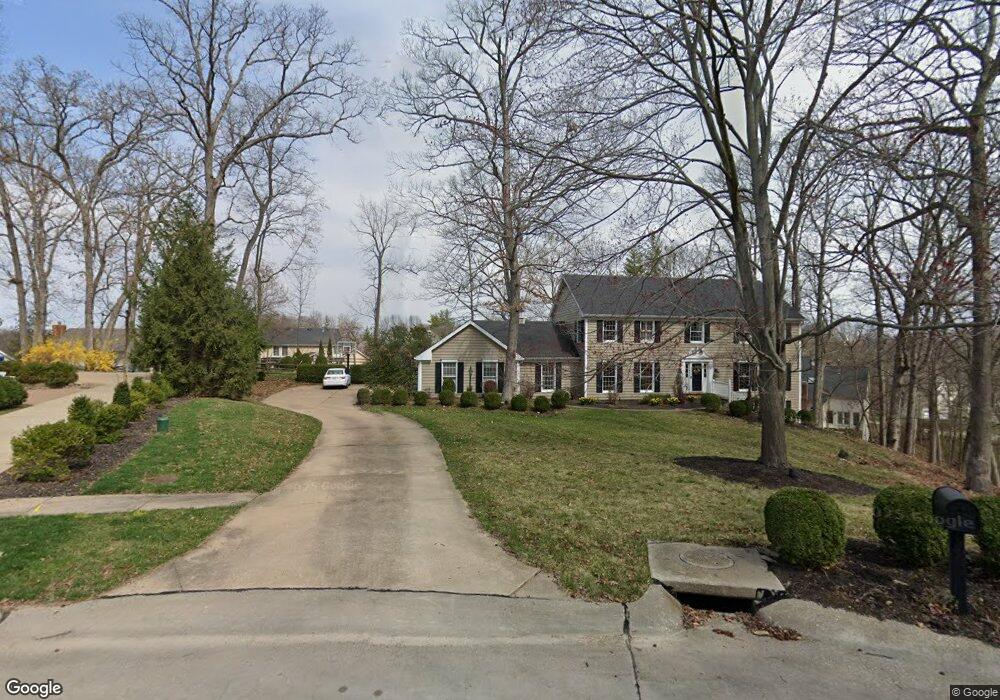
1808 Stenton Path Chesterfield, MO 63005
Estimated Value: $833,000 - $927,879
4
Beds
4
Baths
5,360
Sq Ft
$163/Sq Ft
Est. Value
About This Home
This home is located at 1808 Stenton Path, Chesterfield, MO 63005 and is currently estimated at $873,220, approximately $162 per square foot. 1808 Stenton Path is a home located in St. Louis County with nearby schools including Kehrs Mill Elementary, Crestview Middle School, and Marquette Sr. High School.
Ownership History
Date
Name
Owned For
Owner Type
Purchase Details
Closed on
Dec 20, 2017
Sold by
Madsen Matthew L and Madsen Lisa
Bought by
Madsen Matthew L and Madsen Lisa A
Current Estimated Value
Purchase Details
Closed on
Oct 30, 2005
Sold by
Stein Steven F and Stein Diane E
Bought by
Madsen Matthew L and Madsen Lisa
Home Financials for this Owner
Home Financials are based on the most recent Mortgage that was taken out on this home.
Original Mortgage
$441,600
Outstanding Balance
$238,446
Interest Rate
5.9%
Mortgage Type
Fannie Mae Freddie Mac
Estimated Equity
$634,774
Purchase Details
Closed on
Feb 21, 1997
Sold by
Hobgood Walter P and Hobgood Gail R
Bought by
Stein Steven F and Stein Diane E
Home Financials for this Owner
Home Financials are based on the most recent Mortgage that was taken out on this home.
Original Mortgage
$296,850
Interest Rate
6.37%
Create a Home Valuation Report for This Property
The Home Valuation Report is an in-depth analysis detailing your home's value as well as a comparison with similar homes in the area
Home Values in the Area
Average Home Value in this Area
Purchase History
| Date | Buyer | Sale Price | Title Company |
|---|---|---|---|
| Madsen Matthew L | -- | None Available | |
| Madsen Matthew L | $552,000 | -- | |
| Stein Steven F | -- | -- |
Source: Public Records
Mortgage History
| Date | Status | Borrower | Loan Amount |
|---|---|---|---|
| Open | Madsen Matthew L | $441,600 | |
| Previous Owner | Stein Steven F | $296,850 |
Source: Public Records
Tax History Compared to Growth
Tax History
| Year | Tax Paid | Tax Assessment Tax Assessment Total Assessment is a certain percentage of the fair market value that is determined by local assessors to be the total taxable value of land and additions on the property. | Land | Improvement |
|---|---|---|---|---|
| 2025 | $9,190 | $145,580 | $59,570 | $86,010 |
| 2024 | $9,190 | $129,110 | $37,910 | $91,200 |
| 2023 | $9,190 | $129,110 | $37,910 | $91,200 |
| 2022 | $8,104 | $108,650 | $41,290 | $67,360 |
| 2021 | $8,058 | $108,650 | $41,290 | $67,360 |
| 2020 | $7,865 | $102,390 | $41,650 | $60,740 |
| 2019 | $7,821 | $102,390 | $41,650 | $60,740 |
| 2018 | $7,044 | $86,930 | $27,630 | $59,300 |
| 2017 | $6,886 | $86,930 | $27,630 | $59,300 |
| 2016 | $7,150 | $86,750 | $22,740 | $64,010 |
| 2015 | $7,001 | $86,750 | $22,740 | $64,010 |
| 2014 | $6,555 | $79,060 | $21,190 | $57,870 |
Source: Public Records
Map
Nearby Homes
- 1611 Walpole Dr Unit C
- 1621 Walpole Dr Unit B
- 1910 Walden Pond Ct
- 1566 Milbridge Dr Unit 13
- 15966 Quiet Oak Rd
- 2 Monarch Trace Ct Unit 108
- 831 Stone Meadow Dr
- 1521 Hedgeford Dr Unit 9
- 1521 Hedgeford Dr Unit 8
- 2130 Willow Way Ct
- 1255 Walnut Hill Farm Dr
- 15708 Cedarmill Dr
- 16094 Meadow Oak Dr
- 1904 Dewitt Ridge Dr
- 15561 Highcroft Dr
- 15593 Bedford Forge Dr Unit 6
- 16432 Farmers Mill Ln
- 1512 Bedford Forge Ct Unit 19
- 1530 Bedford Forge Ct Unit 15
- 351 Oak Stand Ct
- 1710 Baxter Forest Valley Ct
- 1706 Baxter Forest Valley Ct
- 16534 Baxter Forest Ridge Dr
- 1814 Stenton Path
- 16538 Baxter Forest Ridge Dr
- 1714 Baxter Forest Valley Ct
- 1805 Stenton Path
- 1802 Stenton Path
- 1702 Baxter Forest Valley Ct
- 1820 Stenton Path
- 1718 Baxter Forest Valley Ct
- 1811 Stenton Path
- 1715 Baxter Forest Valley Ct
- 16531 Baxter Forest Ridge Dr
- 1709 Baxter Forest Valley Ct
- 16527 Baxter Forest Ridge Dr
- 1817 Stenton Path
- 1719 Baxter Forest Valley Ct
- 16546 Baxter Forest Ridge Dr
- 16535 Baxter Forest Ridge Dr