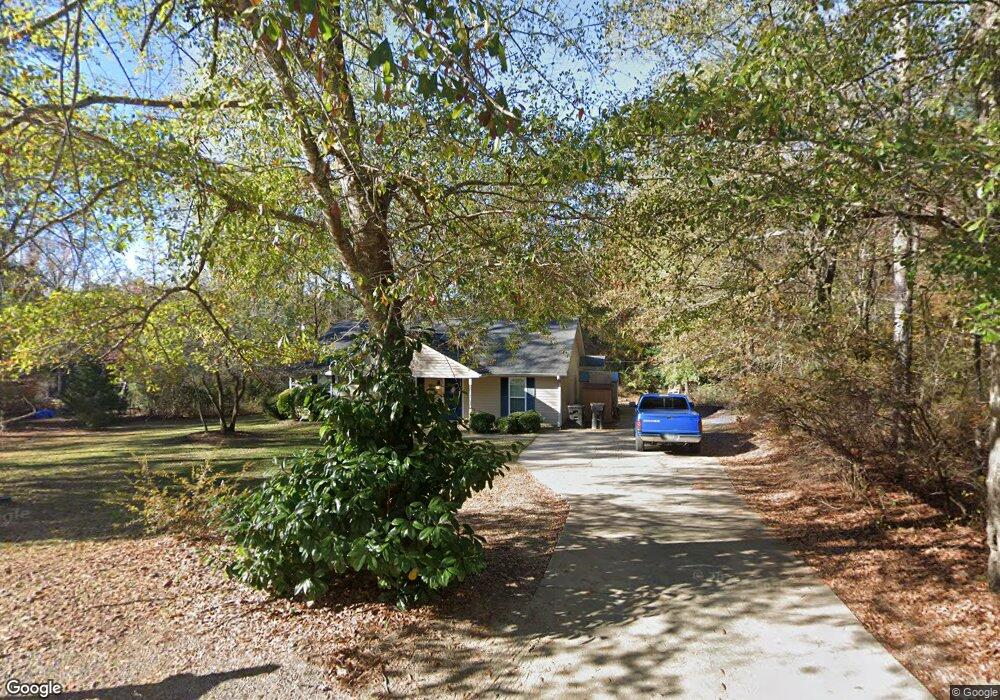
1809 Azalea Dr West Point, GA 31833
Estimated Value: $194,982 - $235,000
3
Beds
2
Baths
1,530
Sq Ft
$143/Sq Ft
Est. Value
About This Home
This home is located at 1809 Azalea Dr, West Point, GA 31833 and is currently estimated at $218,746, approximately $142 per square foot. 1809 Azalea Dr is a home located in Troup County with nearby schools including West Point Elementary School, Long Cane Elementary School, and Berta Weathersbee Elementary School.
Ownership History
Date
Name
Owned For
Owner Type
Purchase Details
Closed on
May 8, 2008
Sold by
Wappler David A
Bought by
Wappler David A and Jones Gisele
Current Estimated Value
Purchase Details
Closed on
Feb 20, 2007
Sold by
Jpmorgan Chase Bank
Bought by
Wappler David
Purchase Details
Closed on
Nov 7, 2006
Sold by
Hurst Robert
Bought by
Jpmorgan Chase Bank National A
Purchase Details
Closed on
Sep 30, 2004
Sold by
Earl Coarting Inc
Bought by
Catherine Hall
Purchase Details
Closed on
Oct 19, 1999
Sold by
Roy Roy B and Roy Robert W
Bought by
Earl Coarting Inc
Purchase Details
Closed on
Nov 30, 1988
Bought by
Roy Roy B and Roy Robert W
Create a Home Valuation Report for This Property
The Home Valuation Report is an in-depth analysis detailing your home's value as well as a comparison with similar homes in the area
Home Values in the Area
Average Home Value in this Area
Purchase History
| Date | Buyer | Sale Price | Title Company |
|---|---|---|---|
| Wappler David A | -- | -- | |
| Wappler David | $108,500 | -- | |
| Jpmorgan Chase Bank National A | $116,500 | -- | |
| Catherine Hall | $15,000 | -- | |
| Earl Coarting Inc | $150,000 | -- | |
| Roy Roy B | $72,400 | -- |
Source: Public Records
Tax History Compared to Growth
Tax History
| Year | Tax Paid | Tax Assessment Tax Assessment Total Assessment is a certain percentage of the fair market value that is determined by local assessors to be the total taxable value of land and additions on the property. | Land | Improvement |
|---|---|---|---|---|
| 2024 | $2,054 | $58,060 | $5,920 | $52,140 |
| 2023 | $2,074 | $58,228 | $5,920 | $52,308 |
| 2022 | $1,520 | $54,468 | $5,920 | $48,548 |
| 2021 | $1,360 | $45,088 | $5,920 | $39,168 |
| 2020 | $1,360 | $45,088 | $5,920 | $39,168 |
| 2019 | $1,221 | $40,488 | $5,520 | $34,968 |
| 2018 | $1,171 | $38,840 | $5,520 | $33,320 |
| 2017 | $1,171 | $38,840 | $5,520 | $33,320 |
| 2016 | $1,153 | $38,229 | $5,520 | $32,709 |
| 2015 | $1,168 | $38,666 | $5,957 | $32,709 |
| 2014 | $873 | $30,838 | $5,960 | $24,878 |
| 2013 | -- | $33,250 | $5,960 | $27,290 |
Source: Public Records
Map
Nearby Homes
- 1903 Ridgewood Dr
- 0 Ga Highway 0116 Unit 10619139
- 508 Pine St
- 1505 Wisteria Dr
- 1410 Roper Ave
- 1314 4th Ave
- 1008 E 12th St
- 1007 4th Ave
- 0 Sunset Dr Unit 10451831
- 713 Avenue H
- 0 Arrowhead Dr Unit 10451860
- 1508 N 4th Ave
- 712 4th Ave
- 804 E 6th St
- 509 Cleveland St
- 8035 County Road 289
- 311 E 4th St
- 4517 Georgia 18
- 4509 Georgia 18
- 4523 Georgia 18
- 1807 Azalea Dr
- 1808 Azalea Dr
- 1805 Azalea Dr
- 1804 Azalea Dr
- 1803 Azalea Dr
- 1802 Azalea Dr
- 1801 Azalea Dr
- 1801 Ridgewood Dr
- 1803 Ridgewood Dr
- 1901 Ridgewood Dr
- 1905 Ridgewood Dr
- 1907 Ridgewood Dr
- 0 Ridgewood Dr Unit 8432928
- 212 Neal St
- 200 Rabern St
- 200 Sheppard St
- 1705 Rosemont Ave
- 202 Rabern St
- 300 Neal St
- 201 Rabern St