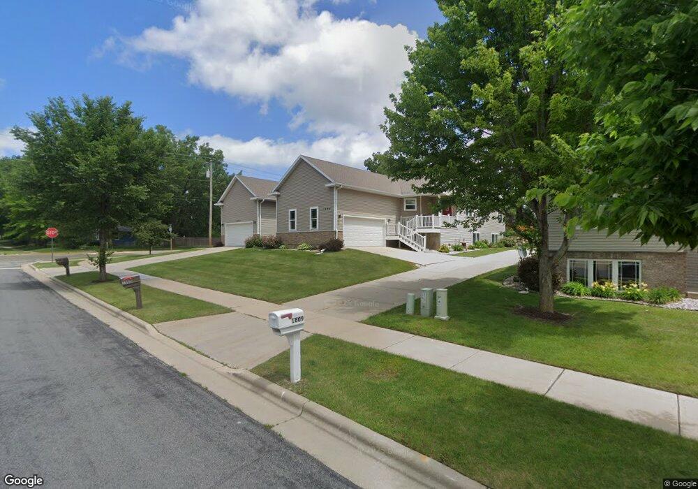
1809 Dondee Rd Madison, WI 53716
East Buckeye NeighborhoodEstimated Value: $419,000 - $449,000
3
Beds
3
Baths
2,716
Sq Ft
$160/Sq Ft
Est. Value
About This Home
This home is located at 1809 Dondee Rd, Madison, WI 53716 and is currently estimated at $434,762, approximately $160 per square foot. 1809 Dondee Rd is a home located in Dane County with nearby schools including Sennett Middle School, La Follette High School, and Nuestro Mundo.
Ownership History
Date
Name
Owned For
Owner Type
Purchase Details
Closed on
Oct 16, 2010
Sold by
Carlson Mark S
Bought by
Carlson Lori A
Current Estimated Value
Purchase Details
Closed on
Nov 1, 2009
Sold by
Carlson Mark
Bought by
Carlson Lori
Purchase Details
Closed on
Jul 31, 2009
Sold by
Miller Construction Inc
Bought by
Carlson Lori A and Carlson Mark
Home Financials for this Owner
Home Financials are based on the most recent Mortgage that was taken out on this home.
Original Mortgage
$124,000
Outstanding Balance
$77,871
Interest Rate
4.5%
Mortgage Type
New Conventional
Estimated Equity
$356,891
Create a Home Valuation Report for This Property
The Home Valuation Report is an in-depth analysis detailing your home's value as well as a comparison with similar homes in the area
Home Values in the Area
Average Home Value in this Area
Purchase History
| Date | Buyer | Sale Price | Title Company |
|---|---|---|---|
| Carlson Lori A | -- | None Available | |
| Carlson Lori | -- | None Available | |
| Carlson Lori A | $224,000 | None Available |
Source: Public Records
Mortgage History
| Date | Status | Borrower | Loan Amount |
|---|---|---|---|
| Open | Carlson Lori A | $124,000 |
Source: Public Records
Tax History
| Year | Tax Paid | Tax Assessment Tax Assessment Total Assessment is a certain percentage of the fair market value that is determined by local assessors to be the total taxable value of land and additions on the property. | Land | Improvement |
|---|---|---|---|---|
| 2024 | $12,339 | $368,400 | $56,200 | $312,200 |
| 2023 | $5,694 | $334,300 | $54,500 | $279,800 |
| 2022 | $12,523 | $334,300 | $46,000 | $288,300 |
| 2021 | $5,783 | $273,000 | $23,000 | $250,000 |
| 2020 | $6,055 | $273,000 | $23,000 | $250,000 |
| 2019 | $6,079 | $273,000 | $23,000 | $250,000 |
| 2018 | $6,070 | $273,000 | $23,000 | $250,000 |
| 2017 | $6,430 | $279,000 | $23,000 | $256,000 |
| 2016 | $5,290 | $224,000 | $23,000 | $201,000 |
| 2015 | $5,346 | $224,000 | $11,500 | $212,500 |
| 2014 | $5,349 | $224,000 | $11,500 | $212,500 |
| 2013 | $5,084 | $224,000 | $11,500 | $212,500 |
Source: Public Records
Map
Nearby Homes
- 1907-1909 Dondee Rd
- 5001 Stonehaven Dr
- 4615 Maher Ave
- 1133 Bonnie Ln
- 1606 Ellen Ave
- 1317 Ellen Ave
- 5525 Forge Dr
- 1100 Pflaum Rd
- 1002 Ellen Ave
- 1005 Tompkins Dr
- 10 Kings Mill Cir Unit 304
- 5316 Groveland Terrace
- 1634 Kings Mill Way Unit 208
- 122 Copps Ave
- 3602 Agriculture Dr
- 1314 Manassas Trail
- 4721 Femrite Dr
- 101 Ferchland Place Unit 105
- 3837 Monona Dr Unit 2
- 6159 Dell Dr Unit 1
- 1909 Dondee Rd
- 1907 Dondee Rd
- 1924 Tarragon Dr
- 1903 Dondee Rd
- 1821 Dondee Rd
- 1823 Dondee Rd
- 1803 Dondee Rd
- 1811 Dondee Rd Unit 1811
- 1803 Dondee Rd
- 1907 - 1909 Dondee Rd
- 1817 Dondee Rd
- 1901 Dondee Rd
- 1926 Tarragon Dr
- 1815 Dondee Rd
- 1805 Dondee Rd
- 1809 Dondee Rd Unit 1809
- 1818 Tarragon Dr
- 1814 Tarragon Dr
- 1902 Tarragon Dr
- 1824 Dondee Rd
Your Personal Tour Guide
Ask me questions while you tour the home.