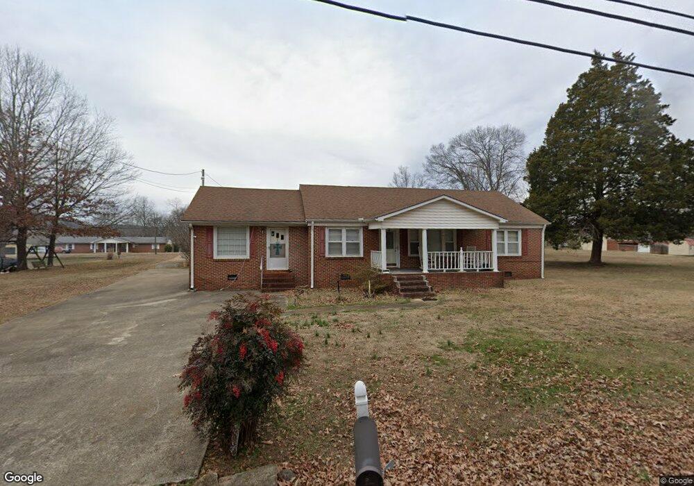
1809 Moody Ridge Rd Scottsboro, AL 35768
Estimated Value: $196,000 - $296,000
4
Beds
2
Baths
1,819
Sq Ft
$129/Sq Ft
Est. Value
About This Home
This home is located at 1809 Moody Ridge Rd, Scottsboro, AL 35768 and is currently estimated at $234,087, approximately $128 per square foot. 1809 Moody Ridge Rd is a home located in Jackson County with nearby schools including Scottsboro High School.
Ownership History
Date
Name
Owned For
Owner Type
Purchase Details
Closed on
Sep 4, 2012
Sold by
Dirrim Allen L and Dirrim Plennia
Bought by
Skipper Harl and Skipper Barbara
Current Estimated Value
Purchase Details
Closed on
May 11, 2011
Sold by
Homesales Inc
Bought by
Skipper Harl and Skipper Barbara
Home Financials for this Owner
Home Financials are based on the most recent Mortgage that was taken out on this home.
Original Mortgage
$55,000
Interest Rate
4.88%
Purchase Details
Closed on
Mar 28, 2008
Sold by
Sampley Lonnie R and Sampley Judy A
Bought by
Denton Donald G
Home Financials for this Owner
Home Financials are based on the most recent Mortgage that was taken out on this home.
Original Mortgage
$110,000
Interest Rate
6.22%
Create a Home Valuation Report for This Property
The Home Valuation Report is an in-depth analysis detailing your home's value as well as a comparison with similar homes in the area
Home Values in the Area
Average Home Value in this Area
Purchase History
| Date | Buyer | Sale Price | Title Company |
|---|---|---|---|
| Skipper Harl | -- | -- | |
| Skipper Harl | -- | -- | |
| Denton Donald G | -- | -- |
Source: Public Records
Mortgage History
| Date | Status | Borrower | Loan Amount |
|---|---|---|---|
| Previous Owner | Skipper Harl | $55,000 | |
| Previous Owner | Denton Donald G | $110,000 |
Source: Public Records
Tax History Compared to Growth
Tax History
| Year | Tax Paid | Tax Assessment Tax Assessment Total Assessment is a certain percentage of the fair market value that is determined by local assessors to be the total taxable value of land and additions on the property. | Land | Improvement |
|---|---|---|---|---|
| 2024 | $758 | $15,620 | $0 | $0 |
| 2023 | $655 | $13,500 | $0 | $0 |
| 2022 | $655 | $13,500 | $0 | $0 |
| 2021 | $655 | $13,500 | $0 | $0 |
| 2020 | $574 | $11,840 | $0 | $0 |
| 2019 | $0 | $11,840 | $0 | $0 |
| 2018 | $0 | $10,920 | $0 | $0 |
| 2017 | $0 | $109,100 | $0 | $0 |
| 2016 | -- | $104,200 | $0 | $0 |
| 2015 | -- | $104,200 | $0 | $0 |
| 2014 | -- | $104,200 | $0 | $0 |
| 2013 | -- | $104,200 | $0 | $0 |
Source: Public Records
Map
Nearby Homes
- 610 E Willow St
- 2205 E Willow St
- 3303 E Willow St
- 5 Newport Dr
- 25924 John T Reid Pkwy
- 528 Quincy St
- 525 Quincy St
- 109 Colonial Dr
- 410 Ponroy St
- 27 Alabama Ave
- 413 Alabama Ave
- 312 Kirby St
- 303 Veterans Dr
- 166 Alabama Ave
- 306 Larkin St
- 23 N George Adams Rd
- 206 Linwood St
- 2003 Cunningham St
- 260 E Maple Ave
- 39 S Kyle St
- 1807 Moody Ridge Rd
- 1808 E Willow St
- 1812 Moody Ridge Rd
- 1808 Moody Ridge Rd
- 1805 Moody Ridge Rd
- 1810 E Willow St
- 1815 Moody Ridge Rd
- 1814 Moody Ridge Rd
- 1812 E Willow St
- 1801 E Willow St
- 1816 Moody Ridge Rd
- 1802 Moody Ridge Rd
- 1803 E Willow St
- 1801 Moody Ridge Rd
- 1814 E Willow St
- 1901 Moody Ridge Rd
- 1717 E Willow St
- 1816 E Willow St
- 1902 Moody Ridge Rd
- 1703 Ashley St