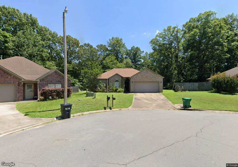
1809 Overview Dr Benton, AR 72015
Estimated Value: $191,000 - $200,000
3
Beds
2
Baths
1,315
Sq Ft
$149/Sq Ft
Est. Value
About This Home
This home is located at 1809 Overview Dr, Benton, AR 72015 and is currently estimated at $195,792, approximately $148 per square foot. 1809 Overview Dr is a home located in Saline County with nearby schools including Angie Grant Elementary School, Benton Middle School, and Benton Junior High School.
Ownership History
Date
Name
Owned For
Owner Type
Purchase Details
Closed on
Dec 8, 2010
Sold by
Stone Farris Lisa N
Bought by
Mcswain Beverly J
Current Estimated Value
Home Financials for this Owner
Home Financials are based on the most recent Mortgage that was taken out on this home.
Original Mortgage
$95,900
Outstanding Balance
$63,359
Interest Rate
4.22%
Mortgage Type
New Conventional
Estimated Equity
$132,433
Purchase Details
Closed on
Mar 7, 2005
Sold by
Newcomb Cost Co Inc
Bought by
Stone Lisa N and Stone Jeffery
Home Financials for this Owner
Home Financials are based on the most recent Mortgage that was taken out on this home.
Original Mortgage
$85,840
Interest Rate
5.71%
Mortgage Type
New Conventional
Purchase Details
Closed on
May 21, 2003
Bought by
Newcomb
Purchase Details
Closed on
Mar 11, 2003
Bought by
Regions Bank
Create a Home Valuation Report for This Property
The Home Valuation Report is an in-depth analysis detailing your home's value as well as a comparison with similar homes in the area
Home Values in the Area
Average Home Value in this Area
Purchase History
| Date | Buyer | Sale Price | Title Company |
|---|---|---|---|
| Mcswain Beverly J | $120,000 | -- | |
| Stone Lisa N | $18,000 | -- | |
| Newcomb | $158,000 | -- | |
| Regions Bank | $163,500 | -- |
Source: Public Records
Mortgage History
| Date | Status | Borrower | Loan Amount |
|---|---|---|---|
| Open | Mcswain Beverly J | $95,900 | |
| Previous Owner | Stone Lisa N | $85,840 |
Source: Public Records
Tax History
| Year | Tax Paid | Tax Assessment Tax Assessment Total Assessment is a certain percentage of the fair market value that is determined by local assessors to be the total taxable value of land and additions on the property. | Land | Improvement |
|---|---|---|---|---|
| 2025 | $1,360 | $30,111 | $5,200 | $24,911 |
| 2024 | $1,391 | $30,111 | $5,200 | $24,911 |
| 2023 | $935 | $30,111 | $5,200 | $24,911 |
| 2022 | $985 | $30,111 | $5,200 | $24,911 |
| 2021 | $920 | $23,370 | $4,000 | $19,370 |
| 2020 | $920 | $23,370 | $4,000 | $19,370 |
| 2019 | $920 | $23,370 | $4,000 | $19,370 |
| 2018 | $942 | $23,370 | $4,000 | $19,370 |
| 2017 | $939 | $23,370 | $4,000 | $19,370 |
| 2016 | $1,259 | $22,200 | $4,000 | $18,200 |
| 2015 | $887 | $22,200 | $4,000 | $18,200 |
| 2014 | $895 | $22,200 | $4,000 | $18,200 |
Source: Public Records
Map
Nearby Homes
- 1210 Ridgecrest Dr
- 1200 Oakview Dr
- 2902 Bristol Dr
- 818 Canterbury
- 814 Canterbury
- 816 Coral Cove
- 3451 Edison Ave
- 3716 & 3722 Silica Heights Rd
- 116 Austin
- 2200 Chatfield
- 1 Church
- 2002 Auburn Hills Dr
- 1815 Milburn Dr
- 1838 Milburn Dr
- 613 Church
- 2211 S Chatfield Rd
- 1120 Highway 35 Tract 3
- 000 Hwy 35 Tract B
- 391 Genesis Dr
- 00 Edison
- 1805 Ridgecrest Dr
- 1801 Overview Dr
- 1725 Overview Dr
- 1407 Ridgecrest Dr
- 0 Ridgecrest Dr Unit 15035019
- 0 Ridgecrest Dr Unit 17008434
- 0 Ridgecrest Dr Unit 17022154
- 0 Ridgecrest Dr Unit 17034578
- 1328 Ridgecrest Dr
- 1717 Overview Dr
- 1403 Ridgecrest Dr
- 1406 Cedar Crest Dr
- 1320 Ridgecrest Dr
- 1707 Overview Dr
- 1402 Cedar Crest Dr
- 1312 Ridgecrest Dr
- 1701 Overview Dr
- 1317 Ridgecrest Cove
- 1317 Ridgecrest Cove
- 1324 Hickory Crest
Your Personal Tour Guide
Ask me questions while you tour the home.