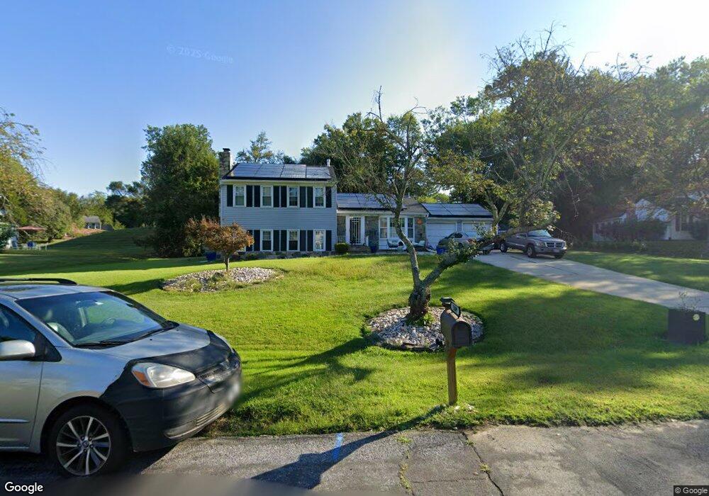
1809 Queensguard Rd Silver Spring, MD 20906
Layhill NeighborhoodEstimated Value: $676,000 - $702,000
Studio
3
Baths
2,292
Sq Ft
$299/Sq Ft
Est. Value
About This Home
This home is located at 1809 Queensguard Rd, Silver Spring, MD 20906 and is currently estimated at $686,376, approximately $299 per square foot. 1809 Queensguard Rd is a home located in Montgomery County with nearby schools including Bel Pre Elementary School, Strathmore Elementary School, and Argyle Middle School.
Ownership History
Date
Name
Owned For
Owner Type
Purchase Details
Closed on
Jul 7, 2005
Sold by
Rivera Ana L and Rivera Camilo O
Bought by
Green Paul and Green Henrietta M
Current Estimated Value
Home Financials for this Owner
Home Financials are based on the most recent Mortgage that was taken out on this home.
Original Mortgage
$359,650
Outstanding Balance
$184,383
Interest Rate
5.78%
Mortgage Type
New Conventional
Estimated Equity
$501,993
Purchase Details
Closed on
Sep 1, 2004
Sold by
Lemonovich William G and Lemonovich M M
Bought by
Rivera Ana L and Rivera Camilo O
Create a Home Valuation Report for This Property
The Home Valuation Report is an in-depth analysis detailing your home's value as well as a comparison with similar homes in the area
Home Values in the Area
Average Home Value in this Area
Purchase History
| Date | Buyer | Sale Price | Title Company |
|---|---|---|---|
| Green Paul | $567,876 | -- | |
| Rivera Ana L | $446,250 | -- | |
| Rivera Ana L | $446,250 | -- |
Source: Public Records
Mortgage History
| Date | Status | Borrower | Loan Amount |
|---|---|---|---|
| Open | Green Paul | $359,650 | |
| Closed | Green Paul | $179,800 |
Source: Public Records
Tax History
| Year | Tax Paid | Tax Assessment Tax Assessment Total Assessment is a certain percentage of the fair market value that is determined by local assessors to be the total taxable value of land and additions on the property. | Land | Improvement |
|---|---|---|---|---|
| 2025 | $6,679 | $573,100 | $194,300 | $378,800 |
| 2024 | $6,679 | $524,600 | $0 | $0 |
| 2023 | $5,333 | $476,100 | $0 | $0 |
| 2022 | $4,613 | $427,600 | $194,300 | $233,300 |
| 2021 | $4,261 | $415,600 | $0 | $0 |
| 2020 | $4,261 | $403,600 | $0 | $0 |
| 2019 | $4,104 | $391,600 | $194,300 | $197,300 |
| 2018 | $4,098 | $391,600 | $194,300 | $197,300 |
| 2017 | $4,173 | $391,600 | $0 | $0 |
| 2016 | $3,448 | $395,800 | $0 | $0 |
| 2015 | $3,448 | $381,100 | $0 | $0 |
| 2014 | $3,448 | $366,400 | $0 | $0 |
Source: Public Records
Map
Nearby Homes
- 18 Catoctin Ct
- 2013 Sullivan Ln
- 14312 Morton Hall Rd
- 1709 Shilling Ln
- 14125 Parker Farm Way
- 1815 Bonifant Rd
- 14209 Parker Farm Way
- 14316 Piccadilly Rd
- 2202 Mears Ln
- 32 Long Green Ct
- 44 Long Green Ct
- 13525 Winding Trail Ct
- 2428 White Horse Ln
- 2498 Sun Valley Cir
- 2346 Sun Valley Cir Unit 2-A
- 2360 Sun Valley Cir Unit 2
- 14400 Gunstock Ct
- 14410 Astrodome Dr
- 14418 Bel Pre Dr
- 14908 Village Gate Dr
- 1716 Woodwell Rd
- 1805 Queensguard Rd
- 1708 Woodwell Rd
- 1704 Woodwell Rd
- 1808 Queensguard Rd
- 1801 Queensguard Rd
- 1812 Queensguard Rd
- 1700 Woodwell Rd
- 1804 Queensguard Rd
- 1816 Queensguard Rd
- 1721 Woodwell Rd
- 1717 Woodwell Rd
- 1620 Woodwell Rd
- 1900 Queensguard Rd
- 1705 Woodwell Rd
- 1709 Woodwell Rd
- 1713 Woodwell Rd
- 1701 Woodwell Rd
- 1619 Woodwell Rd
- 1905 Queensguard Rd
Your Personal Tour Guide
Ask me questions while you tour the home.