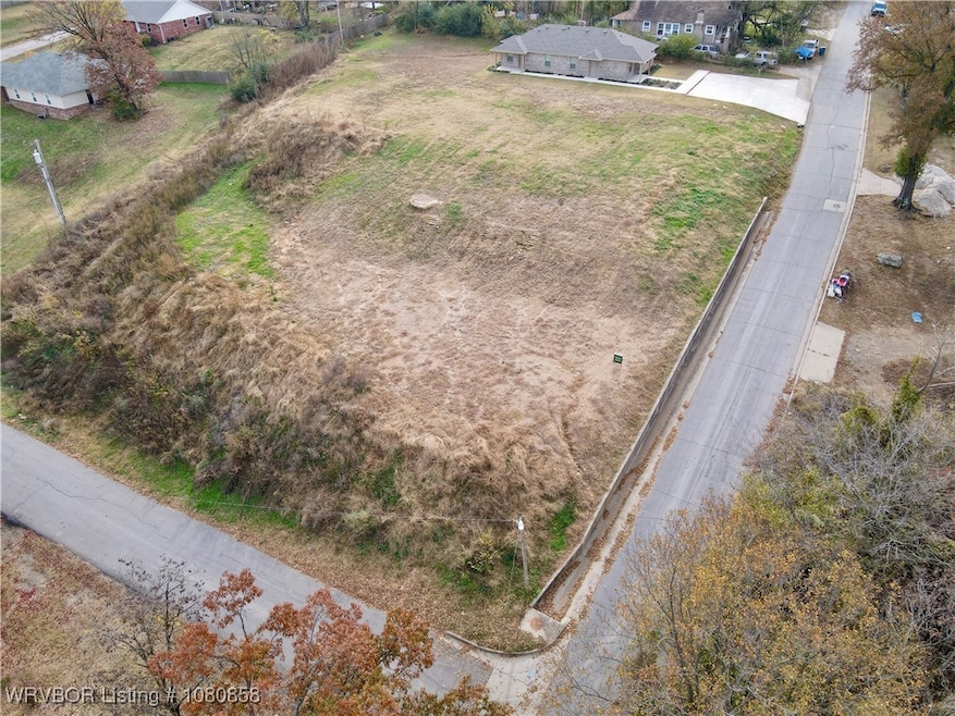
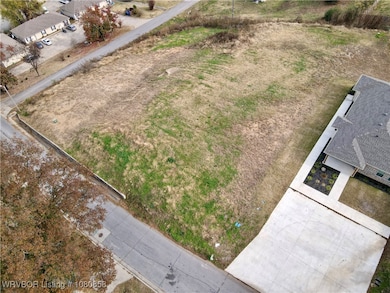
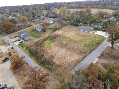
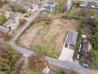
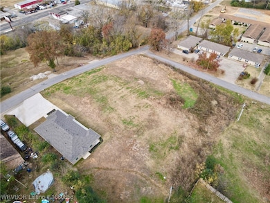
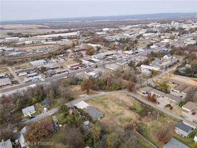
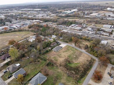
1809 S 12th St Fort Smith, AR 72901
Estimated payment $252/month
Total Views
18,163
0.92
Acre
$42,391
Price per Acre
40,075
Sq Ft Lot
Highlights
- 0.92 Acre Lot
- Views
- Public Transportation
- Corner Lot
About This Lot
Perfect spot for your investment property with flexible building options. Located just minutes from Baptist Health Hospital this Generous corner lot has a spectacular northwest view of Ft Smith. Water, sewer and electric on property.
Property Details
Property Type
- Land
Est. Annual Taxes
- $568
Lot Details
- 0.92 Acre Lot
- Corner Lot
- Sloped Lot
- Cleared Lot
Schools
- Ballman Elementary School
- Ramsey Middle School
- Southside High School
Utilities
- Not Connected to Water Source
- Not Connected to Sewer
Additional Features
- Property Views
Community Details
- Sulphur Spgs Town Subdivision
- Public Transportation
Listing and Financial Details
- Legal Lot and Block 1-4 / E
- Assessor Parcel Number 17621-0003-00005-00
Map
Create a Home Valuation Report for This Property
The Home Valuation Report is an in-depth analysis detailing your home's value as well as a comparison with similar homes in the area
Home Values in the Area
Average Home Value in this Area
Tax History
| Year | Tax Paid | Tax Assessment Tax Assessment Total Assessment is a certain percentage of the fair market value that is determined by local assessors to be the total taxable value of land and additions on the property. | Land | Improvement |
|---|---|---|---|---|
| 2025 | $581 | $10,000 | $10,000 | -- |
| 2024 | $514 | $9,790 | $7,500 | $2,290 |
| 2023 | $568 | $9,790 | $7,500 | $2,290 |
| 2022 | $568 | $9,790 | $7,500 | $2,290 |
| 2021 | $543 | $9,790 | $7,500 | $2,290 |
| 2020 | $498 | $9,790 | $7,500 | $2,290 |
| 2019 | $452 | $7,790 | $5,500 | $2,290 |
| 2018 | $632 | $10,880 | $5,500 | $5,380 |
| 2017 | $571 | $10,880 | $5,500 | $5,380 |
| 2016 | $571 | $10,880 | $5,500 | $5,380 |
| 2015 | $571 | $10,880 | $5,500 | $5,380 |
| 2014 | $407 | $7,750 | $2,000 | $5,750 |
Source: Public Records
Property History
| Date | Event | Price | List to Sale | Price per Sq Ft | Prior Sale |
|---|---|---|---|---|---|
| 10/02/2025 10/02/25 | Price Changed | $39,000 | -20.4% | -- | |
| 06/02/2025 06/02/25 | Price Changed | $49,000 | -38.8% | -- | |
| 05/07/2025 05/07/25 | For Sale | $80,000 | +81.8% | -- | |
| 04/14/2025 04/14/25 | Sold | $44,000 | -15.4% | $34 / Sq Ft | View Prior Sale |
| 03/26/2025 03/26/25 | Pending | -- | -- | -- | |
| 01/21/2025 01/21/25 | Price Changed | $52,000 | -13.3% | $41 / Sq Ft | |
| 12/27/2024 12/27/24 | For Sale | $60,000 | -- | $47 / Sq Ft |
Source: Western River Valley Board of REALTORS®
Purchase History
| Date | Type | Sale Price | Title Company |
|---|---|---|---|
| Warranty Deed | $44,000 | None Listed On Document | |
| Warranty Deed | -- | None Listed On Document | |
| Quit Claim Deed | -- | None Available |
Source: Public Records
Mortgage History
| Date | Status | Loan Amount | Loan Type |
|---|---|---|---|
| Open | $33,000 | New Conventional | |
| Previous Owner | $174,250 | Construction |
Source: Public Records
Source: Western River Valley Board of REALTORS®
MLS Number: 1080858
APN: 17621-0003-00005-00
Nearby Homes
- 1600 S 11th St
- 1400 S 11th St
- 1404 S 11th St
- 1712 S 11th St
- 1710 S 11th St
- 1504 Lexington Ave
- 1501 S 12th St
- 1500 S 12th St
- 1418 S 12th St
- 617 & 619 S 23rd St
- TBD Jenny Lind & South W
- 621 & 623 S 23rd St
- 5017 & 5019 S 28th St
- 1425 S 16th St
- 1805 S T St
- 1907 S R St
- 1510 Bluff Ave
- 2910, 2912 S 16th St
- 1517 Bluff Ave
- 1312 Dodson Ave
- 1717 S W St
- 2005 S P St
- 1101 S 11th St
- 2105 S O St
- 1010 S 19th St Unit 1
- 2301 S V St Unit 5
- 1500 Boston St
- 922 S 23rd St
- 324 S 12th St
- 800 S 25th St
- 1624 S Fresno St
- 1411 Rogers Ave
- 101 N 11th St
- 4001 S 16th St
- 718 N 18th St Unit 4
- 718 N 18th St Unit 4
- 3603 Free Ferry Rd
- 4313 S 22nd St
- 3600 Kinkead Ave
- 109 N 3rd St
