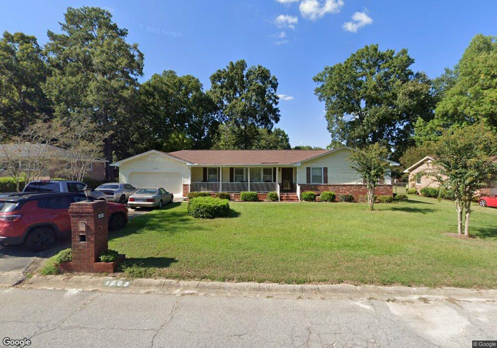
1809 Sapling Dr Columbia, SC 29210
Saint Andrews NeighborhoodEstimated Value: $182,965 - $215,000
3
Beds
2
Baths
1,479
Sq Ft
$135/Sq Ft
Est. Value
About This Home
This home is located at 1809 Sapling Dr, Columbia, SC 29210 and is currently estimated at $200,241, approximately $135 per square foot. 1809 Sapling Dr is a home located in Richland County with nearby schools including H. B. Rhame Elementary School, St. Andrews Middle School, and Columbia High School.
Ownership History
Date
Name
Owned For
Owner Type
Purchase Details
Closed on
Apr 25, 2018
Sold by
Mcguinn Homes Llc
Bought by
Mnsf Ii Acquisitions Llc
Current Estimated Value
Purchase Details
Closed on
Dec 7, 2017
Sold by
Mak Investments Llc
Bought by
Mcguinn Homes Llc
Home Financials for this Owner
Home Financials are based on the most recent Mortgage that was taken out on this home.
Original Mortgage
$269,775
Interest Rate
3.94%
Mortgage Type
Purchase Money Mortgage
Create a Home Valuation Report for This Property
The Home Valuation Report is an in-depth analysis detailing your home's value as well as a comparison with similar homes in the area
Home Values in the Area
Average Home Value in this Area
Purchase History
| Date | Buyer | Sale Price | Title Company |
|---|---|---|---|
| Mnsf Ii Acquisitions Llc | $1,583,090 | None Available | |
| Mcguinn Homes Llc | $60,000 | None Available |
Source: Public Records
Mortgage History
| Date | Status | Borrower | Loan Amount |
|---|---|---|---|
| Previous Owner | Mcguinn Homes Llc | $269,775 |
Source: Public Records
Tax History
| Year | Tax Paid | Tax Assessment Tax Assessment Total Assessment is a certain percentage of the fair market value that is determined by local assessors to be the total taxable value of land and additions on the property. | Land | Improvement |
|---|---|---|---|---|
| 2024 | $729 | $100,000 | $0 | $0 |
| 2023 | $701 | $3,476 | $0 | $0 |
| 2022 | $594 | $86,900 | $9,200 | $77,700 |
| 2021 | $575 | $3,480 | $0 | $0 |
| 2020 | $580 | $3,480 | $0 | $0 |
| 2019 | $546 | $3,480 | $0 | $0 |
| 2018 | $470 | $3,230 | $0 | $0 |
| 2017 | $464 | $3,230 | $0 | $0 |
| 2016 | $463 | $3,230 | $0 | $0 |
| 2015 | -- | $3,230 | $0 | $0 |
| 2014 | $448 | $80,700 | $0 | $0 |
| 2013 | -- | $3,230 | $0 | $0 |
Source: Public Records
Map
Nearby Homes
- 2103 Marley Dr
- 6 Woodtrail Ct
- 0 Marley Dr Unit 623584
- 1917 Kathleen Dr
- 528 Wimbledon Ct
- 1913 Grays Inn Rd
- 1908 Grays Inn Rd
- 1613 Ashford Ln
- 2309 Cunningham Rd
- 1725 Kathleen Dr Unit A&B
- 2341 Rolling Hills Rd
- 2309 Hillbeck Dr
- 1540 Romain Dr
- 2135 Rolling Hills Rd
- 1533 Westchester Dr
- 1657 Omarest Dr
- 1727 Omarest Dr
- 1650 Omarest Dr
- 1900 Rolling Hills Rd
- 1924 Koulter Dr
- 1805 Sapling Dr
- 1813 Sapling Dr
- 2100 Woodtrail Dr
- 2106 Woodtrail Dr
- 1801 Sapling Dr
- 0 Elise Dr
- 1808 Sapling Dr
- 1817 Sapling Dr
- 1804 Sapling Dr
- 2110 Woodtrail Dr
- 1812 Sapling Dr
- 2012 Woodtrail Dr
- 1800 Sapling Dr
- 1821 Sapling Dr
- 1739 Sapling Dr
- 2114 Woodtrail Dr
- 1816 Sapling Dr
- 2008 Woodtrail Dr
- 1740 Sapling Dr
- 2101 Woodtrail Dr
Your Personal Tour Guide
Ask me questions while you tour the home.