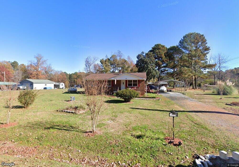
181 Airstrip Rd Mount Gilead, NC 27306
Estimated Value: $113,000 - $240,000
3
Beds
1
Bath
1,000
Sq Ft
$160/Sq Ft
Est. Value
About This Home
This home is located at 181 Airstrip Rd, Mount Gilead, NC 27306 and is currently estimated at $159,555, approximately $159 per square foot. 181 Airstrip Rd is a home with nearby schools including Mount Gilead Elementary School and West Middle School.
Ownership History
Date
Name
Owned For
Owner Type
Purchase Details
Closed on
Apr 5, 2011
Sold by
French Velma Terrell
Bought by
French Velma Terrell
Current Estimated Value
Home Financials for this Owner
Home Financials are based on the most recent Mortgage that was taken out on this home.
Original Mortgage
$60,000
Outstanding Balance
$22,884
Interest Rate
4.83%
Mortgage Type
New Conventional
Estimated Equity
$136,671
Purchase Details
Closed on
Sep 15, 2006
Sold by
Fairley Burlee and Fairley Theora D
Bought by
Fairley Theora D
Home Financials for this Owner
Home Financials are based on the most recent Mortgage that was taken out on this home.
Original Mortgage
$47,658
Interest Rate
6.52%
Mortgage Type
New Conventional
Create a Home Valuation Report for This Property
The Home Valuation Report is an in-depth analysis detailing your home's value as well as a comparison with similar homes in the area
Home Values in the Area
Average Home Value in this Area
Purchase History
| Date | Buyer | Sale Price | Title Company |
|---|---|---|---|
| French Velma Terrell | -- | None Available | |
| Fairley Theora D | -- | -- |
Source: Public Records
Mortgage History
| Date | Status | Borrower | Loan Amount |
|---|---|---|---|
| Open | French Velma Terrell | $60,000 | |
| Previous Owner | Fairley Theora D | $47,658 |
Source: Public Records
Tax History Compared to Growth
Tax History
| Year | Tax Paid | Tax Assessment Tax Assessment Total Assessment is a certain percentage of the fair market value that is determined by local assessors to be the total taxable value of land and additions on the property. | Land | Improvement |
|---|---|---|---|---|
| 2025 | $478 | $77,675 | $5,490 | $72,185 |
| 2024 | $478 | $77,675 | $5,490 | $72,185 |
| 2023 | $478 | $77,675 | $5,490 | $72,185 |
| 2022 | $478 | $77,675 | $5,490 | $72,185 |
| 2021 | $478 | $77,675 | $5,490 | $72,185 |
| 2020 | $478 | $77,675 | $5,490 | $72,185 |
| 2018 | $448 | $72,200 | $5,490 | $66,710 |
| 2017 | $448 | $72,200 | $5,490 | $66,710 |
| 2016 | $448 | $72,200 | $5,490 | $66,710 |
| 2015 | -- | $72,200 | $0 | $0 |
| 2014 | -- | $72,213 | $0 | $0 |
Source: Public Records
Map
Nearby Homes
- 0 Webb Loop Rd
- 2485 Nc Highway 109 S
- 302 Williams St
- 141 Lewis St
- 000 N Carolina 109
- 00 Rock Dr
- 211 Rock Dr
- 403 Julius Chambers Ave
- 401 Julius Chambers Ave
- 105 E 2nd Ave
- 00 Pleasant Valley Rd
- 318 Stanback St
- 128 Loblolly Dr
- 174 Mask Rd Unit tract 3
- VAC Calvary Church Rd
- 517 Mask Rd
- 368 Gaddy Farm Rd
- 4207 N Carolina 73
- 0 Russ Dr Unit 7 CAR4299539
- Lot 14 Russ Dr
- 191 Airstrip Rd
- 192 Webb Loop Rd
- 201 Airstrip Rd
- 200 Webb Loop Rd
- 194 Webb Loop Rd
- 212 Webb Loop Rd
- 180 Webb Loop Rd
- 209 Airstrip Rd
- 151 Airstrip Rd
- 151 Airstrip Rd
- 222 Webb Loop Rd
- 146 Rudisell Rd
- 143 Rudisell Rd
- 219 Airstrip Rd
- 232 Webb Loop Rd
- 124 High St
- 227 Webb Loop Rd
- 127 Rudisell Rd
- 239 Webb Loop Rd
- 120 Rudisell Rd