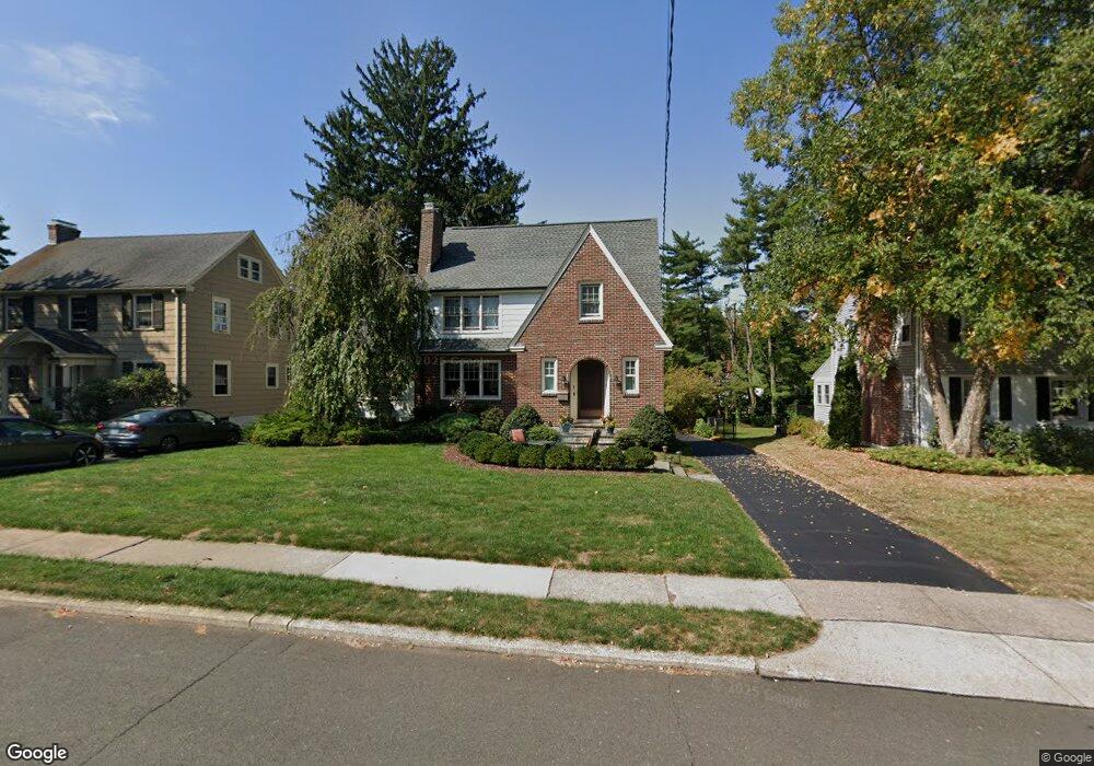
181 Ballard Dr West Hartford, CT 06119
Estimated Value: $600,000 - $663,000
3
Beds
3
Baths
2,012
Sq Ft
$307/Sq Ft
Est. Value
About This Home
This home is located at 181 Ballard Dr, West Hartford, CT 06119 and is currently estimated at $617,439, approximately $306 per square foot. 181 Ballard Dr is a home located in Hartford County with nearby schools including Morley School, King Philip Middle School, and Hall High School.
Ownership History
Date
Name
Owned For
Owner Type
Purchase Details
Closed on
Aug 21, 1998
Sold by
Olsen Karl J and Olsen Paul M
Bought by
Donahue Thomas L and Deyoung Holly C
Current Estimated Value
Home Financials for this Owner
Home Financials are based on the most recent Mortgage that was taken out on this home.
Original Mortgage
$163,000
Outstanding Balance
$33,827
Interest Rate
6.86%
Mortgage Type
Unknown
Estimated Equity
$583,612
Purchase Details
Closed on
Jun 10, 1993
Sold by
Callahan John and Callahan Marie
Bought by
Olsen Karl
Home Financials for this Owner
Home Financials are based on the most recent Mortgage that was taken out on this home.
Original Mortgage
$165,750
Interest Rate
7.41%
Mortgage Type
Unknown
Create a Home Valuation Report for This Property
The Home Valuation Report is an in-depth analysis detailing your home's value as well as a comparison with similar homes in the area
Home Values in the Area
Average Home Value in this Area
Purchase History
| Date | Buyer | Sale Price | Title Company |
|---|---|---|---|
| Donahue Thomas L | $182,000 | -- | |
| Olsen Karl | $174,500 | -- |
Source: Public Records
Mortgage History
| Date | Status | Borrower | Loan Amount |
|---|---|---|---|
| Open | Olsen Karl | $50,000 | |
| Open | Olsen Karl | $163,000 | |
| Previous Owner | Olsen Karl | $165,750 | |
| Previous Owner | Olsen Karl | $15,000 |
Source: Public Records
Tax History Compared to Growth
Tax History
| Year | Tax Paid | Tax Assessment Tax Assessment Total Assessment is a certain percentage of the fair market value that is determined by local assessors to be the total taxable value of land and additions on the property. | Land | Improvement |
|---|---|---|---|---|
| 2025 | $12,090 | $269,990 | $104,160 | $165,830 |
| 2024 | $11,200 | $264,460 | $104,160 | $160,300 |
| 2023 | $10,822 | $264,460 | $104,160 | $160,300 |
| 2022 | $10,758 | $264,460 | $104,160 | $160,300 |
| 2021 | $9,995 | $235,620 | $108,500 | $127,120 |
| 2020 | $9,378 | $224,350 | $101,640 | $122,710 |
| 2019 | $9,378 | $224,350 | $101,640 | $122,710 |
| 2018 | $9,198 | $224,350 | $101,640 | $122,710 |
| 2017 | $9,207 | $224,350 | $101,640 | $122,710 |
| 2016 | $9,063 | $229,390 | $88,970 | $140,420 |
| 2015 | $8,788 | $229,390 | $88,970 | $140,420 |
| 2014 | $8,075 | $216,090 | $88,970 | $127,120 |
Source: Public Records
Map
Nearby Homes
- 1268 Trout Brook Dr
- 1272 Trout Brook Dr
- 129 Middlebrook Rd
- 1294 Trout Brook Dr
- 1196 Trout Brook Dr
- 132 N Main St
- 11 Lawler Rd
- 105 Ardmore Rd
- 1110 Trout Brook Dr
- 3 Trumbull Ln
- 54 Robin Rd Unit B2
- 183 Loomis Dr Unit 109
- 237 Fern St Unit 314
- 48 Walkley Rd
- 3 Pilgrim Rd
- 1006A Trout Brook Dr Unit 1006A
- 16 Lilley Rd
- 869 Farmington Ave Unit 305
- 62 Blue Ridge Ln
- 30 Outlook Ave Unit 205
- 175 Ballard Dr
- 185 Ballard Dr
- 189 Ballard Dr
- 169 Ballard Dr
- 1266 Trout Brook Dr
- 1262 Trout Brook Dr
- 165 Ballard Dr
- 193 Ballard Dr
- 1260 Trout Brook Dr
- 178 Ballard Dr
- 182 Ballard Dr
- 174 Ballard Dr
- 186 Ballard Dr
- 170 Ballard Dr
- 1258 Trout Brook Dr
- 161 Ballard Dr
- 190 Ballard Dr
- 166 Ballard Dr
- 125 Middlebrook Rd
- 109 Middlebrook Rd