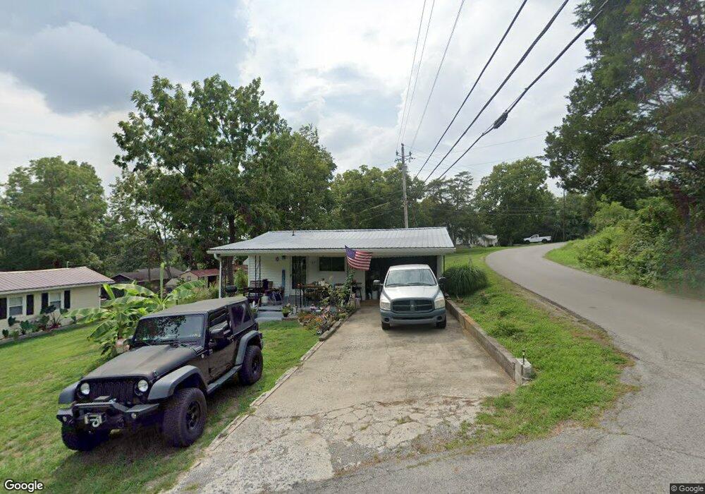
181 Cedarwood Ct Harrodsburg, KY 40330
Estimated Value: $101,659 - $229,000
--
Bed
--
Bath
792
Sq Ft
$234/Sq Ft
Est. Value
About This Home
This home is located at 181 Cedarwood Ct, Harrodsburg, KY 40330 and is currently estimated at $185,665, approximately $234 per square foot. 181 Cedarwood Ct is a home located in Mercer County with nearby schools including Burgin Independent School.
Ownership History
Date
Name
Owned For
Owner Type
Purchase Details
Closed on
Oct 16, 2023
Sold by
James R Lawrence Revocable Trust
Bought by
James R Lawrence Family Trust and Lawrence
Current Estimated Value
Purchase Details
Closed on
Dec 27, 2019
Sold by
Hayslett William L
Bought by
Curtis Rodney M
Home Financials for this Owner
Home Financials are based on the most recent Mortgage that was taken out on this home.
Original Mortgage
$42,828
Interest Rate
3.6%
Mortgage Type
New Conventional
Create a Home Valuation Report for This Property
The Home Valuation Report is an in-depth analysis detailing your home's value as well as a comparison with similar homes in the area
Home Values in the Area
Average Home Value in this Area
Purchase History
| Date | Buyer | Sale Price | Title Company |
|---|---|---|---|
| James R Lawrence Family Trust | -- | None Listed On Document | |
| Curtis Rodney M | $42,400 | None Available |
Source: Public Records
Mortgage History
| Date | Status | Borrower | Loan Amount |
|---|---|---|---|
| Previous Owner | Curtis Rodney M | $42,828 |
Source: Public Records
Tax History Compared to Growth
Tax History
| Year | Tax Paid | Tax Assessment Tax Assessment Total Assessment is a certain percentage of the fair market value that is determined by local assessors to be the total taxable value of land and additions on the property. | Land | Improvement |
|---|---|---|---|---|
| 2024 | $331 | $69,054 | $15,000 | $54,054 |
| 2023 | $338 | $69,054 | $0 | $0 |
| 2022 | $203 | $42,400 | $0 | $0 |
| 2021 | $207 | $42,400 | $0 | $0 |
| 2020 | $205 | $56,700 | $15,000 | $41,700 |
| 2019 | $274 | $56,700 | $15,000 | $41,700 |
| 2018 | $261 | $54,000 | $0 | $0 |
| 2017 | $254 | $54,000 | $0 | $0 |
| 2016 | $251 | $54,000 | $0 | $0 |
| 2015 | $241 | $54,000 | $15,000 | $39,000 |
| 2014 | $241 | $54,000 | $15,000 | $39,000 |
| 2010 | -- | $54,000 | $15,000 | $39,000 |
Source: Public Records
Map
Nearby Homes
- 1011 Hancock Cir Unit 9-10
- 1015 Hancock Cir Unit 18
- 182 Sunrise Shores
- 106 Sunrise Shores
- 465 Sunrise Shores
- 178 Lakeview Point Rd
- 340 Lakeview Point Rd
- 392 Lakeview Point Rd
- 154 Cedar Ln
- 1552 Paradise Camp Rd
- 1 S Homestead Ln
- 146 S Homestead Ln
- 0 Carmichael Rd
- 275 Carmichael Rd
- 207 S Homestead Ln
- 0 Homestead Ln Unit 24009596
- 221 N Homestead Ln
- 1599 Kennedy Bridge Rd Unit 30 & 31
- 763 Lots 110/111 Herrington Woods
- 763 Lots 112/113 Herrington Woods
- 175 Cedarwood Ct
- 898 Paradise Camp Rd
- 1 Cedarwood Ct
- 145 Cedarwood Ct
- 172 Cedarwood Ct
- 140 Cedarwood Ct
- 138 Cedarwood Ct
- 156 Cedarwood Ct
- 158 Cedarwood Ct
- 164 Cedarwood Ct
- 951 Paradise Camp Rd
- 844 Paradise Camp Rd
- 1022 Hancock Cir
- 1022 Hancock Cir
- 1022 Hancock Cir
- 1000 Kennedy Bridge Rd
- 832 Paradise Camp Rd
- 1011 Hancock Cir Unit 9
- 1011 Hancock Cir
- 1020 Hancock Cir