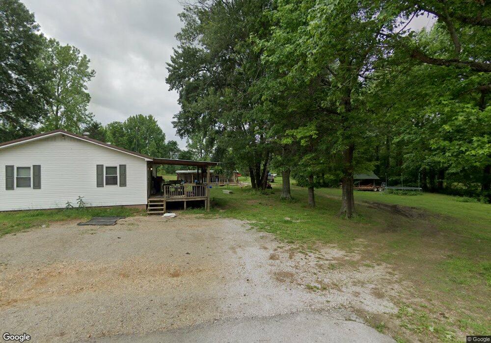
181 Debbie Dr Paragould, AR 72450
Estimated Value: $107,894 - $177,000
--
Bed
1
Bath
1,176
Sq Ft
$117/Sq Ft
Est. Value
About This Home
This home is located at 181 Debbie Dr, Paragould, AR 72450 and is currently estimated at $137,224, approximately $116 per square foot. 181 Debbie Dr is a home located in Greene County with nearby schools including Paragould High School.
Ownership History
Date
Name
Owned For
Owner Type
Purchase Details
Closed on
May 19, 2017
Sold by
Acam Properties Llc
Bought by
Calver Tyler
Current Estimated Value
Home Financials for this Owner
Home Financials are based on the most recent Mortgage that was taken out on this home.
Original Mortgage
$84,848
Outstanding Balance
$70,393
Interest Rate
4.1%
Mortgage Type
New Conventional
Estimated Equity
$66,831
Purchase Details
Closed on
Mar 3, 2017
Sold by
Dodd Freda and Frank White Revocable Living T
Bought by
Acam Properties Llc
Purchase Details
Closed on
May 31, 2013
Sold by
White Frank
Bought by
Dodd Freda and Frank White Revocable Living T
Purchase Details
Closed on
Apr 20, 1976
Bought by
Frank and Shirley White
Create a Home Valuation Report for This Property
The Home Valuation Report is an in-depth analysis detailing your home's value as well as a comparison with similar homes in the area
Home Values in the Area
Average Home Value in this Area
Purchase History
| Date | Buyer | Sale Price | Title Company |
|---|---|---|---|
| Calver Tyler | $84,000 | None Available | |
| Acam Properties Llc | $45,000 | None Available | |
| Dodd Freda | -- | None Available | |
| Frank | -- | -- |
Source: Public Records
Mortgage History
| Date | Status | Borrower | Loan Amount |
|---|---|---|---|
| Open | Calver Tyler | $84,848 |
Source: Public Records
Tax History Compared to Growth
Tax History
| Year | Tax Paid | Tax Assessment Tax Assessment Total Assessment is a certain percentage of the fair market value that is determined by local assessors to be the total taxable value of land and additions on the property. | Land | Improvement |
|---|---|---|---|---|
| 2025 | $645 | $19,460 | $5,500 | $13,960 |
| 2024 | $615 | $19,460 | $5,500 | $13,960 |
| 2023 | $586 | $12,960 | $3,000 | $9,960 |
| 2022 | $211 | $12,960 | $3,000 | $9,960 |
| 2021 | $199 | $12,960 | $3,000 | $9,960 |
| 2020 | $547 | $12,100 | $3,000 | $9,100 |
| 2019 | $172 | $12,100 | $3,000 | $9,100 |
| 2018 | $197 | $12,100 | $3,000 | $9,100 |
| 2017 | $340 | $11,100 | $2,000 | $9,100 |
| 2016 | $340 | $11,100 | $2,000 | $9,100 |
| 2015 | $301 | $9,640 | $2,000 | $7,640 |
| 2014 | -- | $9,640 | $2,000 | $7,640 |
Source: Public Records
Map
Nearby Homes
- 5.38 AC Highway 135 N
- 146 Messer Dr
- 205 Raymond
- 181 Misty Marie
- 422 Sunset Dr
- 1 Acre Hwy 34 W
- 193 Granny Jean Ln
- 522 Vaughn Dr
- 44 Oak Grove Rd
- 233 Lois Ln
- 9496 Arkansas 135
- 1094 Greene Road 508
- 0 Greene 611 Tract A East Rd
- 197 Greene Road 535
- TBD Greene Road 611
- 1387 Greene Road 517
- 3 Highway 135 N
- 00 Off Hwy 135 N
- 1904 Greene Road 516
- Tract 4 Greene 726 Rd
- 0 Debbie Dr
- 129 Debbie Dr
- 23 Stormes Dr Unit 1
- 23 Stormes Dr Unit 2
- 23 Stormes Dr Unit 3
- 92 Debbie Dr
- 143 Lee St
- 62 Debbie Dr
- 183 Lee St
- 0 Lee St
- 34 Debbie Dr
- 63 Lee St
- 138 Lee St
- 138 Lee St
- 462 Highway 34 W
- 462 Highway 34 W
- 630 Highway 34 W
- 350 Highway 34 W
- 350 Highway 34 W
- 350 Highway 34 W Unit 21 & 23 LEE STREET