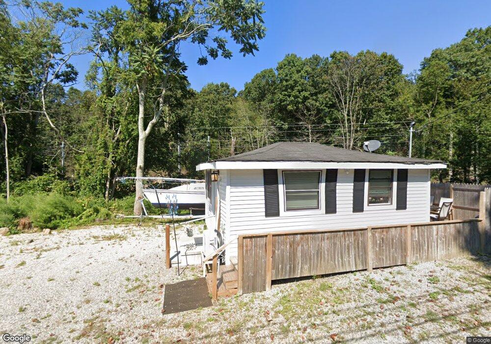
181 Hammock Rd N Westbrook, CT 06498
Estimated Value: $183,929 - $338,000
1
Bed
1
Bath
336
Sq Ft
$691/Sq Ft
Est. Value
About This Home
This home is located at 181 Hammock Rd N, Westbrook, CT 06498 and is currently estimated at $232,232, approximately $691 per square foot. 181 Hammock Rd N is a home located in Middlesex County with nearby schools including Daisy Ingraham School, Westbrook Middle School, and Westbrook High School.
Ownership History
Date
Name
Owned For
Owner Type
Purchase Details
Closed on
Oct 19, 2023
Sold by
Galardi Ralph J
Bought by
Brutcher Janet L
Current Estimated Value
Home Financials for this Owner
Home Financials are based on the most recent Mortgage that was taken out on this home.
Original Mortgage
$121,500
Outstanding Balance
$118,693
Interest Rate
7.18%
Mortgage Type
Purchase Money Mortgage
Estimated Equity
$113,539
Purchase Details
Closed on
Apr 10, 2023
Sold by
Inghilterra John
Bought by
Galardi Ralph J
Purchase Details
Closed on
Jun 2, 2005
Sold by
Norton Robert
Bought by
Norton Richard
Create a Home Valuation Report for This Property
The Home Valuation Report is an in-depth analysis detailing your home's value as well as a comparison with similar homes in the area
Home Values in the Area
Average Home Value in this Area
Purchase History
| Date | Buyer | Sale Price | Title Company |
|---|---|---|---|
| Brutcher Janet L | $150,000 | None Available | |
| Galardi Ralph J | $150,000 | None Available | |
| Norton Richard | $4,000 | -- |
Source: Public Records
Mortgage History
| Date | Status | Borrower | Loan Amount |
|---|---|---|---|
| Open | Brutcher Janet L | $121,500 |
Source: Public Records
Tax History
| Year | Tax Paid | Tax Assessment Tax Assessment Total Assessment is a certain percentage of the fair market value that is determined by local assessors to be the total taxable value of land and additions on the property. | Land | Improvement |
|---|---|---|---|---|
| 2025 | $1,962 | $87,200 | $45,700 | $41,500 |
| 2024 | $1,892 | $87,200 | $45,700 | $41,500 |
| 2023 | $1,695 | $79,500 | $45,700 | $33,800 |
| 2022 | $1,217 | $58,640 | $45,700 | $12,940 |
| 2021 | $1,745 | $69,790 | $51,280 | $18,510 |
| 2020 | $1,745 | $69,790 | $51,280 | $18,510 |
| 2019 | $1,722 | $69,790 | $51,280 | $18,510 |
| 2018 | $1,701 | $69,790 | $51,280 | $18,510 |
| 2017 | $1,701 | $69,790 | $51,280 | $18,510 |
| 2016 | $1,586 | $68,540 | $50,620 | $17,920 |
| 2015 | $1,543 | $68,540 | $50,620 | $17,920 |
| 2014 | $1,493 | $68,540 | $50,620 | $17,920 |
Source: Public Records
Map
Nearby Homes
- 328 Hammock Rd N
- 951 Old Clinton Rd Unit 15
- 0 Boston Post Rd Unit 24080344
- 11a/11b Pond Circle Rd
- 44 Linden Ave N
- 18 Broadway N
- 41 Trolley Rd
- 85 McVeagh Rd
- 29 Salt Island Rd
- 37 Nolin Rd
- 296 E Main St
- 0 Causeway
- 176 Shore Rd
- 167 Shore Rd
- 280 E Main St Unit E2
- 144 Shore Rd
- 19 Old Forge Rd
- 81 Founders Village Unit 81
- 39 Founders Village Unit 39
- 5 Cook Terrace
- 181 Hammock Rd
- 228 Hammock Rd N
- 210 Hammock Rd N
- 240 Hammock Rd N
- 258 Hammock Rd N
- 192 Hammock Rd N
- 264 Hammock Rd N
- 179 Hammock Rd N
- 174 Hammock Rd N
- 163 Hammock Rd N
- 23 Meadowbrook Road Extension
- 306 Hammock Rd N
- 287 Hammock Rd N
- 49 Meadowbrook Rd
- 12 Meadowbrook Road Extension
- 19 Meadowbrook Road Extension
- 164 Hammock Rd N Unit 23
- 164 Hammock Rd N Unit 19
- 164 Hammock Rd N Unit 6
- 164 Hammock Rd N Unit 7
Your Personal Tour Guide
Ask me questions while you tour the home.