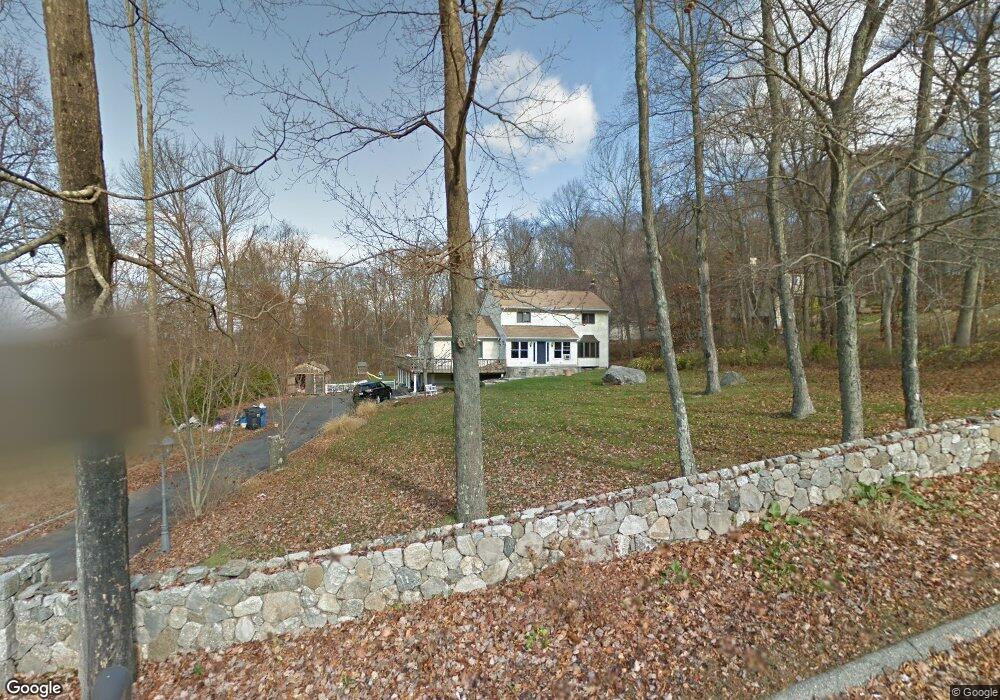
181 Josies Ring Rd Monroe, CT 06468
Estimated Value: $691,000 - $841,000
3
Beds
3
Baths
2,841
Sq Ft
$270/Sq Ft
Est. Value
About This Home
This home is located at 181 Josies Ring Rd, Monroe, CT 06468 and is currently estimated at $766,113, approximately $269 per square foot. 181 Josies Ring Rd is a home located in Fairfield County with nearby schools including Fawn Hollow Elementary School, Jockey Hollow Middle School, and Masuk High School.
Ownership History
Date
Name
Owned For
Owner Type
Purchase Details
Closed on
Nov 19, 2010
Sold by
Wells Fargo Bk
Bought by
Mauri Louis G
Current Estimated Value
Purchase Details
Closed on
Jan 5, 2001
Sold by
Iannetti Joseph F and Iannetti Sue F
Bought by
Santella Louis and Santella Kristine M
Home Financials for this Owner
Home Financials are based on the most recent Mortgage that was taken out on this home.
Original Mortgage
$278,000
Interest Rate
7.69%
Purchase Details
Closed on
Aug 9, 1999
Sold by
Gambini Michael and Gambini Madalena M
Bought by
Iannetti Joseph F and Iannetti Sue F
Home Financials for this Owner
Home Financials are based on the most recent Mortgage that was taken out on this home.
Original Mortgage
$240,000
Interest Rate
7.54%
Create a Home Valuation Report for This Property
The Home Valuation Report is an in-depth analysis detailing your home's value as well as a comparison with similar homes in the area
Home Values in the Area
Average Home Value in this Area
Purchase History
| Date | Buyer | Sale Price | Title Company |
|---|---|---|---|
| Mauri Louis G | $251,000 | -- | |
| Mauri Louis G | $251,000 | -- | |
| Santella Louis | $347,500 | -- | |
| Santella Louis | $347,500 | -- | |
| Iannetti Joseph F | $319,900 | -- | |
| Iannetti Joseph F | $319,900 | -- |
Source: Public Records
Mortgage History
| Date | Status | Borrower | Loan Amount |
|---|---|---|---|
| Previous Owner | Iannetti Joseph F | $278,000 | |
| Previous Owner | Iannetti Joseph F | $240,000 |
Source: Public Records
Tax History
| Year | Tax Paid | Tax Assessment Tax Assessment Total Assessment is a certain percentage of the fair market value that is determined by local assessors to be the total taxable value of land and additions on the property. | Land | Improvement |
|---|---|---|---|---|
| 2025 | $12,259 | $427,600 | $112,000 | $315,600 |
| 2024 | $11,110 | $290,300 | $96,600 | $193,700 |
| 2023 | $10,901 | $290,300 | $96,600 | $193,700 |
| 2022 | $10,700 | $290,300 | $96,600 | $193,700 |
| 2021 | $10,555 | $290,300 | $96,600 | $193,700 |
| 2020 | $10,300 | $290,300 | $96,600 | $193,700 |
| 2019 | $10,482 | $294,600 | $96,600 | $198,000 |
| 2018 | $10,206 | $289,600 | $96,600 | $193,000 |
| 2017 | $10,356 | $289,600 | $96,600 | $193,000 |
| 2016 | $10,035 | $286,700 | $96,600 | $190,100 |
| 2015 | $9,848 | $286,700 | $96,600 | $190,100 |
| 2014 | $10,113 | $326,130 | $121,100 | $205,030 |
Source: Public Records
Map
Nearby Homes
- 24 Legacy Ln
- 34 Bagburn Rd
- 15 Legacy Ln
- 124 Bagburn Rd
- 1161 Monroe Turnpike
- 455 Barn Hill Rd
- 1115 Monroe Turnpike
- 1093 Monroe Turnpike
- 3 Serenity Ln
- 13 Jordan Hill Rd Unit Lot 4
- 275 Hammertown Rd
- 56 Downs Rd
- 59 Great Ring Rd
- 39 Bradley Ln
- 8 Stone Bridge Trail
- 49 Great Ring Rd
- 30 E Village Rd
- 40 Great Ring Rd
- 42 Great Ring Rd
- 32 Valley View Rd
- 189 Josies Ring Rd
- 177 Old Zoar Rd
- 187 Old Zoar Rd
- 166 Old Zoar Rd
- 197 Josies Ring Rd
- 196 Old Zoar Rd
- 193 Old Zoar Rd
- 167 Old Zoar Rd
- 205 Josies Ring Rd
- 202 Josies Ring Rd
- 199 Old Zoar Rd
- 156 Old Zoar Rd
- 204 Old Zoar Rd
- 155 Old Zoar Rd
- 208 Josies Ring Rd
- 155 Josies Ring Rd
- 211 Old Zoar Rd
- 150 Old Zoar Rd
- 140 Josies Ring Rd
- 1335 Monroe Turnpike
Your Personal Tour Guide
Ask me questions while you tour the home.