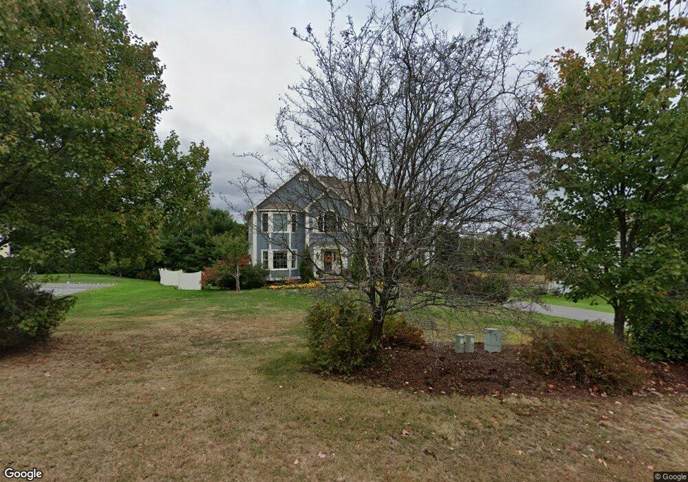
181 Kara Dr North Andover, MA 01845
Estimated Value: $1,166,000 - $1,469,000
5
Beds
4
Baths
4,765
Sq Ft
$282/Sq Ft
Est. Value
About This Home
This home is located at 181 Kara Dr, North Andover, MA 01845 and is currently estimated at $1,343,229, approximately $281 per square foot. 181 Kara Dr is a home located in Essex County with nearby schools including Annie L Sargent Elementary School, North Andover Middle School, and North Andover High School.
Ownership History
Date
Name
Owned For
Owner Type
Purchase Details
Closed on
May 5, 1995
Sold by
Coolidge Constr Co Inc
Bought by
Cusack Dolores A
Current Estimated Value
Home Financials for this Owner
Home Financials are based on the most recent Mortgage that was taken out on this home.
Original Mortgage
$193,750
Interest Rate
8.36%
Mortgage Type
Purchase Money Mortgage
Create a Home Valuation Report for This Property
The Home Valuation Report is an in-depth analysis detailing your home's value as well as a comparison with similar homes in the area
Home Values in the Area
Average Home Value in this Area
Purchase History
| Date | Buyer | Sale Price | Title Company |
|---|---|---|---|
| Cusack Dolores A | $387,500 | -- | |
| Coolidge Constr Co Inc | $108,000 | -- |
Source: Public Records
Mortgage History
| Date | Status | Borrower | Loan Amount |
|---|---|---|---|
| Open | Coolidge Constr Co Inc | $228,500 | |
| Closed | Coolidge Constr Co Inc | $181,000 | |
| Closed | Coolidge Constr Co Inc | $193,750 | |
| Closed | Coolidge Constr Co Inc | $193,750 |
Source: Public Records
Tax History Compared to Growth
Tax History
| Year | Tax Paid | Tax Assessment Tax Assessment Total Assessment is a certain percentage of the fair market value that is determined by local assessors to be the total taxable value of land and additions on the property. | Land | Improvement |
|---|---|---|---|---|
| 2025 | $13,583 | $1,206,300 | $372,800 | $833,500 |
| 2024 | $12,987 | $1,171,100 | $353,200 | $817,900 |
| 2023 | $12,573 | $1,027,200 | $298,200 | $729,000 |
| 2022 | $11,952 | $883,400 | $259,000 | $624,400 |
| 2021 | $11,509 | $812,200 | $235,500 | $576,700 |
| 2020 | $11,079 | $806,300 | $229,600 | $576,700 |
| 2019 | $10,812 | $806,300 | $229,600 | $576,700 |
| 2018 | $12,480 | $858,900 | $229,600 | $629,300 |
| 2017 | $11,475 | $803,600 | $214,700 | $588,900 |
| 2016 | $10,798 | $756,700 | $216,800 | $539,900 |
| 2015 | $11,312 | $786,100 | $200,100 | $586,000 |
Source: Public Records
Map
Nearby Homes
- 122 Lisa Ln
- 495 Johnson St
- 80 Sandra Ln
- 316 Johnson St
- 124 Hillside Rd
- 34 Rosemont Dr
- 26 Woodberry Ln
- 174 Chestnut St Unit 14
- 75 Thistle Rd
- 378 Salem St
- 74 Hewitt Ave
- 70 Salem St
- 58 Berkeley Rd
- 3 Great Pond Rd
- 40 Flagship Dr
- 12 Farnum St
- 27 Marbleridge Rd
- 240 Dale St
- 204 Chestnut St
- 127 Tucker Farm Rd