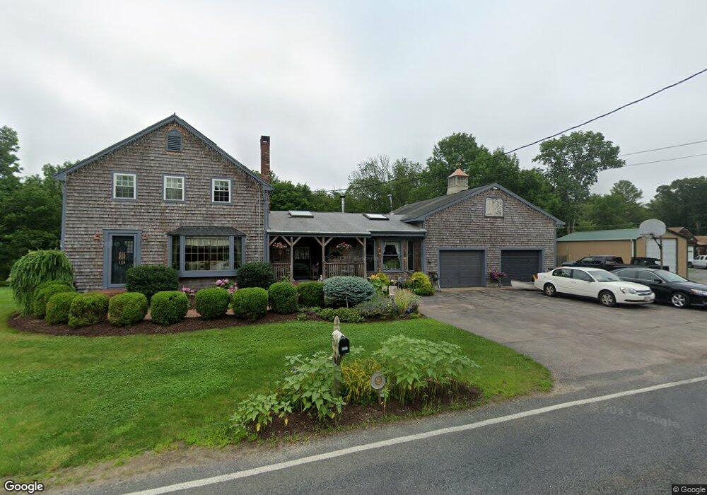
181 Mattapoisett Rd Acushnet, MA 02743
Estimated Value: $502,000 - $623,000
--
Bed
1
Bath
1,597
Sq Ft
$351/Sq Ft
Est. Value
About This Home
This home is located at 181 Mattapoisett Rd, Acushnet, MA 02743 and is currently estimated at $560,366, approximately $350 per square foot. 181 Mattapoisett Rd is a home located in Bristol County with nearby schools including Acushnet Elementary School, Albert F Ford Middle School, and St Francis Xavier Elementary School.
Ownership History
Date
Name
Owned For
Owner Type
Purchase Details
Closed on
Aug 19, 2013
Sold by
Perry Harold R and Ward Debra
Bought by
Perry Harold R and Ward Debra
Current Estimated Value
Home Financials for this Owner
Home Financials are based on the most recent Mortgage that was taken out on this home.
Original Mortgage
$105,500
Outstanding Balance
$26,164
Interest Rate
4.31%
Mortgage Type
New Conventional
Estimated Equity
$534,202
Purchase Details
Closed on
Jan 3, 1983
Bought by
Perry Harold R and Perry Debra
Create a Home Valuation Report for This Property
The Home Valuation Report is an in-depth analysis detailing your home's value as well as a comparison with similar homes in the area
Home Values in the Area
Average Home Value in this Area
Purchase History
| Date | Buyer | Sale Price | Title Company |
|---|---|---|---|
| Perry Harold R | -- | -- | |
| Perry Harold R | -- | -- |
Source: Public Records
Mortgage History
| Date | Status | Borrower | Loan Amount |
|---|---|---|---|
| Open | Perry Harold R | $105,500 | |
| Previous Owner | Perry Harold R | $106,000 | |
| Previous Owner | Perry Harold R | $112,000 | |
| Previous Owner | Perry Harold R | $105,000 |
Source: Public Records
Tax History Compared to Growth
Tax History
| Year | Tax Paid | Tax Assessment Tax Assessment Total Assessment is a certain percentage of the fair market value that is determined by local assessors to be the total taxable value of land and additions on the property. | Land | Improvement |
|---|---|---|---|---|
| 2025 | $45 | $418,700 | $170,200 | $248,500 |
| 2024 | $4,342 | $380,500 | $160,900 | $219,600 |
| 2023 | $4,096 | $341,300 | $139,500 | $201,800 |
| 2022 | $4,163 | $313,700 | $133,500 | $180,200 |
| 2021 | $6,993 | $308,100 | $133,500 | $174,600 |
| 2020 | $6,970 | $308,100 | $133,500 | $174,600 |
| 2019 | $4,177 | $294,600 | $136,500 | $158,100 |
| 2018 | $4,090 | $283,600 | $136,500 | $147,100 |
| 2017 | $5,752 | $275,600 | $136,500 | $139,100 |
| 2016 | $3,773 | $259,700 | $127,500 | $132,200 |
| 2015 | $3,709 | $259,700 | $127,500 | $132,200 |
Source: Public Records
Map
Nearby Homes
- 180 Mattapoisett Rd
- 175 Mattapoisett Rd
- 183 Mattapoisett Rd
- 182 Mattapoisett Rd
- 170 Mattapoisett Rd
- 185 Mattapoisett Rd
- 184 Mattapoisett Rd
- 186 Mattapoisett Rd
- 159 Mattapoisett Rd
- 187 Mattapoisett Rd
- 188 Mattapoisett Rd
- 189 Mattapoisett Rd
- 190 Mattapoisett Rd
- 141 Mattapoisett Rd
- 192 Mattapoisett Rd
- 195 Mattapoisett Rd
- 198 Mattapoisett Rd
- 135 Mattapoisett Rd
- 200 Mattapoisett Rd
- 205 Mattapoisett Rd