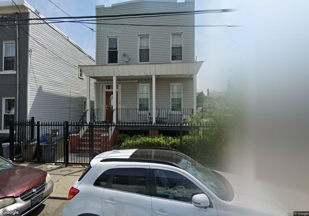
181 New Jersey Ave Brooklyn, NY 11207
East New York NeighborhoodEstimated Value: $775,231 - $998,000
--
Bed
--
Bath
2,000
Sq Ft
$448/Sq Ft
Est. Value
About This Home
This home is located at 181 New Jersey Ave, Brooklyn, NY 11207 and is currently estimated at $896,808, approximately $448 per square foot. 181 New Jersey Ave is a home located in Kings County with nearby schools including P.S. 149 Danny Kaye, Liberty Avenue Middle School, and Vista Academy.
Ownership History
Date
Name
Owned For
Owner Type
Purchase Details
Closed on
Apr 23, 2009
Sold by
Logan Christopher and Logan Jerome M
Bought by
Collins Elsie and Collins Keisha
Current Estimated Value
Home Financials for this Owner
Home Financials are based on the most recent Mortgage that was taken out on this home.
Original Mortgage
$430,148
Outstanding Balance
$271,338
Interest Rate
4.9%
Mortgage Type
Purchase Money Mortgage
Estimated Equity
$625,470
Purchase Details
Closed on
Nov 11, 2005
Sold by
Logan Maxine
Bought by
Logan Christopher and Logan Jerome M
Create a Home Valuation Report for This Property
The Home Valuation Report is an in-depth analysis detailing your home's value as well as a comparison with similar homes in the area
Home Values in the Area
Average Home Value in this Area
Purchase History
| Date | Buyer | Sale Price | Title Company |
|---|---|---|---|
| Collins Elsie | $445,000 | -- | |
| Collins Elsie | $445,000 | -- | |
| Logan Christopher | -- | -- | |
| Logan Christopher | -- | -- |
Source: Public Records
Mortgage History
| Date | Status | Borrower | Loan Amount |
|---|---|---|---|
| Open | Collins Elsie | $430,148 | |
| Closed | Collins Elsie | $430,148 |
Source: Public Records
Tax History Compared to Growth
Tax History
| Year | Tax Paid | Tax Assessment Tax Assessment Total Assessment is a certain percentage of the fair market value that is determined by local assessors to be the total taxable value of land and additions on the property. | Land | Improvement |
|---|---|---|---|---|
| 2025 | $3,886 | $54,300 | $16,500 | $37,800 |
| 2024 | $3,886 | $52,920 | $16,500 | $36,420 |
| 2023 | $3,710 | $48,480 | $16,500 | $31,980 |
| 2022 | $3,447 | $47,760 | $16,500 | $31,260 |
| 2021 | $3,431 | $45,660 | $16,500 | $29,160 |
| 2020 | $1,705 | $47,340 | $16,500 | $30,840 |
| 2019 | $3,373 | $47,340 | $16,500 | $30,840 |
| 2018 | $3,104 | $15,225 | $5,286 | $9,939 |
| 2017 | $2,933 | $14,389 | $6,069 | $8,320 |
| 2016 | $2,716 | $13,584 | $6,804 | $6,780 |
| 2015 | $1,637 | $13,584 | $5,299 | $8,285 |
| 2014 | $1,637 | $13,436 | $5,584 | $7,852 |
Source: Public Records
Map
Nearby Homes
- 159 Wyona St
- 124 Pennsylvania Ave
- 90 Wyona St
- 95 Wyona St
- 207 Bradford St
- 168 Miller Ave
- 57 Wyona St
- 2735 Fulton St
- 174 van Siclen Ave
- 243 Wyona St
- 52 Bradford St
- 35 Wyona St
- 2825 Atlantic Ave
- 34&36 Marginal St
- 303 Hendrix St
- 202 Schenck Ave
- 279 van Siclen Ave
- 52 van Siclen Ave
- 48 van Siclen Ave
- 2210 Pitkin Ave
- 187 New Jersey Ave
- 179 New Jersey Ave Unit 4
- 189 New Jersey Ave
- 191 New Jersey Ave
- 193 New Jersey Ave
- 2686 Atlantic Ave
- 182 Vermont St
- 186 Vermont St
- 195 New Jersey Ave
- 192 Vermont St
- 194 Vermont St
- 199 New Jersey Ave
- 196 Vermont St
- 198 Vermont St
- 395 Liberty Ave
- 200 Vermont St
- 202 Vermont St
- 198 New Jersey Ave
- 391 Liberty Ave Ave
- 399 Liberty Ave