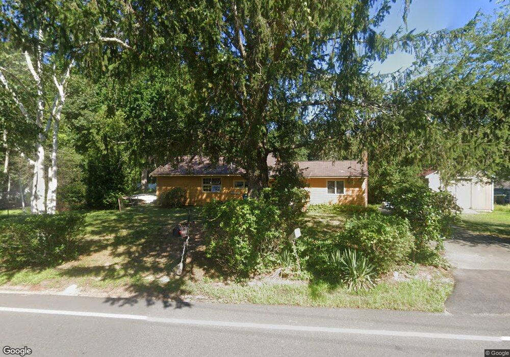
181 Puritan Rd Bourne, MA 2532
Buzzards Bay NeighborhoodEstimated Value: $437,000 - $502,000
--
Bed
--
Bath
--
Sq Ft
0.63
Acres
About This Home
This home is located at 181 Puritan Rd, Bourne, MA 2532 and is currently estimated at $463,887. 181 Puritan Rd is a home located in Barnstable County with nearby schools including Bourne High School and St Margaret Regional School.
Ownership History
Date
Name
Owned For
Owner Type
Purchase Details
Closed on
Jan 30, 2024
Sold by
Doane Abigail E and Andrews Stanley D
Bought by
Andrews Stanley D
Current Estimated Value
Purchase Details
Closed on
Oct 1, 2021
Sold by
Busnengo Ronald J and Flynn Sherry M
Bought by
Andrews Stanley D and Doane Abigail E
Home Financials for this Owner
Home Financials are based on the most recent Mortgage that was taken out on this home.
Original Mortgage
$300,000
Interest Rate
2.8%
Mortgage Type
Purchase Money Mortgage
Purchase Details
Closed on
Jan 31, 2013
Sold by
Mckenney Dennis D and Mckenney Darlene
Bought by
Busnengo Ronald J and Flynn Sherry M
Create a Home Valuation Report for This Property
The Home Valuation Report is an in-depth analysis detailing your home's value as well as a comparison with similar homes in the area
Home Values in the Area
Average Home Value in this Area
Purchase History
| Date | Buyer | Sale Price | Title Company |
|---|---|---|---|
| Andrews Stanley D | -- | None Available | |
| Andrews Stanley D | -- | None Available | |
| Andrews Stanley D | $375,000 | None Available | |
| Andrews Stanley D | $375,000 | None Available | |
| Busnengo Ronald J | $117,250 | -- | |
| Busnengo Ronald J | $117,250 | -- |
Source: Public Records
Mortgage History
| Date | Status | Borrower | Loan Amount |
|---|---|---|---|
| Previous Owner | Andrews Stanley D | $300,000 |
Source: Public Records
Tax History Compared to Growth
Tax History
| Year | Tax Paid | Tax Assessment Tax Assessment Total Assessment is a certain percentage of the fair market value that is determined by local assessors to be the total taxable value of land and additions on the property. | Land | Improvement |
|---|---|---|---|---|
| 2025 | $3,299 | $422,400 | $217,000 | $205,400 |
| 2024 | $3,226 | $402,200 | $206,600 | $195,600 |
| 2023 | $3,139 | $356,300 | $182,900 | $173,400 |
| 2022 | $3,116 | $308,800 | $161,800 | $147,000 |
| 2021 | $3,049 | $283,100 | $147,300 | $135,800 |
| 2020 | $2,966 | $276,200 | $145,900 | $130,300 |
| 2019 | $2,831 | $269,400 | $145,900 | $123,500 |
| 2018 | $2,646 | $251,000 | $138,900 | $112,100 |
| 2017 | $2,565 | $249,000 | $137,600 | $111,400 |
| 2016 | $2,413 | $237,500 | $137,600 | $99,900 |
| 2015 | $2,392 | $237,500 | $137,600 | $99,900 |
Source: Public Records
Map
Nearby Homes
- 171 Puritan Rd
- 162 Puritan Rd
- 4 Knob Ln
- 17 Maple St
- 41 Lewis Point Rd
- 0 Lewis Point Rd
- 65 Lewis Point Rd
- 304 Main St
- 73 Lewis Point Rd
- 38 Old Bridge Rd
- 46 Holt Rd
- 46 Holt Rd Unit A
- 23 Settlers Way
- 810 Head of The Bay Rd
- 151 - 153 Main St
- 9 Hideaway Rd Unit F
- 3 Wolf Rd
- 13 Hideaway Village Unit G
- 34 Washington Ave
- 27 Baker Ln Unit 27H
- 181 Puritan Rd
- 185 Puritan Rd
- 185 Puritan Rd
- 187 Puritan Rd
- 171 Puritan Rd
- 189 Puritan Rd
- 189 Puritan Rd
- 75 & 85 Head of The Bay Rd
- 75 Head of The Bay Rd
- 75 Head of The Bay Rd Unit D
- 75 Head of The Bay Rd
- 75 Head of The Bay Rd
- 85 Head of The Bay Rd
- 162 Puritan Rd
- 5 Kettle Ln
- 1 Kettle Ln
- 154 Puritan Rd
- 4 Little Bay Ln
- 154 Puritan Rd
- 151 Puritan Rd