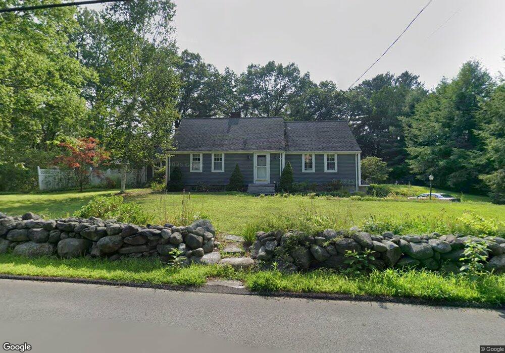
181 Tahattawan Rd Littleton, MA 01460
Littleton Common NeighborhoodEstimated Value: $796,000 - $899,000
4
Beds
3
Baths
2,416
Sq Ft
$342/Sq Ft
Est. Value
About This Home
This home is located at 181 Tahattawan Rd, Littleton, MA 01460 and is currently estimated at $825,758, approximately $341 per square foot. 181 Tahattawan Rd is a home located in Middlesex County with nearby schools including Shaker Lane Elementary School, Russell Street Elementary School, and Littleton Middle School.
Ownership History
Date
Name
Owned For
Owner Type
Purchase Details
Closed on
Sep 29, 1989
Sold by
Carlson Barbara
Bought by
Joyce Steven E
Current Estimated Value
Create a Home Valuation Report for This Property
The Home Valuation Report is an in-depth analysis detailing your home's value as well as a comparison with similar homes in the area
Home Values in the Area
Average Home Value in this Area
Purchase History
| Date | Buyer | Sale Price | Title Company |
|---|---|---|---|
| Joyce Steven E | $180,000 | -- |
Source: Public Records
Mortgage History
| Date | Status | Borrower | Loan Amount |
|---|---|---|---|
| Open | Joyce Steven E | $278,000 | |
| Closed | Joyce Steven E | $300,000 | |
| Closed | Joyce Steven E | $159,500 |
Source: Public Records
Tax History Compared to Growth
Tax History
| Year | Tax Paid | Tax Assessment Tax Assessment Total Assessment is a certain percentage of the fair market value that is determined by local assessors to be the total taxable value of land and additions on the property. | Land | Improvement |
|---|---|---|---|---|
| 2025 | $10,273 | $691,300 | $218,800 | $472,500 |
| 2024 | $10,060 | $677,900 | $212,600 | $465,300 |
| 2023 | $9,735 | $599,100 | $216,700 | $382,400 |
| 2022 | $9,537 | $538,500 | $216,700 | $321,800 |
| 2021 | $8,933 | $504,700 | $208,400 | $296,300 |
| 2020 | $8,501 | $478,400 | $188,600 | $289,800 |
| 2019 | $8,403 | $460,700 | $164,500 | $296,200 |
| 2018 | $7,885 | $434,700 | $162,500 | $272,200 |
| 2017 | $7,732 | $426,000 | $162,500 | $263,500 |
| 2016 | $6,057 | $342,400 | $162,500 | $179,900 |
| 2015 | $5,720 | $316,000 | $140,500 | $175,500 |
Source: Public Records
Map
Nearby Homes
- 305 Harwood Ave
- 146 Tahattawan Rd
- 35 Queen Rd
- 18 Long Lake Rd
- 4 Omega Way
- 221 Foster St
- 16 Fletcher Ln
- Lot 2 Strawberry Farm
- 4 Mars Place
- 336 King St Unit 105
- 115 Goldsmith St
- 34 Baldwin Hill Rd
- 18 Pleasant St
- 8 Edsel Rd
- 12 Paula Beth St
- 55 Jennifer St
- 10 Baldwin Hill Rd
- 17 Hartwell Ave
- 62 Waite Rd
- 63 Leonard Rd Unit 63
- 184 Tahattawan Rd
- 177 Tahattawan Rd
- 275 Harwood Ave
- 178 Tahattawan Rd
- 186 Tahattawan Rd
- 273 Harwood Ave
- 173 Tahattawan Rd
- 174 Tahattawan Rd
- 271 Harwood Ave
- 272 Harwood Ave
- 300 Harwood Ave
- 169 Tahattawan Rd
- 269 Harwood Ave
- 168 Tahattawan Rd
- 1 Worcester Dr
- 304 Harwood Ave
- LOT ONE Lexington Place
- 2 Worcester Dr
- 165 Tahattawan Rd
- 195 Tahattawan Rd