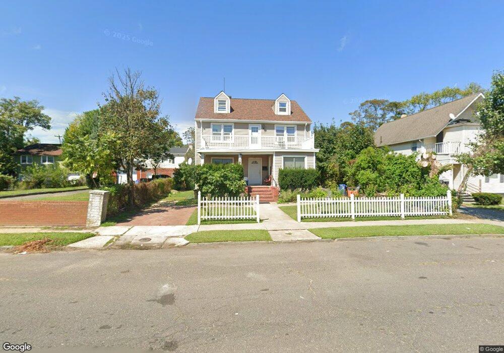
181 Union Ave Long Branch, NJ 07740
Estimated Value: $701,115 - $796,000
5
Beds
3
Baths
1,992
Sq Ft
$372/Sq Ft
Est. Value
About This Home
This home is located at 181 Union Ave, Long Branch, NJ 07740 and is currently estimated at $740,279, approximately $371 per square foot. 181 Union Ave is a home located in Monmouth County with nearby schools including Long Branch High School and Holy Trinity School.
Ownership History
Date
Name
Owned For
Owner Type
Purchase Details
Closed on
Mar 20, 2008
Sold by
Gonzalez Maritza and Torres Maritza
Bought by
Torres Maritza and Torres Jose
Current Estimated Value
Home Financials for this Owner
Home Financials are based on the most recent Mortgage that was taken out on this home.
Original Mortgage
$282,000
Outstanding Balance
$180,894
Interest Rate
6.3%
Mortgage Type
Commercial
Estimated Equity
$559,385
Purchase Details
Closed on
Feb 7, 2003
Sold by
Andujar Juan
Bought by
Gonzalez Maritza
Create a Home Valuation Report for This Property
The Home Valuation Report is an in-depth analysis detailing your home's value as well as a comparison with similar homes in the area
Home Values in the Area
Average Home Value in this Area
Purchase History
| Date | Buyer | Sale Price | Title Company |
|---|---|---|---|
| Torres Maritza | -- | Hunter Title Agency | |
| Gonzalez Maritza | $30,132 | -- |
Source: Public Records
Mortgage History
| Date | Status | Borrower | Loan Amount |
|---|---|---|---|
| Open | Torres Maritza | $282,000 |
Source: Public Records
Tax History Compared to Growth
Tax History
| Year | Tax Paid | Tax Assessment Tax Assessment Total Assessment is a certain percentage of the fair market value that is determined by local assessors to be the total taxable value of land and additions on the property. | Land | Improvement |
|---|---|---|---|---|
| 2025 | $8,564 | $664,500 | $200,000 | $464,500 |
| 2024 | $8,194 | $557,200 | $128,000 | $429,200 |
| 2023 | $8,194 | $527,600 | $118,000 | $409,600 |
| 2022 | $7,786 | $440,800 | $80,000 | $360,800 |
| 2021 | $7,786 | $389,100 | $73,000 | $316,100 |
| 2020 | $7,867 | $376,400 | $62,000 | $314,400 |
| 2019 | $7,563 | $359,800 | $60,000 | $299,800 |
| 2018 | $7,331 | $346,800 | $58,000 | $288,800 |
| 2017 | $7,034 | $341,300 | $58,000 | $283,300 |
| 2016 | $6,791 | $336,000 | $60,000 | $276,000 |
| 2015 | $7,345 | $329,800 | $75,000 | $254,800 |
| 2014 | $6,616 | $313,100 | $87,000 | $226,100 |
Source: Public Records
Map
Nearby Homes
- 40 N 5th Ave
- 40 University Dr
- 145 Stokes Place
- 143 Stokes Place
- 151 N 5th Ave
- 14 Slocum Place
- 39 Slocum Place
- 167 Chelsea Ave
- 148 Sixth Ave
- 184 N 5th Ave
- 176 Chelsea Ave
- 22 Cooper Ave Unit 113
- 22 Cooper Ave Unit 309
- 22 Cooper Ave Unit 110
- 211 Rockwell Ave
- 33 Cooper Ave Unit 213
- 33 Cooper Ave Unit 410
- 40 Seaview Ave Unit A
- 166 Franklin Ave Unit 8
- 103 Franklin Ave
- 185 Union Ave
- 177 Union Ave
- 177 Union Ave Unit 4
- 189 Union Ave
- 40 Lewis Alley
- 42 Liberty St
- 193 Union Ave
- 193 Union Ave Unit 2
- 182 Monmouth Ave
- 186 Monmouth Ave
- 180 Monmouth Ave
- 197 Union Ave
- 52 Liberty St
- 192 Monmouth Ave
- 194 Monmouth Ave
- 194 Monmouth Ave
- 54 Liberty St
- 196 Monmouth Ave
- 196 Monmouth Ave
- 198 Monmouth Ave