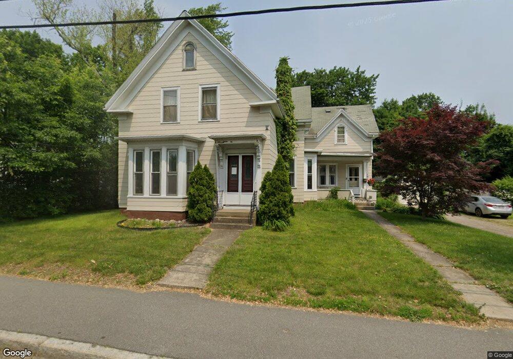
181 W Chestnut St Brockton, MA 02301
Clifton Heights NeighborhoodEstimated Value: $624,048 - $744,000
5
Beds
2
Baths
2,258
Sq Ft
$302/Sq Ft
Est. Value
About This Home
This home is located at 181 W Chestnut St, Brockton, MA 02301 and is currently estimated at $681,512, approximately $301 per square foot. 181 W Chestnut St is a home located in Plymouth County with nearby schools including John F. Kennedy Elementary School, Davis K-8 School, and South Middle School.
Ownership History
Date
Name
Owned For
Owner Type
Purchase Details
Closed on
Jul 10, 2024
Sold by
Amos James R and Amos Jean M
Bought by
Peace Piant Ret and Amos
Current Estimated Value
Purchase Details
Closed on
Oct 2, 2007
Sold by
Buzzell Judith A and Battles Cheryl A
Bought by
Amos James R and Amos Jean M
Home Financials for this Owner
Home Financials are based on the most recent Mortgage that was taken out on this home.
Original Mortgage
$107,000
Interest Rate
6.65%
Mortgage Type
Purchase Money Mortgage
Purchase Details
Closed on
Feb 21, 1996
Sold by
Scb Rt
Bought by
Buzzell Judith A and Battles Cheryl A
Purchase Details
Closed on
Feb 14, 1996
Sold by
Mendes Daniel A and Scb Rt
Bought by
Scb
Purchase Details
Closed on
Jun 1, 1992
Sold by
Hills Davie L
Bought by
Mendes Daniel A and Andrade Jose M
Create a Home Valuation Report for This Property
The Home Valuation Report is an in-depth analysis detailing your home's value as well as a comparison with similar homes in the area
Home Values in the Area
Average Home Value in this Area
Purchase History
| Date | Buyer | Sale Price | Title Company |
|---|---|---|---|
| Peace Piant Ret | -- | None Available | |
| Peace Piant Ret | -- | None Available | |
| Amos James R | $80,000 | -- | |
| Amos James R | $80,000 | -- | |
| Buzzell Judith A | $89,900 | -- | |
| Buzzell Judith A | $89,900 | -- | |
| Scb | $70,000 | -- | |
| Scb | $70,000 | -- | |
| Mendes Daniel A | $122,000 | -- |
Source: Public Records
Mortgage History
| Date | Status | Borrower | Loan Amount |
|---|---|---|---|
| Previous Owner | Mendes Daniel A | $107,000 |
Source: Public Records
Tax History Compared to Growth
Tax History
| Year | Tax Paid | Tax Assessment Tax Assessment Total Assessment is a certain percentage of the fair market value that is determined by local assessors to be the total taxable value of land and additions on the property. | Land | Improvement |
|---|---|---|---|---|
| 2025 | $7,358 | $607,600 | $141,600 | $466,000 |
| 2024 | $7,157 | $595,400 | $141,600 | $453,800 |
| 2023 | $6,633 | $511,000 | $111,700 | $399,300 |
| 2022 | $6,541 | $468,200 | $101,600 | $366,600 |
| 2021 | $6,029 | $415,800 | $86,000 | $329,800 |
| 2020 | $5,337 | $352,300 | $79,000 | $273,300 |
| 2019 | $5,288 | $340,300 | $76,500 | $263,800 |
| 2018 | $5,178 | $322,400 | $76,500 | $245,900 |
| 2017 | $4,450 | $276,400 | $76,500 | $199,900 |
| 2016 | $3,297 | $189,900 | $74,700 | $115,200 |
| 2015 | $2,641 | $145,500 | $74,700 | $70,800 |
| 2014 | $2,692 | $148,500 | $74,700 | $73,800 |
Source: Public Records
Map
Nearby Homes
- 115 Leach Ave
- 115 Market St
- 137 Channing Ave
- 57 Copeland St
- 65 Tremont St
- 977 Warren Ave
- 58 Calmar St
- 153 Bouve Ave
- 936 Warren Ave
- 37 Menlo Ave
- 176 Ettrick St
- 20 Custer St
- 15 1st St
- 184 Myrtle St
- 115 Ettrick St
- 61 Myrtle St
- 223 Clinton St Unit 10
- 223 Clinton St Unit 3
- 47 Southworth St
- 58 Bernice Ave
- 11 Marion Ave
- 167 W Chestnut St
- 187 W Chestnut St
- 17 Marion Ave
- 163 W Chestnut St
- 103 Echo St
- 191 W Chestnut St
- 188 W Chestnut St
- 16 Marion Ave
- 172 W Chestnut St
- 168 W Chestnut St
- 23 Marion Ave
- 166 W Chestnut St
- 166 W Chestnut St Unit 1
- 194 W Chestnut St
- 20 Marion Ave
- 95 Echo St
- 27 Marion Ave
- 162 W Chestnut St
- 14 Donald St