
Seller's Agent in 2020
Don Ngo
RE/MAX RESULTS
(832) 333-0360
2 in this area
89 Total Sales
Estimated Value: $700,357 - $895,000
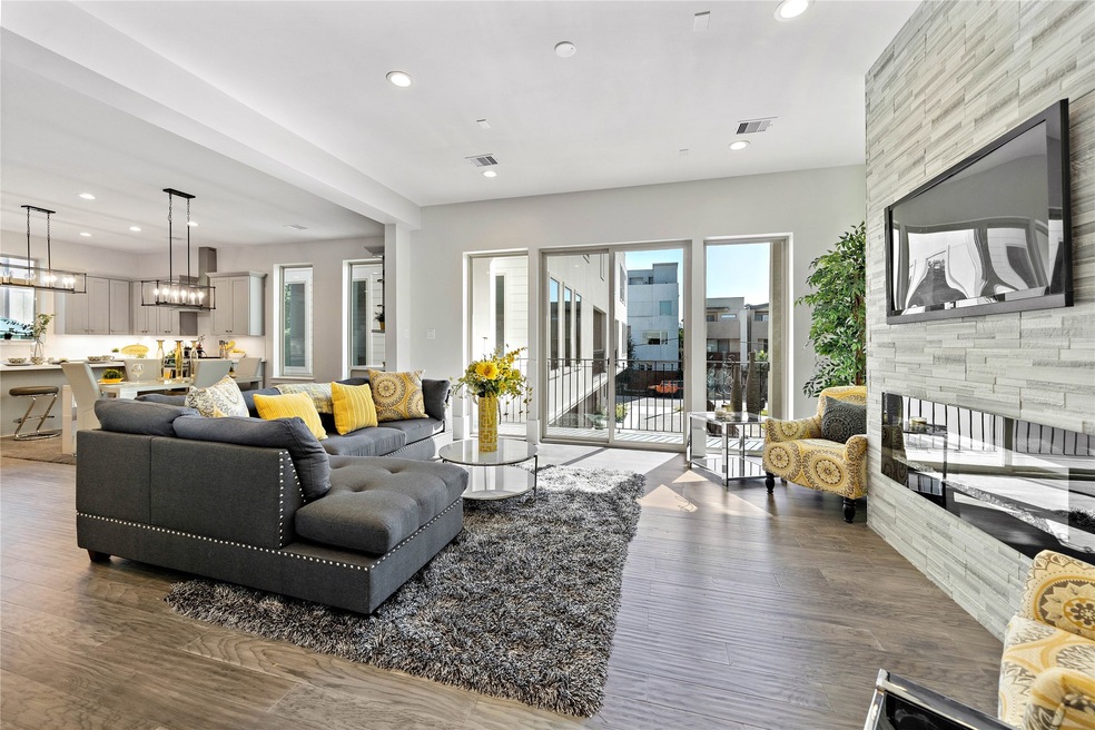
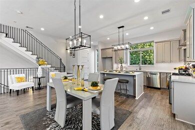
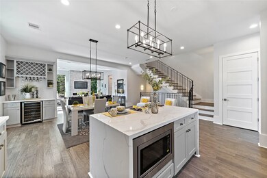
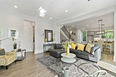
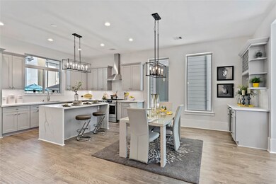
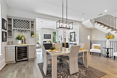
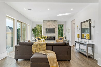
Brand new construction!! Meticulous attention to detail that sophisticated buyers demand in a home. The mahogany front door sets the tone as you'll be greeted with light engineered hardwood flooring, high ceilings, modern fixtures, epoxy coated garage floors, high-end finishes & appliances, and superior craftsmanship in order to experience the luxury you deserve. The wrought iron railings will lead you to your living room with plenty of natural light, elegant dining, luxury kitchen counter with Calcutta quartz, waterfall island, and sleek backsplash radiates the lavish lifestyle you want. The home features high ceilings, 12” base boards, recessed lighting, quartz for added elegance. The massive roof-top terrace will provide you with beautiful views of the Galleria, Montrose, Medical Center and Downtown Houston. Don't miss out on this beautiful home with great value. Schedule your private tour today!!
| Date | Buyer | Sale Price | Title Company |
|---|---|---|---|
| Zhang Xuefeng | -- | Chicago Title |
| Date | Status | Borrower | Loan Amount |
|---|---|---|---|
| Open | Zhang Xuefeng | $510,400 |
| Date | Event | Price | List to Sale | Price per Sq Ft |
|---|---|---|---|---|
| 01/27/2025 01/27/25 | Off Market | -- | -- | -- |
| 02/21/2020 02/21/20 | Sold | -- | -- | -- |
| 01/22/2020 01/22/20 | Pending | -- | -- | -- |
| 11/19/2019 11/19/19 | For Sale | $669,900 | -- | $247 / Sq Ft |
| Year | Tax Paid | Tax Assessment Tax Assessment Total Assessment is a certain percentage of the fair market value that is determined by local assessors to be the total taxable value of land and additions on the property. | Land | Improvement |
|---|---|---|---|---|
| 2025 | $10,421 | $768,677 | $192,500 | $576,177 |
| 2024 | $10,421 | $673,290 | $192,500 | $480,790 |
| 2023 | $10,421 | $750,000 | $192,500 | $557,500 |
| 2022 | $14,510 | $659,000 | $157,500 | $501,500 |
| 2021 | $14,893 | $639,000 | $183,750 | $455,250 |
| 2020 | $15,474 | $639,000 | $183,750 | $455,250 |
| 2019 | $10,782 | $0 | $0 | $0 |
| 2018 | $15,705 | $620,642 | $468,750 | $151,892 |
| 2017 | $9,605 | $620,642 | $468,750 | $151,892 |
| 2016 | $8,811 | $588,369 | $406,250 | $182,119 |
| 2015 | $7,423 | $523,179 | $375,000 | $148,179 |
| 2014 | $7,423 | $483,439 | $343,750 | $139,689 |
Seller's Agent in 2020
Don Ngo
RE/MAX RESULTS
(832) 333-0360
2 in this area
89 Total Sales
B
Buyer's Agent in 2020
Belinda Schmidt
Martha Turner Sotheby's International Realty
(713) 417-1177
6 in this area
68 Total Sales
Source: Houston Association of REALTORS®
MLS Number: 10584687
APN: 1394990010001
Disclaimer: Certain information contained herein is derived from information provided by parties other than Homes.com. All information provided is deemed reliable, but is not guaranteed to be accurate and should be independently verified.
![]() Copyright 2025, Houston REALTORS® Information Service, Inc.
Copyright 2025, Houston REALTORS® Information Service, Inc.
The information provided is exclusively for consumers’ personal, non-commercial use, and may not be used for any purpose other than to identify prospective properties consumers may be interested in purchasing.
Information is deemed reliable but not guaranteed.