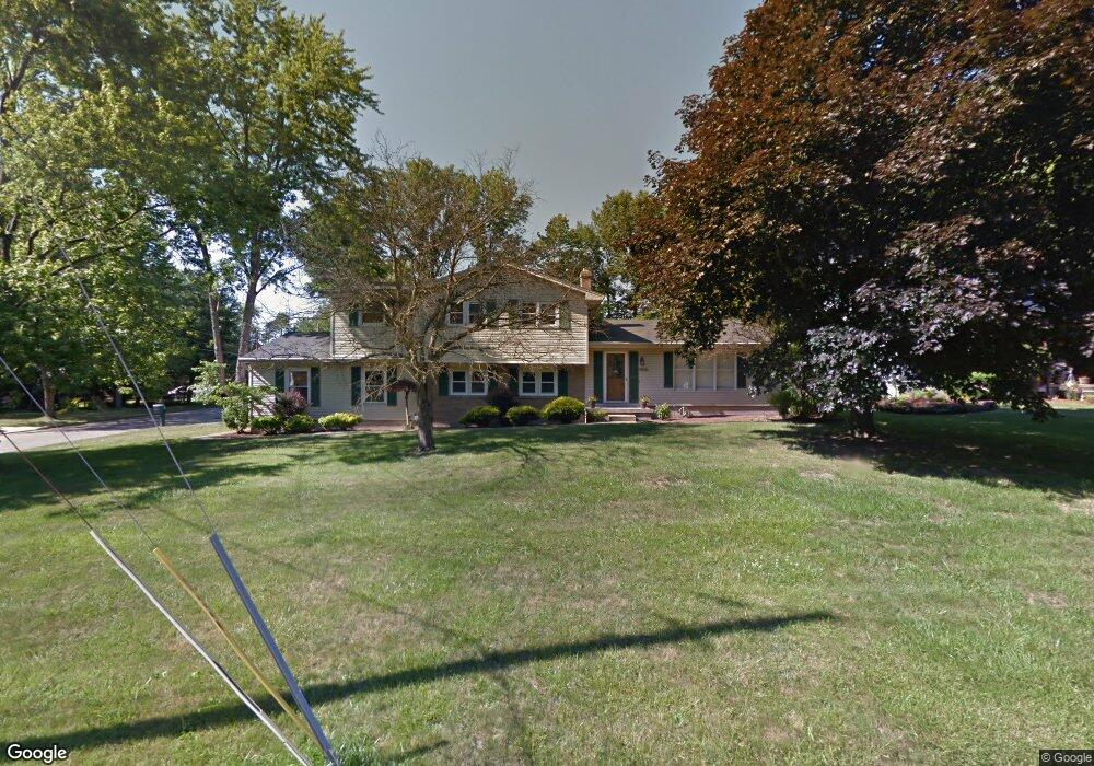
1810 Canavan Dr Youngstown, OH 44514
Estimated Value: $273,279 - $304,000
About This Home
This home is located at 1810 Canavan Dr, Youngstown, OH 44514 and is currently estimated at $293,320, approximately $139 per square foot. 1810 Canavan Dr is a home located in Mahoning County with nearby schools including Poland Union Elementary School, Poland Middle School, and Poland Seminary High School.
Ownership History
We collect this data history from publicly available records. To have your information removed, we recommend requesting removal directly through your county’s website.
Purchase Details
Purchase Details
Home Financials for this Owner
Home Financials are based on the most recent Mortgage that was taken out on this home.Purchase Details
Home Financials for this Owner
Home Financials are based on the most recent Mortgage that was taken out on this home.Purchase Details
Home Financials for this Owner
Home Financials are based on the most recent Mortgage that was taken out on this home.Purchase Details
Home Financials for this Owner
Home Financials are based on the most recent Mortgage that was taken out on this home.Purchase Details
Home Values in the Area
Average Home Value in this Area
Purchase History
We collect this data history from publicly available records. To have your information removed, we recommend requesting removal directly through your county’s website.
| Date | Buyer | Sale Price | Title Company |
|---|---|---|---|
| $36,500 | Escrow | ||
| $79,000 | None Available | ||
| $99,000 | Attorney | ||
| $153,900 | First Service Title Agency | ||
| $135,000 | Northeastern Ohio Title Agen | ||
| $57,000 | -- |
Mortgage History
We collect this data history from publicly available records. To have your information removed, we recommend requesting removal directly through your county’s website.
| Date | Status | Borrower | Loan Amount |
|---|---|---|---|
| Previous Owner | $76,000 | ||
| Previous Owner | $97,206 | ||
| Previous Owner | $123,120 | ||
| Previous Owner | $99,900 | ||
| Closed | $30,780 |
Tax History
We collect this data history from publicly available records. To have your information removed, we recommend requesting removal directly through your county’s website.
| Year | Tax Paid | Tax Assessment Tax Assessment Total Assessment is a certain percentage of the fair market value that is determined by local assessors to be the total taxable value of land and additions on the property. | Land | Improvement |
|---|---|---|---|---|
| 2025 | $4,101 | $74,450 | $9,540 | $64,910 |
| 2024 | $4,368 | $74,450 | $9,540 | $64,910 |
| 2023 | $4,280 | $74,450 | $9,540 | $64,910 |
| 2022 | $3,077 | $50,550 | $9,790 | $40,760 |
| 2021 | $3,082 | $50,550 | $9,790 | $40,760 |
| 2020 | $3,094 | $50,550 | $9,790 | $40,760 |
| 2019 | $2,961 | $44,350 | $8,590 | $35,760 |
| 2018 | $2,789 | $44,350 | $8,590 | $35,760 |
| 2017 | $2,852 | $44,350 | $8,590 | $35,760 |
| 2016 | $2,919 | $44,510 | $10,180 | $34,330 |
| 2015 | $2,863 | $44,510 | $10,180 | $34,330 |
| 2014 | $2,872 | $44,510 | $10,180 | $34,330 |
| 2013 | $2,838 | $44,510 | $10,180 | $34,330 |
Map
- 1793 Lealand Ave
- 1859 Mathews Rd
- 0 Mathews Rd Unit 5149232
- 0 Mathews Rd Unit 5143059
- 148 Island Dr
- 0 Oles Ave
- 2035 Woodward Ave
- 0 Woodlawn Ave
- 1852 Massachusetts Ave Unit 8
- 5425 Sheridan Rd
- 5710 Youngstown Poland Rd
- 113 Massachusetts Ave
- 51 Renwick Dr
- 1750 Halbert Dr
- 23 Massachusetts Ave
- 934 Larkridge Ave
- 1505 Brandon Ave
- 144 N Main St
- 1933 Brandon Ave
- 118 N Main St
- 1814 Canavan Dr
- 1809 Lemont Dr
- 1723 Alverne Dr
- 1818 Canavan Dr
- 1813 Lemont Dr
- 1817 Lemont Dr
- 1799 Lemont Dr
- 1732 Alverne Dr
- 1821 Lemont Dr
- 1727 Alverne Dr
- 1795 Lemont Dr
- 1809 Canavan Dr
- 1736 Alverne Dr
- 1825 Lemont Dr
- 1813 Canavan Dr
- 1791 Lemont Dr
- 1826 Canavan Dr
- 1817 Canavan Dr
- 1731 Alverne Dr
- 1829 Lemont Dr
Ask me questions while you tour the home.