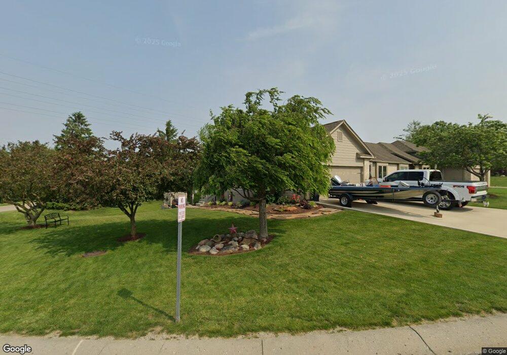
1810 Longest Dr Franklin, IN 46131
Estimated Value: $348,000 - $409,000
4
Beds
2
Baths
2,822
Sq Ft
$134/Sq Ft
Est. Value
About This Home
This home is located at 1810 Longest Dr, Franklin, IN 46131 and is currently estimated at $378,390, approximately $134 per square foot. 1810 Longest Dr is a home located in Johnson County with nearby schools including Needham Elementary School, Franklin Community Middle School, and Custer Baker Intermediate School.
Ownership History
Date
Name
Owned For
Owner Type
Purchase Details
Closed on
Dec 31, 2008
Sold by
Raymond Brian S
Bought by
Massinon Eric L and Massinon Robin
Current Estimated Value
Home Financials for this Owner
Home Financials are based on the most recent Mortgage that was taken out on this home.
Original Mortgage
$130,000
Outstanding Balance
$83,694
Interest Rate
5.53%
Mortgage Type
New Conventional
Estimated Equity
$294,696
Purchase Details
Closed on
Nov 10, 2005
Sold by
Blackwell Deborah J
Bought by
Raymond Brian S
Home Financials for this Owner
Home Financials are based on the most recent Mortgage that was taken out on this home.
Original Mortgage
$215,000
Interest Rate
6.13%
Mortgage Type
New Conventional
Purchase Details
Closed on
Apr 29, 2005
Sold by
Blackwell Robert A
Bought by
Blackwell Deborah J
Create a Home Valuation Report for This Property
The Home Valuation Report is an in-depth analysis detailing your home's value as well as a comparison with similar homes in the area
Home Values in the Area
Average Home Value in this Area
Purchase History
| Date | Buyer | Sale Price | Title Company |
|---|---|---|---|
| Massinon Eric L | -- | Chicago Title Insurance Co | |
| Raymond Brian S | -- | None Available | |
| Blackwell Deborah J | -- | None Available |
Source: Public Records
Mortgage History
| Date | Status | Borrower | Loan Amount |
|---|---|---|---|
| Open | Massinon Eric L | $130,000 | |
| Previous Owner | Raymond Brian S | $215,000 |
Source: Public Records
Tax History Compared to Growth
Tax History
| Year | Tax Paid | Tax Assessment Tax Assessment Total Assessment is a certain percentage of the fair market value that is determined by local assessors to be the total taxable value of land and additions on the property. | Land | Improvement |
|---|---|---|---|---|
| 2025 | $3,380 | $318,100 | $32,400 | $285,700 |
| 2024 | $3,380 | $304,000 | $32,900 | $271,100 |
| 2023 | $3,297 | $296,200 | $32,900 | $263,300 |
| 2022 | $2,982 | $265,900 | $30,400 | $235,500 |
| 2021 | $2,425 | $217,400 | $30,400 | $187,000 |
| 2020 | $2,318 | $208,100 | $30,400 | $177,700 |
| 2019 | $2,258 | $202,900 | $30,400 | $172,500 |
| 2018 | $2,071 | $215,700 | $30,400 | $185,300 |
| 2017 | $1,985 | $198,500 | $30,400 | $168,100 |
| 2016 | $1,983 | $192,200 | $30,400 | $161,800 |
| 2014 | $1,983 | $198,300 | $30,400 | $167,900 |
| 2013 | $1,983 | $198,300 | $30,400 | $167,900 |
Source: Public Records
Map
Nearby Homes
- 1850 Longest Dr
- 2117 Jennifer Ct
- 1532 Williamsburg Ln
- 2136 Jennifer Ct
- 1083 Beechtree Ln
- 1185 Beechtree Ln
- 1682 Millpond Ln
- 1669 Millpond Ln
- 1646 Millpond Ln
- 1636 Millpond Ln
- 1679 Millpond Ln
- 1690 Millpond Ln
- 1642 Millpond Ln
- 1663 Millpond Ln
- 1640 Millpond Ln
- 1650 Millpond Ln
- 1654 Millpond Ln
- 1660 Millpond Ln
- 1653 Millpond Ln
- 1686 Millpond Ln
- 1820 Longest Dr
- 1825 Longest Dr
- 1849 Golfview Ct
- 1847 Golfview Ct
- 155 Fairway Ct
- 1835 Longest Dr
- 195 Fairway Ct
- 1843 Golfview Ct
- 1845 Longest Dr
- 1855 Longest Dr
- 1855 Longest Dr Unit 1
- 0 Fairway Ct
- 1846 Golfview Ct
- 1842 Golfview Ct
- 1875 Longest Dr
- 1838 Golfview Ct
- 245 Fairway Ct
- 150 Fairway Ct
- 1860 Longest Dr
- 190 Fairway Ct