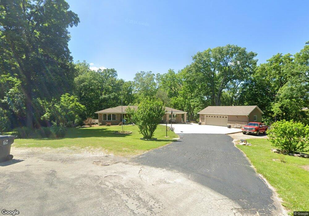
1810 Sand Creek Cir Decatur, IL 62521
Estimated Value: $215,000 - $246,000
3
Beds
2
Baths
2,152
Sq Ft
$108/Sq Ft
Est. Value
About This Home
This home is located at 1810 Sand Creek Cir, Decatur, IL 62521 and is currently estimated at $231,344, approximately $107 per square foot. 1810 Sand Creek Cir is a home located in Macon County with nearby schools including McGaughey Elementary School, Mt. Zion Elementary School, and Mt. Zion Intermediate School.
Ownership History
Date
Name
Owned For
Owner Type
Purchase Details
Closed on
Oct 4, 2005
Sold by
Ryan Wallace E and Ryan Helen
Bought by
Tippit Terry A and Tippit Michelle R
Current Estimated Value
Home Financials for this Owner
Home Financials are based on the most recent Mortgage that was taken out on this home.
Original Mortgage
$126,400
Outstanding Balance
$68,166
Interest Rate
5.88%
Mortgage Type
New Conventional
Estimated Equity
$163,178
Create a Home Valuation Report for This Property
The Home Valuation Report is an in-depth analysis detailing your home's value as well as a comparison with similar homes in the area
Home Values in the Area
Average Home Value in this Area
Purchase History
| Date | Buyer | Sale Price | Title Company |
|---|---|---|---|
| Tippit Terry A | $158,000 | None Available |
Source: Public Records
Mortgage History
| Date | Status | Borrower | Loan Amount |
|---|---|---|---|
| Open | Tippit Terry A | $126,400 |
Source: Public Records
Tax History Compared to Growth
Tax History
| Year | Tax Paid | Tax Assessment Tax Assessment Total Assessment is a certain percentage of the fair market value that is determined by local assessors to be the total taxable value of land and additions on the property. | Land | Improvement |
|---|---|---|---|---|
| 2024 | $4,234 | $71,313 | $11,111 | $60,202 |
| 2023 | $3,930 | $64,387 | $11,111 | $53,276 |
| 2022 | $3,765 | $61,426 | $10,600 | $50,826 |
| 2021 | $3,704 | $58,436 | $10,084 | $48,352 |
| 2020 | $3,522 | $55,388 | $9,558 | $45,830 |
| 2019 | $3,522 | $55,388 | $9,558 | $45,830 |
| 2018 | $3,365 | $53,278 | $9,194 | $44,084 |
| 2017 | $3,302 | $52,781 | $9,108 | $43,673 |
| 2016 | $3,320 | $52,670 | $9,089 | $43,581 |
| 2015 | $3,150 | $51,136 | $8,824 | $42,312 |
| 2014 | $3,384 | $50,630 | $8,737 | $41,893 |
| 2013 | $3,439 | $50,630 | $8,737 | $41,893 |
Source: Public Records
Map
Nearby Homes
- 3137 Southland Rd
- 435 Dawson Rd
- 4115 Meadow Park Dr
- 2330 S Shores Dr
- 3020 S Laura St
- 0 E Danceland Rd
- 2605 S Forrest Green Dr
- 2626 S Forrest Green Dr
- 2628 S Forrest Green Dr
- 1935 Buckhead Ct
- 2125 Reserve Way
- 4090 S Lake Ct
- 98 Ridgeway Dr
- 2030 Buckhead Ln
- 102 Phillips Dr
- 2020 Buckhead Ln
- 1820 Buckhead Ln
- 43 Ridgedale Dr
- 65 S Shores Dr
- 2110 Buckhead Ln
- 1825 Sand Creek Cir
- 1855 Sand Creek Cir
- 1885 Sand Creek Cir
- 4270 Sand Creek Rd
- 4125 Sand Creek Rd
- 4240 Sand Creek Rd
- 4095 Sand Creek Rd
- 4090 Sand Creek Rd
- 4315 Sand Creek Rd
- 4010 Sand Creek Rd
- 4010 Sand Creek Rd
- 3990 Sand Creek Rd
- 4405 Sand Creek Rd
- 3964 Sand Creek Rd
- 3960 Sand Creek Rd
- 3930 Sandcreek Rd
- 4435 Sand Creek Rd
- 3965 Sand Creek Rd
- 3965 Sand Creek Rd
- 3880 Sand Creek Rd