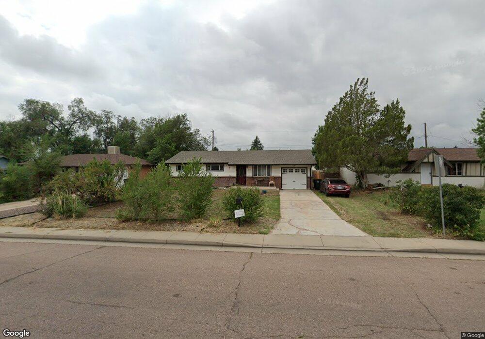
1810 Security Blvd Colorado Springs, CO 80911
Security-Widefield NeighborhoodEstimated Value: $301,646 - $332,000
2
Beds
1
Bath
1,040
Sq Ft
$305/Sq Ft
Est. Value
About This Home
This home is located at 1810 Security Blvd, Colorado Springs, CO 80911 and is currently estimated at $317,412, approximately $305 per square foot. 1810 Security Blvd is a home located in El Paso County with nearby schools including Pinello Elementary School, Sproul Junior High School, and Widefield High School.
Ownership History
Date
Name
Owned For
Owner Type
Purchase Details
Closed on
Jan 8, 2021
Sold by
Abeyta Joc and Epler Amanda
Bought by
York Michael Anthony and Vigil Janelle Nicole
Current Estimated Value
Home Financials for this Owner
Home Financials are based on the most recent Mortgage that was taken out on this home.
Original Mortgage
$275,910
Outstanding Balance
$246,251
Interest Rate
2.71%
Mortgage Type
FHA
Estimated Equity
$71,161
Purchase Details
Closed on
Jan 5, 2018
Sold by
Frazier Kelsey Karin and Ballard Kelsey K
Bought by
Epler Amanda and Abeyta Joe
Home Financials for this Owner
Home Financials are based on the most recent Mortgage that was taken out on this home.
Original Mortgage
$183,612
Interest Rate
5.5%
Mortgage Type
FHA
Purchase Details
Closed on
Aug 17, 2011
Sold by
Keown Justin A and Keown Nicole L
Bought by
Ballard Kelsey K
Home Financials for this Owner
Home Financials are based on the most recent Mortgage that was taken out on this home.
Original Mortgage
$110,525
Interest Rate
4.5%
Mortgage Type
FHA
Purchase Details
Closed on
Mar 18, 2008
Sold by
Privitera Dennis
Bought by
Keown Justin A and Keown Nicole L
Home Financials for this Owner
Home Financials are based on the most recent Mortgage that was taken out on this home.
Original Mortgage
$145,665
Interest Rate
5.67%
Mortgage Type
VA
Purchase Details
Closed on
Sep 12, 2007
Sold by
Deutsche Bank Trust Co Americas
Bought by
Privitera Dennis
Purchase Details
Closed on
Sep 16, 2005
Sold by
Stephens Sam
Bought by
Jones Stephanie L and Jones Michael D
Home Financials for this Owner
Home Financials are based on the most recent Mortgage that was taken out on this home.
Original Mortgage
$104,000
Interest Rate
8.25%
Mortgage Type
Fannie Mae Freddie Mac
Purchase Details
Closed on
Dec 12, 1988
Bought by
Epler Amanda
Purchase Details
Closed on
Sep 9, 1975
Bought by
Epler Amanda
Create a Home Valuation Report for This Property
The Home Valuation Report is an in-depth analysis detailing your home's value as well as a comparison with similar homes in the area
Home Values in the Area
Average Home Value in this Area
Purchase History
| Date | Buyer | Sale Price | Title Company |
|---|---|---|---|
| York Michael Anthony | $281,000 | Unified Title Co | |
| Epler Amanda | $187,000 | Unified Title Company | |
| Ballard Kelsey K | $113,400 | Fidelity National Title Insu | |
| Keown Justin A | $142,600 | Fahtco | |
| Privitera Dennis | $93,000 | None Available | |
| Jones Stephanie L | $130,000 | -- | |
| Epler Amanda | -- | -- | |
| Epler Amanda | -- | -- |
Source: Public Records
Mortgage History
| Date | Status | Borrower | Loan Amount |
|---|---|---|---|
| Open | York Michael Anthony | $275,910 | |
| Previous Owner | Epler Amanda | $183,612 | |
| Previous Owner | Ballard Kelsey K | $110,525 | |
| Previous Owner | Keown Justin A | $145,665 | |
| Previous Owner | Jones Stephanie L | $104,000 |
Source: Public Records
Tax History Compared to Growth
Tax History
| Year | Tax Paid | Tax Assessment Tax Assessment Total Assessment is a certain percentage of the fair market value that is determined by local assessors to be the total taxable value of land and additions on the property. | Land | Improvement |
|---|---|---|---|---|
| 2025 | $1,325 | $21,660 | -- | -- |
| 2024 | $1,260 | $21,660 | $3,220 | $18,440 |
| 2023 | $1,260 | $21,660 | $3,220 | $18,440 |
| 2022 | $1,231 | $16,490 | $2,220 | $14,270 |
| 2021 | $1,328 | $16,970 | $2,290 | $14,680 |
| 2020 | $1,043 | $12,950 | $2,000 | $10,950 |
| 2019 | $1,037 | $12,950 | $2,000 | $10,950 |
| 2018 | $700 | $8,160 | $1,500 | $6,660 |
| 2017 | $708 | $8,160 | $1,500 | $6,660 |
| 2016 | $571 | $8,030 | $1,590 | $6,440 |
| 2015 | $585 | $8,030 | $1,590 | $6,440 |
| 2014 | $526 | $7,240 | $1,430 | $5,810 |
Source: Public Records
Map
Nearby Homes
- 4027 Silver Star Grove
- 105 Larch Dr
- 4020 Silver Star Grove
- 93 Sumac Dr
- 124 Sumac Dr
- 213 Sumac Dr
- 4634 Cassidy St
- 4666 Hennings Dr
- 4658 Hennings Dr
- 2246 Bison Dr
- 96 Davie Dr
- 4790 Hennings Dr
- 405 Birch Dr
- 217 Steven Dr
- 208 Davie Dr
- 308 Steven Dr
- 4385 Cassidy St
- 4375 Cassidy St
- 324 Davie Dr
- 4145 Dooley Way
- 1814 Security Blvd
- 1806 Security Blvd
- 1809 Couch Place
- 1813 Couch Place
- 1805 Couch Place
- 1802 Security Blvd
- 1818 Security Blvd
- 1801 Couch Place
- 101 Sitka Dr
- 1817 Couch Place
- 1714 Security Blvd
- 100 Larch Dr
- 1713 Couch Place
- 100 Sitka Dr
- 105 Sitka Dr
- 1710 Security Blvd
- 1810 Couch Place
- 104 Larch Dr
- 104 Sitka Dr
- 1806 Couch Place