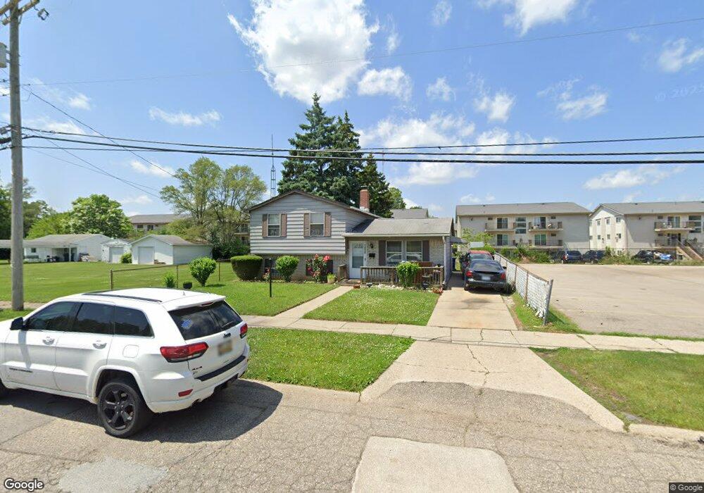
1810 Seymour Ave Flint, MI 48503
South Parks NeighborhoodEstimated Value: $73,000 - $89,000
3
Beds
2
Baths
1,312
Sq Ft
$63/Sq Ft
Est. Value
About This Home
This home is located at 1810 Seymour Ave, Flint, MI 48503 and is currently estimated at $82,198, approximately $62 per square foot. 1810 Seymour Ave is a home located in Genesee County with nearby schools including Freeman Elementary School, Flint Southwestern Classical Academy, and International Academy of Flint (K-12).
Ownership History
Date
Name
Owned For
Owner Type
Purchase Details
Closed on
May 4, 2021
Sold by
Marie Roberts Velma
Bought by
Henry Mark
Current Estimated Value
Purchase Details
Closed on
Apr 15, 2008
Sold by
Da Realty Inc
Bought by
Roberts Velma
Purchase Details
Closed on
May 17, 2006
Sold by
Johnson Lazarre
Bought by
Lasalle Bank Midwest Na and Michigan National Bank
Create a Home Valuation Report for This Property
The Home Valuation Report is an in-depth analysis detailing your home's value as well as a comparison with similar homes in the area
Home Values in the Area
Average Home Value in this Area
Purchase History
| Date | Buyer | Sale Price | Title Company |
|---|---|---|---|
| Henry Mark | -- | None Listed On Document | |
| Roberts Velma | $16,000 | None Available | |
| Lasalle Bank Midwest Na | $24,817 | None Available |
Source: Public Records
Tax History Compared to Growth
Tax History
| Year | Tax Paid | Tax Assessment Tax Assessment Total Assessment is a certain percentage of the fair market value that is determined by local assessors to be the total taxable value of land and additions on the property. | Land | Improvement |
|---|---|---|---|---|
| 2025 | $1,896 | $31,100 | $0 | $0 |
| 2024 | $1,740 | $27,200 | $0 | $0 |
| 2023 | $1,686 | $23,100 | $0 | $0 |
| 2022 | $0 | $20,700 | $0 | $0 |
| 2021 | $954 | $17,500 | $0 | $0 |
| 2020 | $880 | $14,000 | $0 | $0 |
| 2019 | $862 | $12,800 | $0 | $0 |
| 2018 | $847 | $12,100 | $0 | $0 |
| 2017 | $826 | $0 | $0 | $0 |
| 2016 | $820 | $0 | $0 | $0 |
| 2015 | -- | $0 | $0 | $0 |
| 2014 | -- | $0 | $0 | $0 |
| 2012 | -- | $11,600 | $0 | $0 |
Source: Public Records
Map
Nearby Homes
- 1601 Wayne St
- 1917 Whittlesey St
- 1840 Mcphail St
- 1937 Chelan St
- 1510 S Franklin Ave
- 9211 Owen St
- 1110 Pingree Ave
- 2029 Aitken Ave
- 2010 Crocker Ave
- 2313 Brookside Dr
- 2319 Calumet St
- 1018 Lafayette St
- 2122 Pierce St
- 2221 Howard Ave
- 930 Belmont Ave
- 1628 Broad Ct
- 2121 Dwight Ave
- 2224 Crocker Ave
- 2050 Ferris Ave
- 2013 E Court St
- 1832 Seymour Ave
- 1823 Seymour Ave
- 1827 Seymour Ave
- 1840 Seymour Ave
- 1835 Seymour Ave
- 1818 Barks St
- 1822 Barks St
- 1814 Barks St
- 1839 Seymour Ave
- 1826 Barks St
- 2324 Lapeer Rd
- 1844 Seymour Ave
- 1834 Barks St
- 1843 Seymour Ave
- 2418 Lapeer Rd
- 1838 Barks St
- 1842 Barks St
- 1609 Kent St
- 2367 Lapeer Rd
- 1851 Seymour Ave