1811 25th St Port Huron, MI 48060
Estimated payment $807/month
Highlights
- No HOA
- 1-Story Property
- Baseboard Heating
About This Home
PRICE REDUCTION - SCHEDULE YOUR SHOWING NOW
CASH FLOWING TRIPLEX IN THE TOWNSHIP - RENTED AND READY TO GO
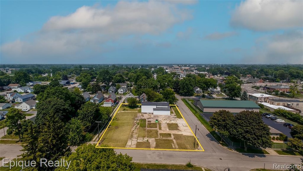
Great investment opportunity in Port Huron Township. Half acre commercial lot zoned B3 and divisible. Property includes approximately 3500 square feet with three fully remodeled rental units on annual leases. Two one-bedroom units rent for 800 per month each and one efficiency unit rents for 700 per month. Total gross monthly rent is 2300. Landlord pays for dumpster service, water, gas heat in one unit, gas water heater in one unit, and basement and common area electric. There is one gas meter and four electric meters. Recent updates include a new roof, updated plumbing, and updated electrical. Located in Port Huron Township where no rental certificate is required. Strong cash flow with great tenants in place. Zoned B3 allowing for a wide variety of commercial uses. Ideal for investors looking for turn-key income with future potential.
Home Details
Home Type
- Single Family
Est. Annual Taxes
Year Built
- Built in 1945
Lot Details
- 0.47 Acre Lot
- Lot Dimensions are 142x142
Home Design
- Block Foundation
- Vinyl Construction Material
Interior Spaces
- 3,181 Sq Ft Home
- 1-Story Property
- Unfinished Basement
Bedrooms and Bathrooms
- 3 Bedrooms
- 3 Full Bathrooms
Location
- Ground Level
Utilities
- Baseboard Heating
- Heating System Uses Natural Gas
Community Details
- No Home Owners Association
- Elmwood Subdivision
Listing and Financial Details
- Assessor Parcel Number 74282530103000
Map
Home Values in the Area
Average Home Value in this Area
Tax History
| Year | Tax Paid | Tax Assessment Tax Assessment Total Assessment is a certain percentage of the fair market value that is determined by local assessors to be the total taxable value of land and additions on the property. | Land | Improvement |
|---|---|---|---|---|
| 2025 | $2,568 | $77,800 | $0 | $0 |
| 2024 | $1,663 | $75,800 | $0 | $0 |
| 2023 | $1,559 | $64,900 | $0 | $0 |
| 2022 | $2,179 | $52,700 | $0 | $0 |
| 2021 | $2,024 | $47,200 | $0 | $0 |
| 2020 | $2,024 | $48,600 | $19,200 | $29,400 |
| 2019 | $1,986 | $41,400 | $0 | $0 |
| 2018 | $1,940 | $41,400 | $0 | $0 |
| 2017 | $2,018 | $40,400 | $0 | $0 |
| 2016 | $1,382 | $40,400 | $0 | $0 |
| 2015 | -- | $40,400 | $5,900 | $34,500 |
| 2014 | -- | $38,300 | $5,900 | $32,400 |
| 2013 | -- | $37,600 | $0 | $0 |
Property History
| Date | Event | Price | List to Sale | Price per Sq Ft |
|---|---|---|---|---|
| 10/08/2025 10/08/25 | Pending | -- | -- | -- |
| 09/29/2025 09/29/25 | Price Changed | $114,900 | -11.5% | $36 / Sq Ft |
| 09/04/2025 09/04/25 | Price Changed | $129,900 | -13.3% | $41 / Sq Ft |
| 08/07/2025 08/07/25 | For Sale | $149,900 | -- | $47 / Sq Ft |
Purchase History
| Date | Type | Sale Price | Title Company |
|---|---|---|---|
| Quit Claim Deed | -- | None Listed On Document | |
| Quit Claim Deed | -- | None Listed On Document | |
| Interfamily Deed Transfer | -- | None Available | |
| Interfamily Deed Transfer | -- | None Available | |
| Interfamily Deed Transfer | -- | None Available | |
| Interfamily Deed Transfer | -- | None Available |
Source: Realcomp
MLS Number: 20251025007
APN: 28-253-0103-000
Disclaimer: Certain information contained herein is derived from information provided by parties other than Homes.com. All information provided is deemed reliable, but is not guaranteed to be accurate and should be independently verified.
![]() IDX provided courtesy of Realcomp II Ltd. via Ten-X and MLS
IDX provided courtesy of Realcomp II Ltd. via Ten-X and MLS
Copyright 2025 Realcomp II Ltd. Shareholders
IDX information is provided exclusively for consumers' personal, noncommercial use and may not be used for any purpose other than to identify prospective properties consumers may be interested in purchasing. The accuracy of all information, regardless of source, is not guaranteed or warranted. All information should be independently verified.
Listing Information presented by local MLS brokerage: Ten-X, local REALTOR®- Arlene Richardson - (888)-952-6393
