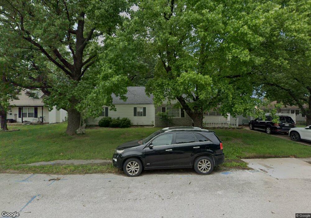
1811 Forest St Carthage, MO 64836
Estimated Value: $185,087 - $209,000
3
Beds
2
Baths
1,695
Sq Ft
$116/Sq Ft
Est. Value
About This Home
This home is located at 1811 Forest St, Carthage, MO 64836 and is currently estimated at $196,522, approximately $115 per square foot. 1811 Forest St is a home located in Jasper County with nearby schools including Carthage High School, St. Ann's Catholic School, and Victory Academy.
Ownership History
Date
Name
Owned For
Owner Type
Purchase Details
Closed on
Dec 27, 2012
Sold by
Manzer Wesley R
Bought by
Kyler Mckinney David Addison
Current Estimated Value
Home Financials for this Owner
Home Financials are based on the most recent Mortgage that was taken out on this home.
Original Mortgage
$87,755
Outstanding Balance
$60,583
Interest Rate
3.37%
Mortgage Type
New Conventional
Estimated Equity
$135,939
Purchase Details
Closed on
Mar 12, 2008
Sold by
Manzer Rachel L
Bought by
Manzer Wesley R
Purchase Details
Closed on
Jul 19, 2005
Sold by
Snow Holly Anne and Snow Alan
Bought by
Manzer Wesley R
Home Financials for this Owner
Home Financials are based on the most recent Mortgage that was taken out on this home.
Original Mortgage
$90,815
Interest Rate
5.64%
Mortgage Type
Fannie Mae Freddie Mac
Create a Home Valuation Report for This Property
The Home Valuation Report is an in-depth analysis detailing your home's value as well as a comparison with similar homes in the area
Home Values in the Area
Average Home Value in this Area
Purchase History
| Date | Buyer | Sale Price | Title Company |
|---|---|---|---|
| Kyler Mckinney David Addison | -- | None Available | |
| Manzer Wesley R | -- | None Available | |
| Manzer Wesley R | -- | -- |
Source: Public Records
Mortgage History
| Date | Status | Borrower | Loan Amount |
|---|---|---|---|
| Open | Kyler Mckinney David Addison | $87,755 | |
| Previous Owner | Manzer Wesley R | $90,815 |
Source: Public Records
Tax History
| Year | Tax Paid | Tax Assessment Tax Assessment Total Assessment is a certain percentage of the fair market value that is determined by local assessors to be the total taxable value of land and additions on the property. | Land | Improvement |
|---|---|---|---|---|
| 2025 | $842 | $18,360 | $2,640 | $15,720 |
| 2024 | $842 | $16,360 | $2,640 | $13,720 |
| 2023 | $842 | $16,360 | $2,640 | $13,720 |
| 2022 | $822 | $16,020 | $2,640 | $13,380 |
| 2021 | $813 | $16,020 | $2,640 | $13,380 |
| 2020 | $785 | $14,830 | $2,640 | $12,190 |
| 2019 | $787 | $14,830 | $2,640 | $12,190 |
| 2018 | $766 | $14,470 | $0 | $0 |
| 2017 | $768 | $14,470 | $0 | $0 |
| 2016 | $722 | $13,660 | $0 | $0 |
Source: Public Records
Map
Nearby Homes
- 509 W Highland Ave
- 510 W Fairview Ave
- TBD Hazel Ave
- 1615 Forest St
- 1830 S Maple St
- 303 W Centennial Ave
- 1746 Robertson Ave
- 1710 Robertson Ave
- 1732 Robertson Ave
- 1702 Robertson Ave
- 1736 Robertson Ave
- 1720 Robertson Ave
- 1740 Robertson Ave
- 1716 Robertson Ave
- 1513 S Main St
- 831 Rombauer Ave
- 1500 Robertson Ave
- 414 Pine St
- 714 Pine St
- 1373 W Fairview Ave
- 1811 Forest St Unit 1
- 1819 Forest St
- 608 W Highland Ave
- 612 W Highland Ave
- 1814 Hazel St
- 1823 Forest St
- 1818 Hazel Ave
- 532 W Highland Ave
- 1814 Forest St
- 1820 Hazel Ave
- 1831 Forest St
- 1800 Hazel St
- 1820 Forest St
- 1826 Hazel Ave
- 1826 Hazel St
- 1826 Hazel St Unit 1
- 516 18-20- W High Land
- 1715 Hillcrest Dr
- 1716 Hillcrest Dr
- 1714 Hillcrest Dr
Your Personal Tour Guide
Ask me questions while you tour the home.