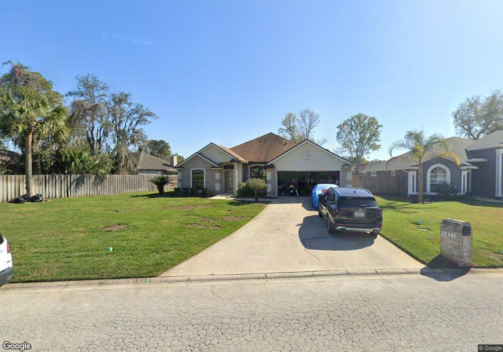
1811 Harbor Island Dr Unit 1 Fleming Island, FL 32003
Estimated Value: $368,165 - $426,000
3
Beds
2
Baths
2,316
Sq Ft
$173/Sq Ft
Est. Value
About This Home
This home is located at 1811 Harbor Island Dr Unit 1, Fleming Island, FL 32003 and is currently estimated at $399,541, approximately $172 per square foot. 1811 Harbor Island Dr Unit 1 is a home located in Clay County with nearby schools including Robert M. Paterson Elementary School, Fleming Island High School, and Green Cove Springs Junior High School.
Ownership History
Date
Name
Owned For
Owner Type
Purchase Details
Closed on
Dec 28, 2001
Sold by
D R Horton Inc Jacksonville
Bought by
Monroe Marvin G and Monroe Kelli L
Current Estimated Value
Home Financials for this Owner
Home Financials are based on the most recent Mortgage that was taken out on this home.
Original Mortgage
$183,498
Outstanding Balance
$70,935
Interest Rate
6.72%
Mortgage Type
Purchase Money Mortgage
Estimated Equity
$328,606
Create a Home Valuation Report for This Property
The Home Valuation Report is an in-depth analysis detailing your home's value as well as a comparison with similar homes in the area
Home Values in the Area
Average Home Value in this Area
Purchase History
| Date | Buyer | Sale Price | Title Company |
|---|---|---|---|
| Monroe Marvin G | $179,900 | -- |
Source: Public Records
Mortgage History
| Date | Status | Borrower | Loan Amount |
|---|---|---|---|
| Open | Monroe Marvin G | $183,498 |
Source: Public Records
Tax History Compared to Growth
Tax History
| Year | Tax Paid | Tax Assessment Tax Assessment Total Assessment is a certain percentage of the fair market value that is determined by local assessors to be the total taxable value of land and additions on the property. | Land | Improvement |
|---|---|---|---|---|
| 2025 | -- | $202,432 | -- | -- |
| 2024 | $2,549 | $196,727 | -- | -- |
| 2023 | $2,549 | $190,998 | $0 | $0 |
| 2022 | $2,356 | $185,435 | $0 | $0 |
| 2021 | $2,343 | $180,034 | $0 | $0 |
| 2020 | $2,264 | $177,549 | $0 | $0 |
| 2019 | $2,227 | $173,558 | $0 | $0 |
| 2018 | $2,042 | $170,322 | $0 | $0 |
| 2017 | $2,028 | $166,819 | $0 | $0 |
| 2016 | $2,022 | $163,388 | $0 | $0 |
| 2015 | $2,076 | $162,252 | $0 | $0 |
| 2014 | $2,022 | $160,964 | $0 | $0 |
Source: Public Records
Map
Nearby Homes
- 1203 Stern Way
- 1279 Pirates Cove Ln
- 1634 Dockside Dr
- 1052 Creighton Rd
- 1040 Creighton Rd
- ST. GEORGE Plan at Creighton Pointe
- GRAYTON II Plan at Creighton Pointe
- MARSHALL Plan at Creighton Pointe
- JENSEN Plan at Creighton Pointe
- JAMESON Plan at Creighton Pointe
- SEASIDE Plan at Creighton Pointe
- EGRET Plan at Creighton Pointe
- ROSEMARY Plan at Creighton Pointe
- 1024 Creighton Rd
- 1028 Creighton Rd
- 1044 Creighton Rd
- 774 Creighton Rd
- 2025 Castle Point Ct
- 2216 Salt Myrtle Ln
- 1452 Water Pipit Ln
- 1815 Harbor Island Dr
- 1322 Portside Dr
- 1326 Portside Dr
- 1318 Portside Dr
- 1819 Harbor Island Dr
- 1351 Keel Ct
- 1330 Portside Dr
- 1814 Harbor Island Dr
- 1355 Keel Ct
- 1823 Harbor Island Dr
- 1820 Harbor Island Dr
- 1334 Portside Dr
- 1810 Harbor Island Dr
- 1352 Keel Ct
- 1312 Portside Dr
- 1827 Harbor Island Dr
- 1824 Harbor Island Dr
- 1321 Portside Dr
- 1325 Portside Dr
- 1338 Portside Dr