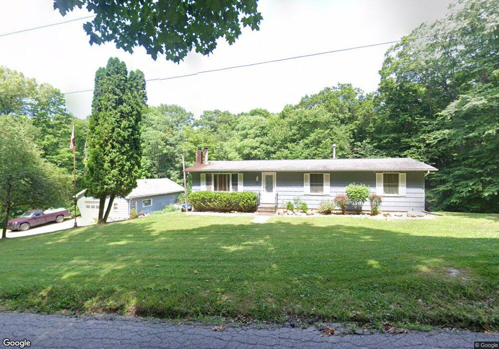
1811 N Goldring Rd La Porte, IN 46350
Estimated Value: $224,000 - $296,000
3
Beds
1
Bath
1,200
Sq Ft
$204/Sq Ft
Est. Value
About This Home
This home is located at 1811 N Goldring Rd, La Porte, IN 46350 and is currently estimated at $245,021, approximately $204 per square foot. 1811 N Goldring Rd is a home located in LaPorte County with nearby schools including Coolspring Elementary School, Barker Middle School, and Michigan City High School.
Ownership History
Date
Name
Owned For
Owner Type
Purchase Details
Closed on
Feb 18, 2011
Sold by
Boardman Michelle M and Lange Michelle M
Bought by
Lange Joseph P
Current Estimated Value
Home Financials for this Owner
Home Financials are based on the most recent Mortgage that was taken out on this home.
Original Mortgage
$109,257
Outstanding Balance
$74,691
Interest Rate
4.76%
Mortgage Type
FHA
Estimated Equity
$170,330
Purchase Details
Closed on
Jun 23, 2009
Sold by
U S Bank National Association
Bought by
Lange Michelle M
Purchase Details
Closed on
Nov 14, 2008
Sold by
Vanhorn Curtis W and Van Horn Jennifer L
Bought by
U S Bank National Association
Purchase Details
Closed on
Jun 8, 2007
Sold by
Boardman Stephen J
Bought by
Vanhorn Curtis W and Vanhorn Jennifer L
Home Financials for this Owner
Home Financials are based on the most recent Mortgage that was taken out on this home.
Original Mortgage
$136,710
Interest Rate
9.92%
Mortgage Type
Unknown
Purchase Details
Closed on
Oct 30, 2006
Sold by
Fannie Mae
Bought by
Boardman Stephen J
Purchase Details
Closed on
Sep 8, 2006
Sold by
Chase Home Finance Llc
Bought by
Federal National Mortgage Association
Create a Home Valuation Report for This Property
The Home Valuation Report is an in-depth analysis detailing your home's value as well as a comparison with similar homes in the area
Home Values in the Area
Average Home Value in this Area
Purchase History
| Date | Buyer | Sale Price | Title Company |
|---|---|---|---|
| Lange Joseph P | -- | Metropolitan Title | |
| Lange Michelle M | -- | Federated Land Title Agency | |
| U S Bank National Association | $118,150 | None Available | |
| Vanhorn Curtis W | -- | None Available | |
| Boardman Stephen J | -- | Ticor Title Insurance Co | |
| Federal National Mortgage Association | -- | None Available | |
| Chase Home Finance Llc | $109,736 | None Available |
Source: Public Records
Mortgage History
| Date | Status | Borrower | Loan Amount |
|---|---|---|---|
| Open | Lange Joseph P | $109,257 | |
| Previous Owner | Vanhorn Curtis W | $136,710 |
Source: Public Records
Tax History Compared to Growth
Tax History
| Year | Tax Paid | Tax Assessment Tax Assessment Total Assessment is a certain percentage of the fair market value that is determined by local assessors to be the total taxable value of land and additions on the property. | Land | Improvement |
|---|---|---|---|---|
| 2024 | $1,319 | $150,100 | $30,200 | $119,900 |
| 2022 | $1,274 | $158,700 | $30,700 | $128,000 |
| 2021 | $1,184 | $149,100 | $30,200 | $118,900 |
| 2020 | $1,198 | $149,100 | $30,200 | $118,900 |
| 2019 | $1,292 | $155,300 | $36,200 | $119,100 |
| 2018 | $1,163 | $143,400 | $30,200 | $113,200 |
| 2017 | $1,094 | $137,700 | $30,200 | $107,500 |
| 2016 | $1,069 | $142,000 | $30,200 | $111,800 |
| 2014 | $1,110 | $137,200 | $30,200 | $107,000 |
Source: Public Records
Map
Nearby Homes
- 5709 W 150 N
- 7101 W 125 N
- 5424 W 150 N
- 2688 N Van Gogh Dr
- 2660 N Rembrandt Ln
- 0 N Forrester Rd
- 2335 N Forrester Rd
- 906 N Honeysuckle Ln
- 2721 N Jongkind Park Dr
- 1441 N Wozniak Rd
- 6989 W 300 N
- 7725 W Arndt Ct
- 0 N Goldring Rd Unit NRA828377
- 0 W Applewood Dr Unit NRA813098
- 2308 N Dianne Dr
- 0 N Dianne Dr
- 1927 N Country Ln
- 1967 N Rustic Ct
- 1587 N Rustic Dr
- 0 Circle View Ln Unit NRA825261
- 1866 N Goldring Rd
- 1765 N Goldring Rd
- 6077 W Goldring Rd
- 1911 N Goldring Rd
- 1908 N Goldring Rd
- 1973 N Goldring Rd
- 1944 N Goldring Rd
- 1677 N Goldring Rd
- 1577 N Goldring Rd
- 1978 N Goldring Rd
- 2048 N Goldring Rd
- 6079 W Goldring Rd
- 6067 W Goldring Rd
- 2055 N Goldring Rd
- 6112 W Goldring Rd
- 6005 W Goldring Rd
- 2077 N Goldring Rd
- 0000 N Goldring Rd
- 1995 N 675 W
- 1805 N 675 W