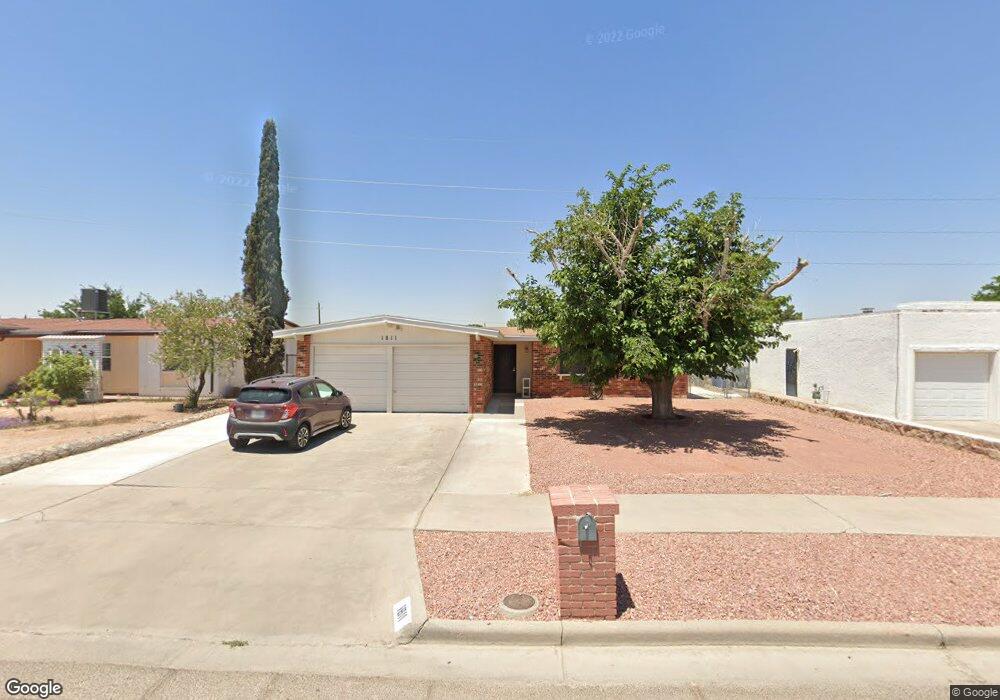
1811 Robert Wynn St El Paso, TX 79936
Vista Del Sol NeighborhoodEstimated Value: $195,000 - $227,000
--
Bed
2
Baths
1,231
Sq Ft
$169/Sq Ft
Est. Value
About This Home
This home is located at 1811 Robert Wynn St, El Paso, TX 79936 and is currently estimated at $207,799, approximately $168 per square foot. 1811 Robert Wynn St is a home located in El Paso County with nearby schools including Tierra Del Sol Elementary School, J M Hanks High School, and EL PASO LEADERSHIP ACADEMY - MIDDLE EAST.
Ownership History
Date
Name
Owned For
Owner Type
Purchase Details
Closed on
Feb 26, 1998
Sold by
Montoya Lydia Schaffino
Bought by
Pytcher John K and Bujanda Lorenza H
Current Estimated Value
Home Financials for this Owner
Home Financials are based on the most recent Mortgage that was taken out on this home.
Original Mortgage
$60,327
Outstanding Balance
$10,929
Interest Rate
6.91%
Mortgage Type
FHA
Estimated Equity
$196,870
Purchase Details
Closed on
Sep 4, 1997
Sold by
Felix Ruby and Montoya Ruby
Bought by
Schaffino Lydia
Create a Home Valuation Report for This Property
The Home Valuation Report is an in-depth analysis detailing your home's value as well as a comparison with similar homes in the area
Home Values in the Area
Average Home Value in this Area
Purchase History
| Date | Buyer | Sale Price | Title Company |
|---|---|---|---|
| Pytcher John K | -- | -- | |
| Schaffino Lydia | -- | -- |
Source: Public Records
Mortgage History
| Date | Status | Borrower | Loan Amount |
|---|---|---|---|
| Open | Pytcher John K | $60,327 |
Source: Public Records
Tax History Compared to Growth
Tax History
| Year | Tax Paid | Tax Assessment Tax Assessment Total Assessment is a certain percentage of the fair market value that is determined by local assessors to be the total taxable value of land and additions on the property. | Land | Improvement |
|---|---|---|---|---|
| 2025 | $2,931 | $186,702 | -- | -- |
| 2024 | $2,931 | $169,729 | -- | -- |
| 2023 | $2,931 | $154,299 | $0 | $0 |
| 2022 | $4,356 | $140,272 | $0 | $0 |
| 2021 | $4,145 | $127,520 | $20,238 | $107,282 |
| 2020 | $3,856 | $122,085 | $18,370 | $103,715 |
| 2018 | $3,904 | $125,552 | $18,370 | $107,182 |
| 2017 | $3,509 | $114,797 | $18,370 | $96,427 |
| 2016 | $3,509 | $114,797 | $18,370 | $96,427 |
| 2015 | $2,838 | $114,797 | $18,370 | $96,427 |
| 2014 | $2,838 | $119,710 | $18,370 | $101,340 |
Source: Public Records
Map
Nearby Homes
- 1804 Jerry Abbott St
- 1703 Robert Wynn St
- 1868 Tom Bolt Dr
- 1700 Jerry Abbott St
- 1913 Seagull Dr
- 11204 Bob Mitchell Dr
- 3655 George Dieter Dr
- 2101 E Glen Dr
- 1617 Tommy Aaron Dr
- 1817 Hugh Royer Place
- 1607 Tommy Aaron Dr
- 11268 Enid Wilson Ln
- 11262 Enid Wilson Ln
- 1901 Bobby Jones Dr
- 2001 Bobby Jones Dr Unit A
- 2009 Bobby Jones Dr Unit B
- 1664 Dick Ritter St
- 11016 Bob Stone Dr
- 1935 Bay City Place
- 11012 Bob Stone Dr
- 1813 Robert Wynn St
- 1809 Robert Wynn St
- 1815 Robert Wynn St
- 1807 Robert Wynn St
- 1810 Robert Wynn St
- 1808 Robert Wynn St
- 1812 Robert Wynn St
- 1817 Robert Wynn St
- 1805 Robert Wynn St
- 1806 Robert Wynn St
- 1814 Robert Wynn St
- 1816 Dale Douglas Dr
- 1812 Dale Douglas Dr
- 1820 Dale Douglas Dr
- 1808 Dale Douglas Dr
- 1819 Robert Wynn St
- 1804 Robert Wynn St
- 1816 Robert Wynn St
- 1803 Robert Wynn St
- 1811 Jerry Abbott St