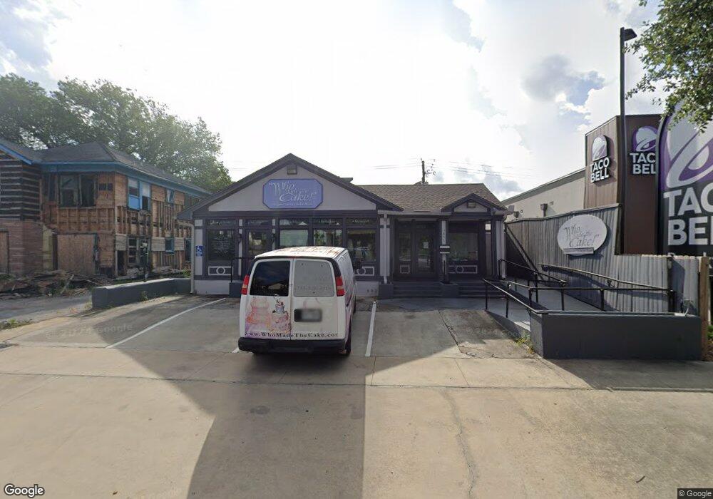
1811 S Shepherd Dr Houston, TX 77019
Montrose NeighborhoodEstimated Value: $599,000 - $712,000
--
Bed
--
Bath
2,654
Sq Ft
$247/Sq Ft
Est. Value
About This Home
This home is located at 1811 S Shepherd Dr, Houston, TX 77019 and is currently estimated at $654,841, approximately $246 per square foot. 1811 S Shepherd Dr is a home located in Harris County with nearby schools including Baker Montessori, Lanier Middle School, and Lamar High School.
Ownership History
Date
Name
Owned For
Owner Type
Purchase Details
Closed on
Sep 26, 2023
Sold by
Dugas Don Charles
Bought by
Porcarello Diana Susan
Current Estimated Value
Purchase Details
Closed on
Oct 5, 2005
Sold by
Porcarello Diana Susan
Bought by
Porcarello Diana Susan and Dugas Don Charles
Purchase Details
Closed on
Jul 13, 2000
Sold by
Dugas Sue L
Bought by
Dugas Sue L and Charles S Dugas Family Trust
Create a Home Valuation Report for This Property
The Home Valuation Report is an in-depth analysis detailing your home's value as well as a comparison with similar homes in the area
Home Values in the Area
Average Home Value in this Area
Purchase History
| Date | Buyer | Sale Price | Title Company |
|---|---|---|---|
| Porcarello Diana Susan | -- | None Listed On Document | |
| Porcarello Diana Susan | -- | -- | |
| Dugas Sue L | -- | -- |
Source: Public Records
Tax History Compared to Growth
Tax History
| Year | Tax Paid | Tax Assessment Tax Assessment Total Assessment is a certain percentage of the fair market value that is determined by local assessors to be the total taxable value of land and additions on the property. | Land | Improvement |
|---|---|---|---|---|
| 2025 | $13,783 | $669,013 | $477,090 | $191,923 |
| 2024 | $13,783 | $658,725 | $477,090 | $181,635 |
| 2023 | $13,783 | $634,270 | $477,090 | $157,180 |
| 2022 | $12,811 | $581,834 | $477,090 | $104,744 |
| 2021 | $13,404 | $575,116 | $451,980 | $123,136 |
| 2020 | $12,899 | $532,682 | $451,980 | $80,702 |
| 2019 | $13,365 | $528,161 | $426,870 | $101,291 |
| 2018 | $13,367 | $537,872 | $426,870 | $111,002 |
| 2017 | $14,017 | $528,231 | $426,870 | $101,361 |
| 2016 | $14,230 | $536,266 | $426,870 | $109,396 |
| 2015 | $513 | $438,184 | $326,430 | $111,754 |
| 2014 | $513 | $453,501 | $331,452 | $122,049 |
Source: Public Records
Map
Nearby Homes
- 1910 Huldy St Unit A
- 2026 Welch St
- 2100 Welch St Unit C113
- 2100 Welch St Unit C101
- 1909 Brun St Unit 17
- 1909 Brun St Unit 16
- 1711 Huldy St Unit A
- 2027 Huldy St
- 2111 Welch St Unit A321
- 2111 Welch St Unit A232
- 2111 Welch St Unit A107
- 1712 Mcduffie St
- 1904 Hazard St
- 2113 Huldy St
- 1810 Hazard St Unit A
- 2115 Huldy St
- 2008 Hazard St
- 2117 Huldy St
- 2119 Huldy St
- 2112 Mcduffie St
- 1809 S Shepherd Dr
- 1806 Huldy St
- 1804 Huldy St
- 1802 Huldy St
- 1800 Huldy St
- 1917 Sharp Place
- 1728 Huldy St
- 1921 Sharp Place
- 1913 Sharp Place
- 1904 Huldy St
- 1720 Huldy St
- 1902 Huldy St
- 1815 Huldy St
- 1900 Huldy St
- 1717 S Shepherd Dr
- 1823 Huldy St
- 1714 Huldy St
- 1908 Huldy St
- 1908 Huldy St
- 2032 Vermont St
