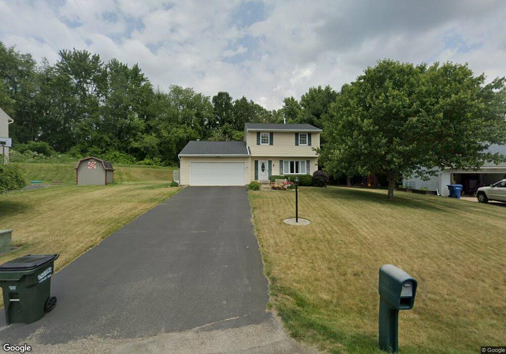
1811 Thornridge Rd NW Massillon, OH 44646
Amherst Heights-Clearview NeighborhoodEstimated Value: $229,037 - $247,000
3
Beds
3
Baths
1,392
Sq Ft
$170/Sq Ft
Est. Value
About This Home
This home is located at 1811 Thornridge Rd NW, Massillon, OH 44646 and is currently estimated at $236,009, approximately $169 per square foot. 1811 Thornridge Rd NW is a home located in Stark County with nearby schools including Pfeiffer Intermediate School, Edison Middle School, and Perry High School.
Ownership History
Date
Name
Owned For
Owner Type
Purchase Details
Closed on
Sep 21, 1994
Sold by
Ruda John G
Bought by
Gressel Scott E and Gressel Jody
Current Estimated Value
Home Financials for this Owner
Home Financials are based on the most recent Mortgage that was taken out on this home.
Original Mortgage
$83,100
Interest Rate
8.62%
Mortgage Type
New Conventional
Create a Home Valuation Report for This Property
The Home Valuation Report is an in-depth analysis detailing your home's value as well as a comparison with similar homes in the area
Home Values in the Area
Average Home Value in this Area
Purchase History
| Date | Buyer | Sale Price | Title Company |
|---|---|---|---|
| Gressel Scott E | $87,500 | -- |
Source: Public Records
Mortgage History
| Date | Status | Borrower | Loan Amount |
|---|---|---|---|
| Closed | Gressel Scott E | $83,100 |
Source: Public Records
Tax History Compared to Growth
Tax History
| Year | Tax Paid | Tax Assessment Tax Assessment Total Assessment is a certain percentage of the fair market value that is determined by local assessors to be the total taxable value of land and additions on the property. | Land | Improvement |
|---|---|---|---|---|
| 2025 | -- | $59,120 | $17,850 | $41,270 |
| 2024 | -- | $59,120 | $17,850 | $41,270 |
| 2023 | $2,498 | $49,810 | $16,380 | $33,430 |
| 2022 | $2,511 | $49,810 | $16,380 | $33,430 |
| 2021 | $2,674 | $49,810 | $16,380 | $33,430 |
| 2020 | $2,312 | $41,310 | $13,760 | $27,550 |
| 2019 | $2,086 | $41,310 | $13,760 | $27,550 |
| 2018 | $2,060 | $41,310 | $13,760 | $27,550 |
| 2017 | $1,938 | $35,980 | $11,130 | $24,850 |
| 2016 | $1,948 | $35,980 | $11,130 | $24,850 |
| 2015 | $1,965 | $35,980 | $11,130 | $24,850 |
| 2014 | $1,874 | $33,780 | $10,430 | $23,350 |
| 2013 | $893 | $33,780 | $10,430 | $23,350 |
Source: Public Records
Map
Nearby Homes
- 1836 Sedwick Ave NW
- Hudson Plan at Aberdeen Oaks - Single Family Homes
- Ballenger Plan at Aberdeen Oaks - Single Family Homes
- Aviano Plan at Aberdeen Oaks - Single Family Homes
- Allegheny Plan at Aberdeen Oaks - Single Family Homes
- Lehigh Plan at Aberdeen Oaks - Single Family Homes
- 2766 Duxbury Cir NW
- 2942 Torrey Pines Cir NW
- 3460 Spindle St NW
- 2827 Bramblebush Ave NW
- 5179 Birkdale St NW
- 3051 Blue Ash Ave NW
- 3450 Crown Point St NW
- 1804 Jackson Ave NW
- 5827 Hawks Nest Cir NW
- 5829 Hawks Nest Cir NW
- 5831 Hawks Nest Cir NW
- 5843 Hawks Nest Cir NW
- 5845 Hawks Nest Cir NW
- 000 Jackson Ave NW
- 1817 Thornridge Rd NW
- 1805 Thornridge Rd NW
- 1825 Thornridge Rd NW
- 1733 Thornridge Rd NW
- 1810 Thornridge Rd NW
- 1727 Thornridge Rd NW
- 1835 Thornridge Rd NW
- 1726 Thornridge Rd NW
- 1805 Brunnerdale Ave NW
- 1717 Thornridge Rd NW
- 1731 Brunnerdale Ave NW
- 1718 Thornridge Rd NW
- 1746 Warrington Rd NW
- 0 Brunnerdale Ave NW
- 1723 Brunnerdale Ave NW
- 1711 Thornridge Rd NW
- 1710 Thornridge Rd NW
- 1736 Warrington Rd NW
- 1715 Brunnerdale Ave NW
- 1703 Thornridge Rd NW